A cluster of thunderstorms developed on the east side of Hurricane
Keith
on October 1st. Moving
northward, it drifted across Cuba into the southeast Gulf of
Mexico.
Reconnaisance aircraft flew into
the system a couple times, and could not find a closed
circulation.
Just before moving inland into
southwestern Florida on the afternoon of the 3rd, the wind field
finally
closed off, and the subtropical
depression moved northeast across Florida, dropping a swath of heavy
rainfall across Miami-Dade
and Broward counties. It eventually moved northeast off the coast
of Cape Canaveral, and acquired
subtropical storm intensity. After nearly becoming a tropical
system with winds close into the center
and a smaller wind field during the morning of the 6th, upper level
winds out of the west and northwest
sheared the system, and it eventually moved northeastward off New
England
as an extratropical low.
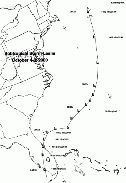
The track of the storm is located below, denoted every six
hours,
using Universal Coorinated Time.
For reference, the time 1200 GMT is the same as 8:00 a.m. EDT.
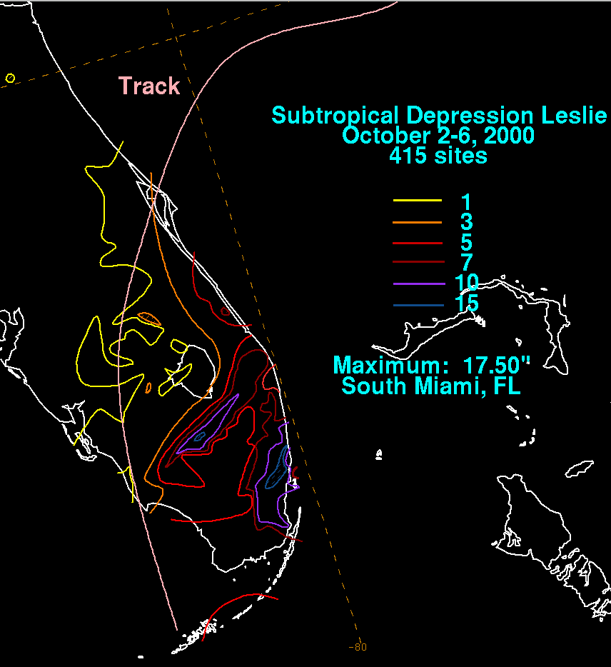
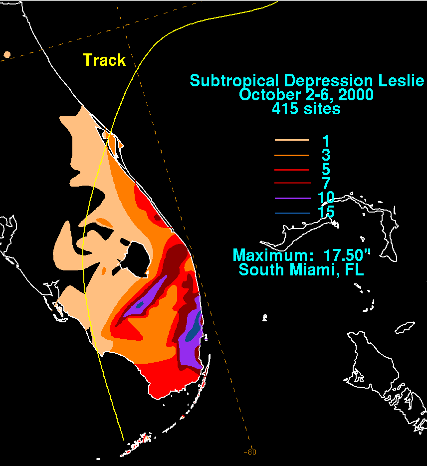
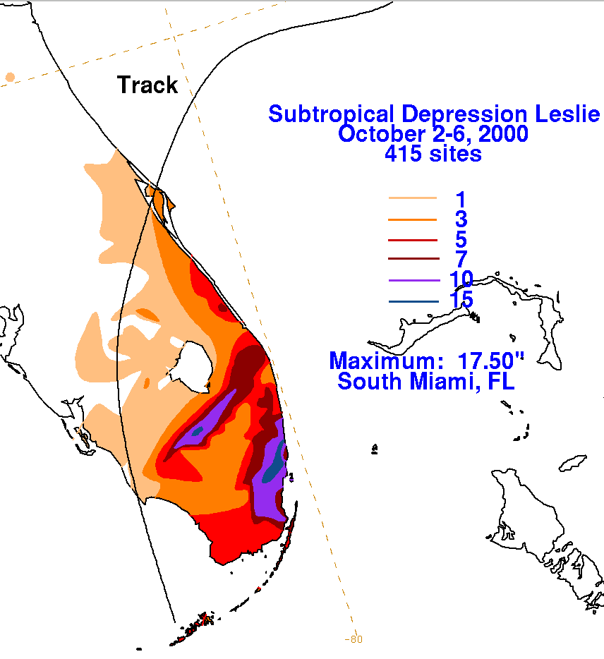
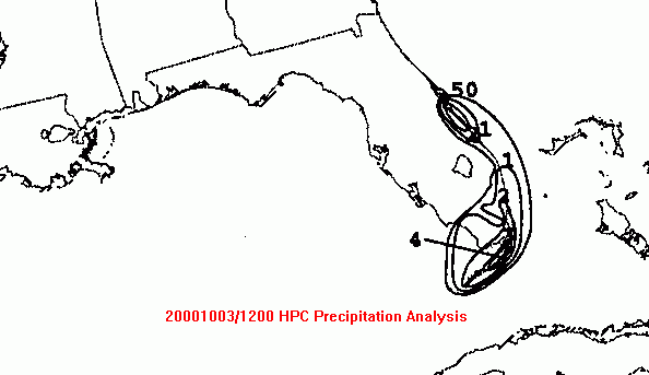
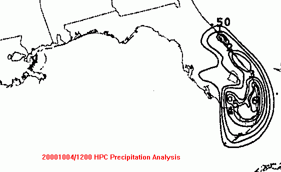
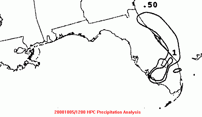
The graphics below show the storm total rainfall for Leslie.
Note
the maxima across southeast
Florida, well to the east of the track. The track itself is
roughly
parallel to the two inch isohyet.
Storm totals were derived from real-time surface observations, and
from totals provided by the
Miami Forecast Office web site.
|
|
|
|
Below is the calendar for Daily Precipitation Maps. Note that
the 24-hour periods end
at 12z that morning.