A weak tropical wave crossed the coast of Africa on the 7th of
August and trekked
westward across the Atlantic and Caribbean. Associated
thunderstorm activity increased
as it entered the eastern Pacific ocean on the 16th. A tropical
depression formed 240 n mi
south of Manzanillo, Mexico on the evening of the 19th. Moving
northwest, the depression
strengthened into a tropical storm on the 20th and a
hurricane on the 22nd while rounding the
western periphery of the subtropical ridge towards a trough
situated on the West coast of the
United States.
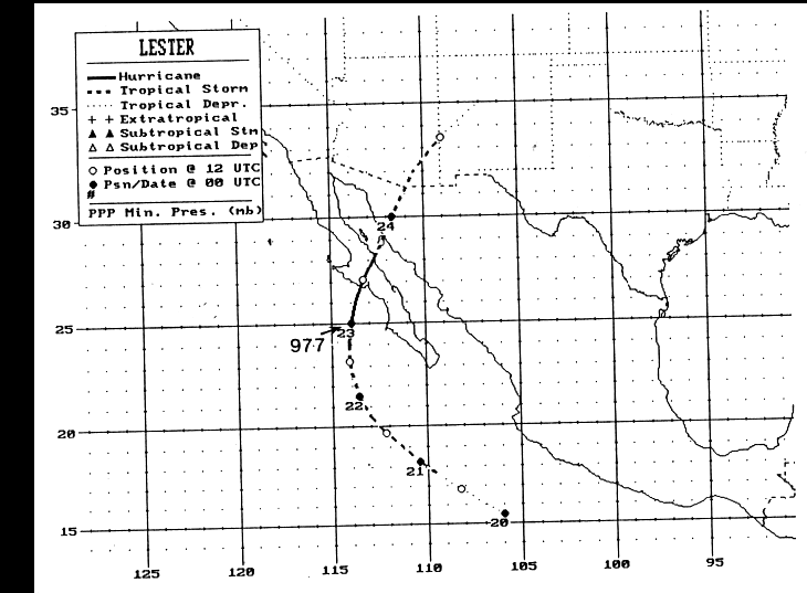
The hurricane first made landfall in Baja California on the 23rd,
striking mainland Mexico
late that day. Accelerating northeast, Lester entered
Arizona as a tropical storm and New
Mexico as a tropical depression before ejecting out into
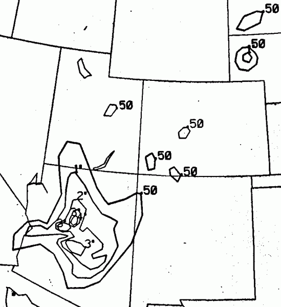
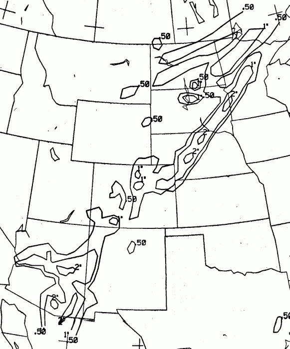
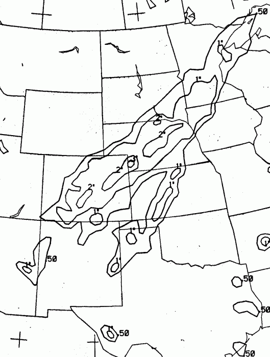
the Plains. Its mid-level center kept
on a northeast coast while the surface low moved along a frontal
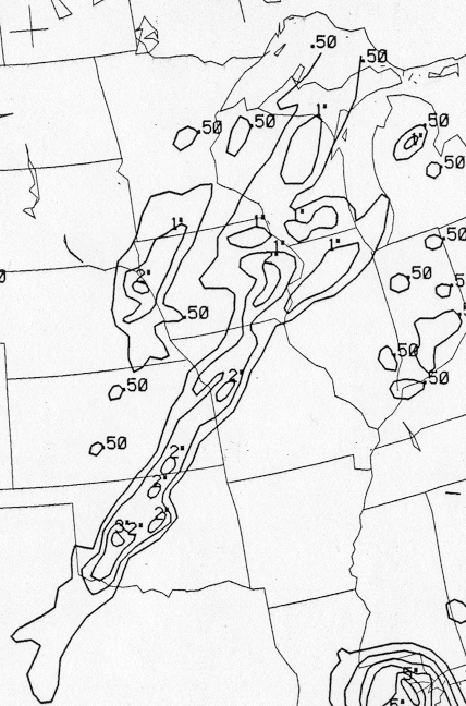
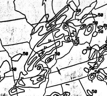
bounday, leading to double
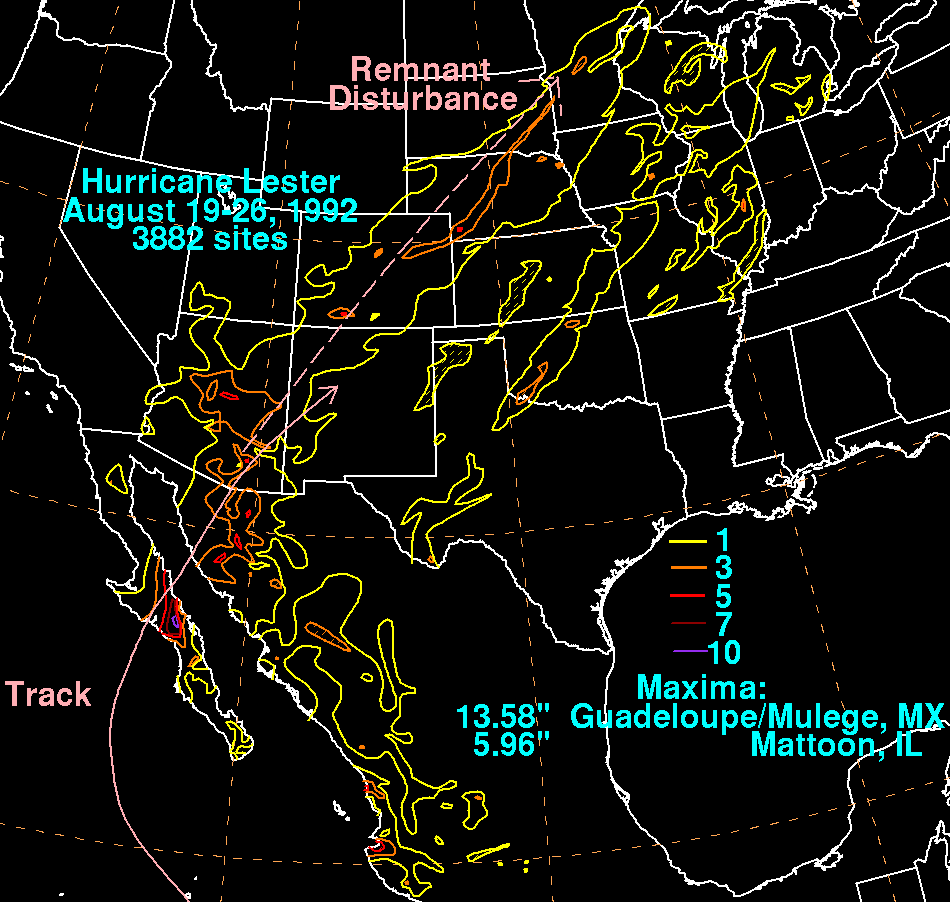
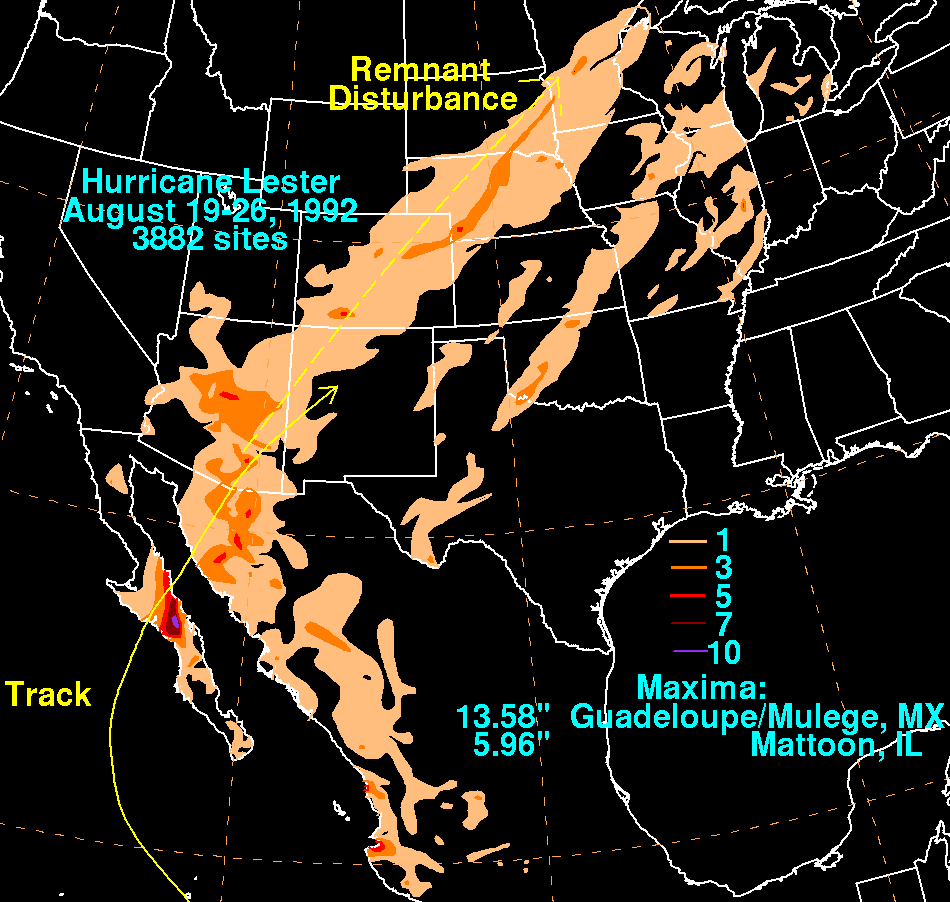
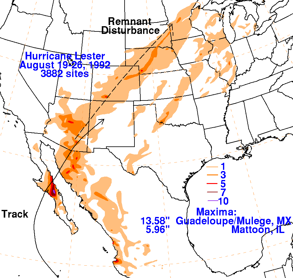
rainfall maxima, which is seen on the rainfall graphic below. Its
track is below, produced
by the National
Hurricane Center.
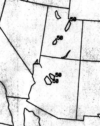
The graphics below show the storm total rainfall for Lester.
Data
for the United States was provided
by the
National Climatic Data Center in Asheville, NC. Data for
Mexico was obtained from the Servicio Nacional
del Agua, the parent agency of Mexico's national weather service.
 |
 |
 |
Below is the calendar for Daily Precipitation Maps. Note that the 24-hour periods end at 12z that morning.