A tropical wave moved off the west coast of Africa on September
29th. As it moved across the Atlantic,
it spawned Hurricane Lisa. The wave continued to move westward
through the tropical Atlantic and
Caribbean thereafter, moving across Central America on October
11th-12th. Becoming a low pressure
area 150 miles south of the El Salvador/Guatemala border on the 13th,
the system continued to organize
and became a tropical depression during the late afternoon of the
14th. The cyclone paralleled the Mexican
coast from the 15th through the 20th, strengthening into a tropical
storm on the 15th and a hurricane on the
16th, steered by the subtropical ridge to its north and
northeast. A shortwave passed to its north, leading to
Lester becoming stationary on the 22nd. A ridge built back in its
its north, leading to a track change initially
to the southwest, before the weakening cyclone resumed a west-northwest
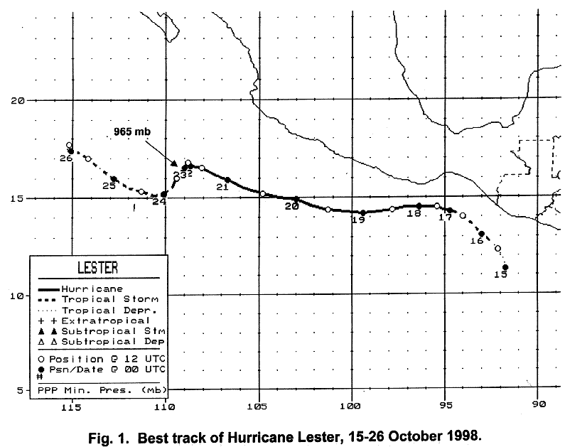
track. Below is a track of the
cyclone,
prepared by the National Hurricane Center.
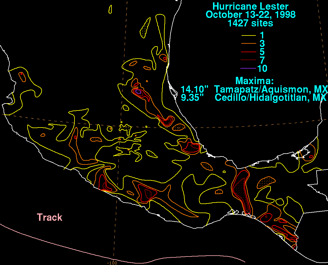
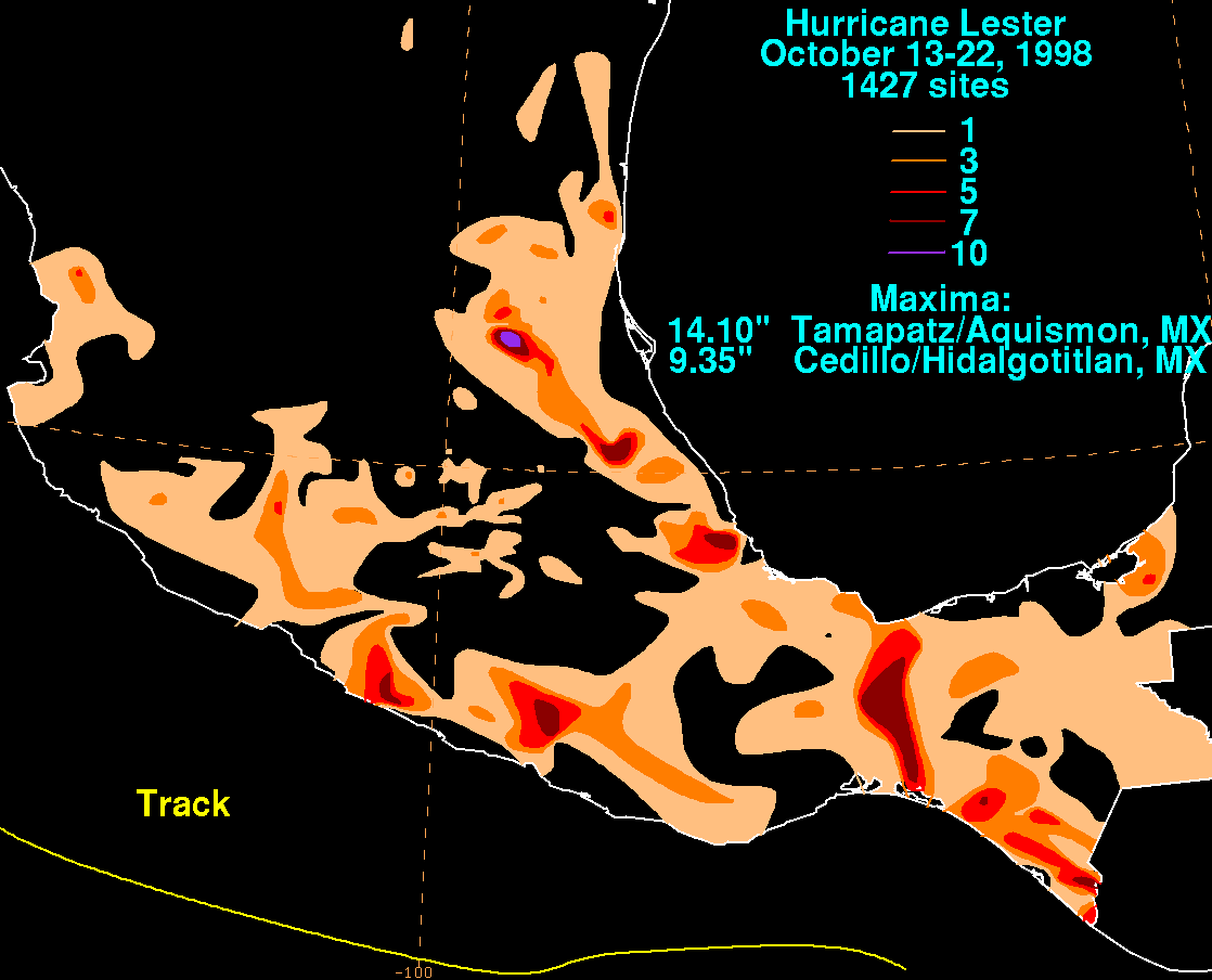
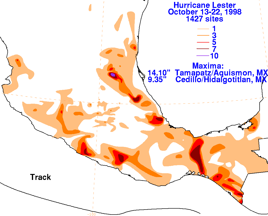
Below are the storm total graphics for Lester. The maximum in
eastern Mexico was due to a moisture surge
moving around its northern periphery into the Sierra Madre Oriental
range. Data for
the maps was obtained
from the Comision Nacional del Agua, the parent
agency of Mexico's National Weather Service.
 |
 |
 |