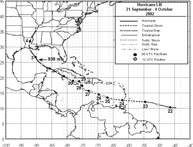
Lili originated from a tropical wave that moved over the tropical
Atlantic
Ocean from the west coast of Africa on
September 16th. The wave developed a low -level cloud circulation
center
midway between Africa and the Lesser
Antilles on the 20th. Convective clouds became sufficiently well
organized
on the 21st to qualify the system as a
tropical depression, centered about 900 n mi east of the Windward
Islands.
Lili's track followed the southwestern
periphery of the subtropical ridge. The tropical cyclone moved just
north of due westward at near 25 mph, crossed
the Windward Islands as a developing tropical storm on the 23rd and
then its winds briefly reached 70 mph on the
24th. The storm weakened to an open tropical wave on the 25th and 26th
in the east central Caribbean Sea as its
organization was disrupted by vertical wind shear.
Lili re-acquired a low-level closed circulation on the 27th, then
its
forward speed slowed towards 6 mph by the
28th while beginning a slow northward jog around the north coast of
Jamaica. The storm dumped heavy rain on
Jamaica and also Haiti. Resuming a west-northwestward track, Lili
became
a hurricane on the 30th, while
passing over Cayman Brac and Little Cayman Islands. The center of the
hurricane moved over the southwest
tip of the Isle of Youth on the morning of October 1st , and over
western
mainland Cuba a few hours later, with
wind speeds as high as 105 mph. Gradually accelerating its forward
speed towards 18 mph, Lili turned northward
and made landfall on the Louisiana coast on the 3rd, with an estimated
90 mph maximum wind speed. However,
between Cuba and Louisiana, Lili intensified to 145 mph early on the
3rd over the north-central Gulf of Mexico
and then rapidly weakened to 90 mph during the 13 hours until landfall.
Lili was absorbed by an extratropical low
on the 4th while moving northeastward near the Tennessee/Arkansas
border.
Lili was the first hurricane to make
landfall in the United States since Irene hit Florida in 1999. Below
is the track of Lili, furnished by the National
Hurricane Center.
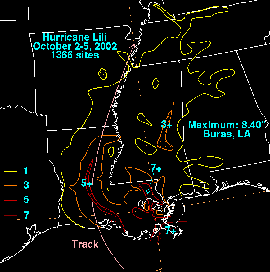
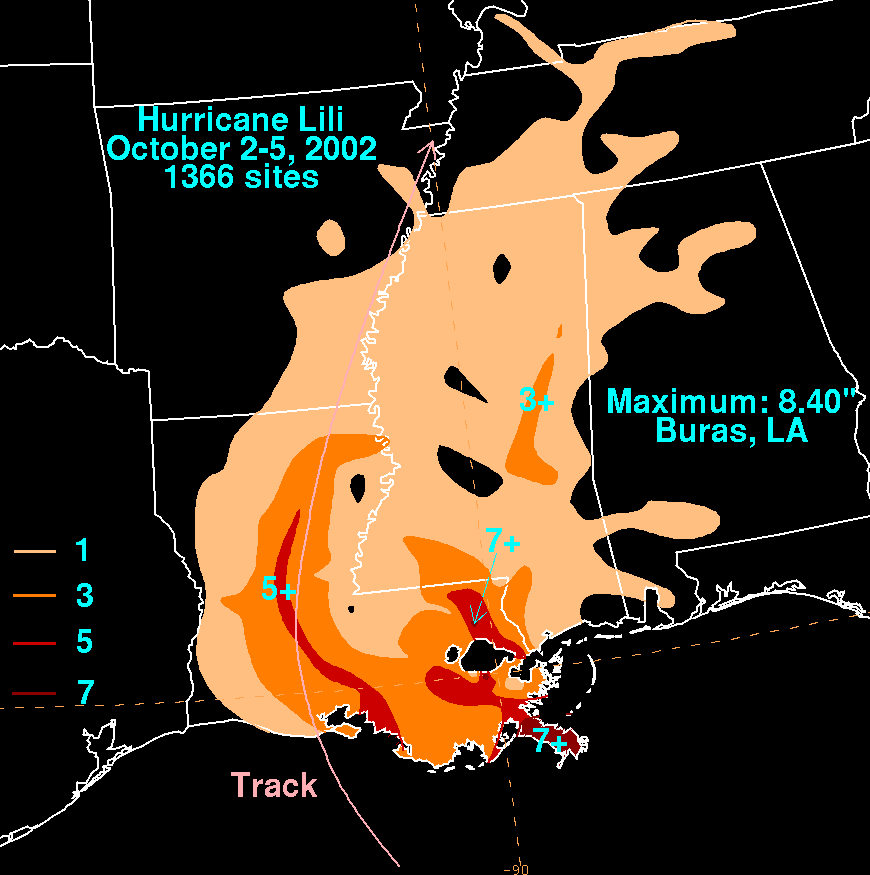
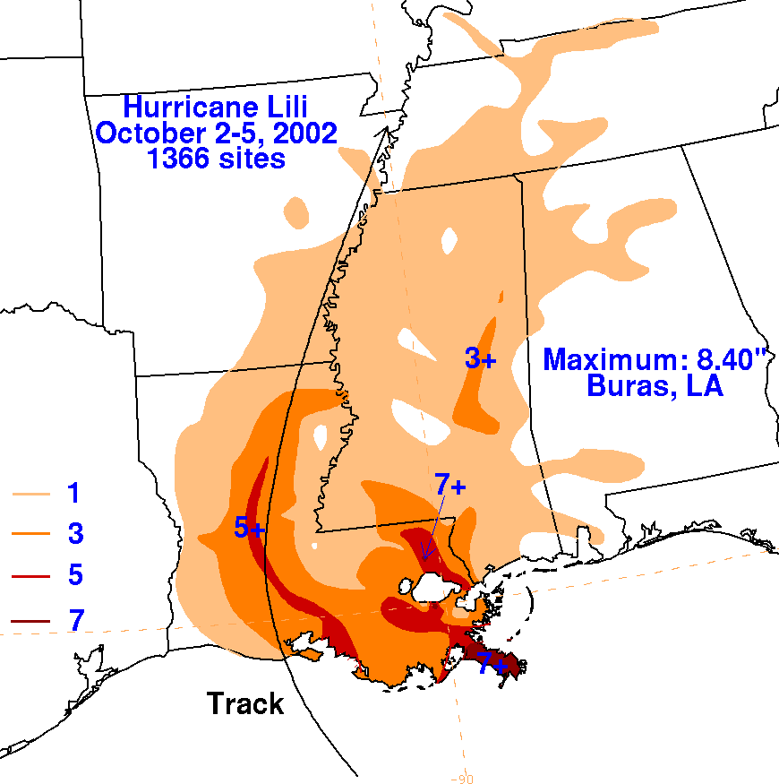
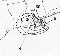
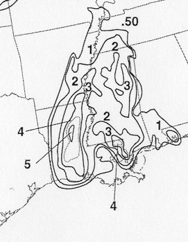
The storm total rainfall maps below were constructed using data from
the
National Climatic Data Center.
 |
 |
 |
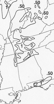
Below are the calendar for Daily Precipitation Maps. Note that
the 24-hour periods end
at 12z that morning.