On September 13, there was indications of a tropical cyclone near
19N 37W. By the 16th, it had become
a strengthening hurricane, near 21N 53W. The system moved just
northeast of the Lesser Antilles into the
southwest Atlantic as a fairly fast clip. On the 19th and
20th, a possible upper cyclone near the Great
Lakes helped turn the hurricane northward offshore the Southeast coast
and an increasingly fast pace.
The cyclone moved past Cape Hatteras around 7:30 am on the 21st, past
Atlantic City around 1 pm,
before moving through Brentwood, Long Island, New York around 2:20 pm,
and inland near New Haven,
Connecticut shortly before 4 pm, before exiting Vermont by 9 pm.
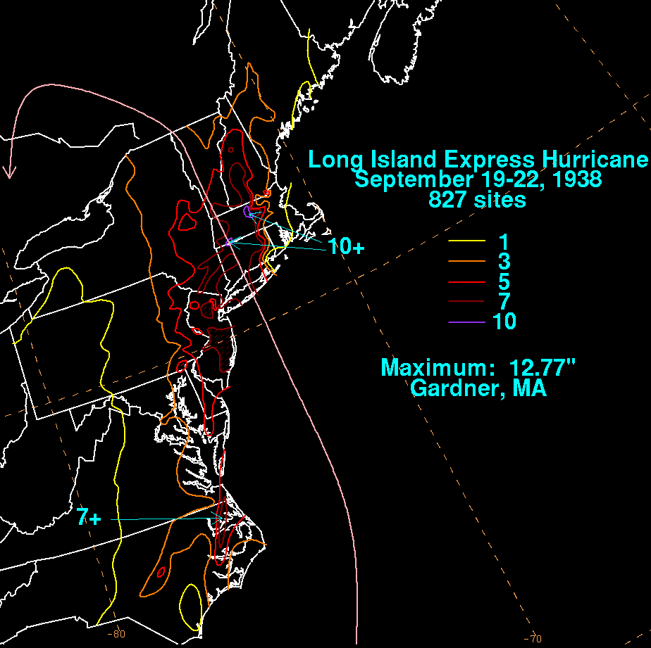
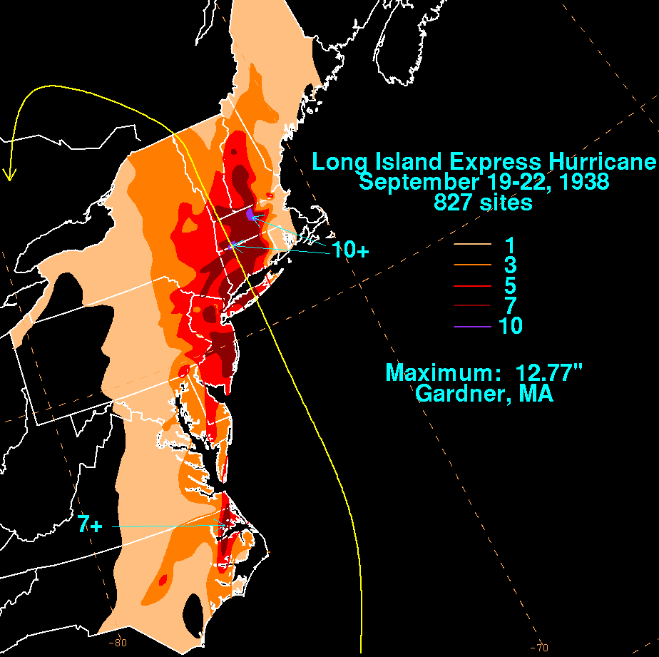
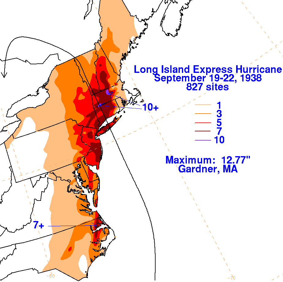
Its storm total rainfall maps are below.
Rainfall information was gleaned from
the National Climatic Data Center in Asheville, North Carolina.
 |
 |
 |