A tropical wave moved off the west coast of Africa on September
25th. Little development occurred as the
wave crossed the tropical Atlantic and Caribbean Sea. Crossing
Central America on October 5th and 6th,
the wave emerged into the eastern Pacific before thunderstorm activity
increased in the Gulf of Tehuantepec
on the 9th. The system became less organized between the 11th and
14th. Thereafter, the system developed
into a tropical depression late on the 15th while located 200 miles
west-southwest of Manzanillo. Favorable
conditions aloft led to its strengthening into a tropical storm on the
morning of the 16th and a hurricane on
the afternoon of the 17th while only 85 miles offshore Cabo
Corrientes. Beginning on the 19th, upper level
winds increased which stripped thunderstorms away from its center and
led to weakening. Tropical storm
intensity was reachieved that morning, and the system devolved into a
tropical depression that evening. The
low dissipated in the Gulf of California, without crossing the
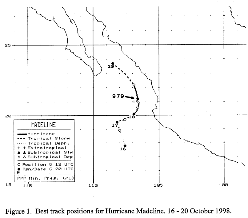
coast. Below is a track of the
cyclone, prepared
by the National Hurricane Center.
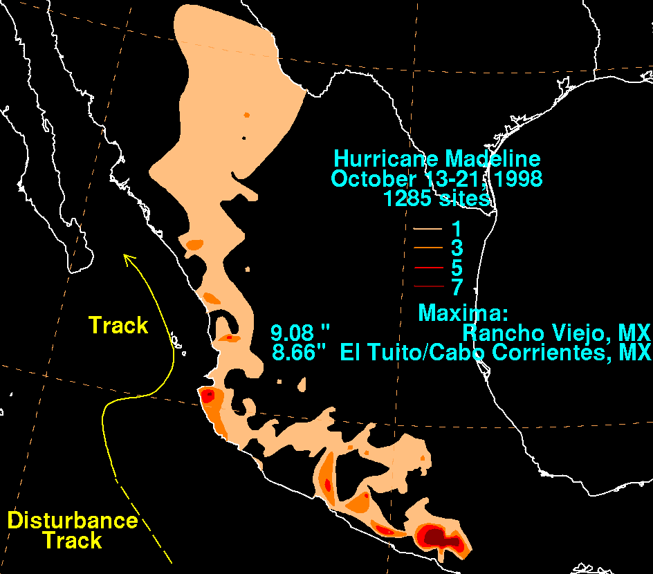
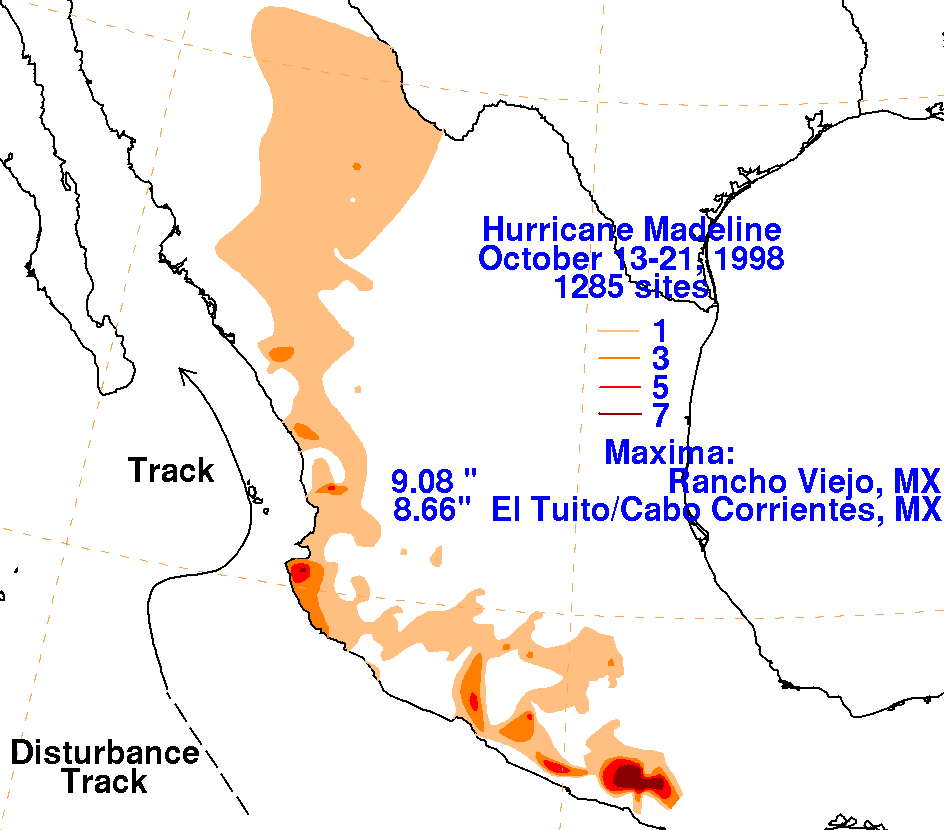
Below are the storm total graphics for Madeline. Two maxima
are seen: one near Cabo Correntes and the other
in south-central Mexico which occurred in a cloud band which connected
Madeline with Lester, which was
located to its east. Data for
the maps was obtained from the Comision Nacional del Agua, the parent
agency
of Mexico's National Weather Service.
 |
 |
 |