The origin of Matthew can be traced to a tropical wave that moved across the west coast of Africa on 19 September.
The wave was very difficult to track between Africa and the Lesser Antilles because its close proximity to Tropical
Storm Lisa and another large disturbance in the tropical Atlantic. The wave crossed the Lesser Antilles on 29 September
and began to interact with a westward moving upper-level low. Cloudiness and showers gradually increased as the wave
moved very slowly westward, trailing the upper-level low. The shower activity associated with the wave reached the Bay
of Campeche on 5 October and gradually became better organized while moving little. An upper-level ridge became
established over the convection and surface pressures began to fall in the area. On 7 October, data from a reconnaissance
aircraft indicated a broad area of low pressure had formed within an inverted surface trough just east of Tampico,
Mexico, accompanied by light winds.
The system continued to become better organized while moving little, and it is estimated that a tropical depression
formed on the morning of 8 October about 180 n mi southeast of Brownsville Texas. By that afternoon, the cyclone
strengthened into Tropical Storm Matthew. Initially, the cyclone moved toward the east and east-northeast, but then
gradually turned to the northeast and north steered by a large mid- to upper-level low over western Texas. It is
estimated that Matthew reached its peak intensity of 45 mph and a minimum pressure of 997 mb early in the
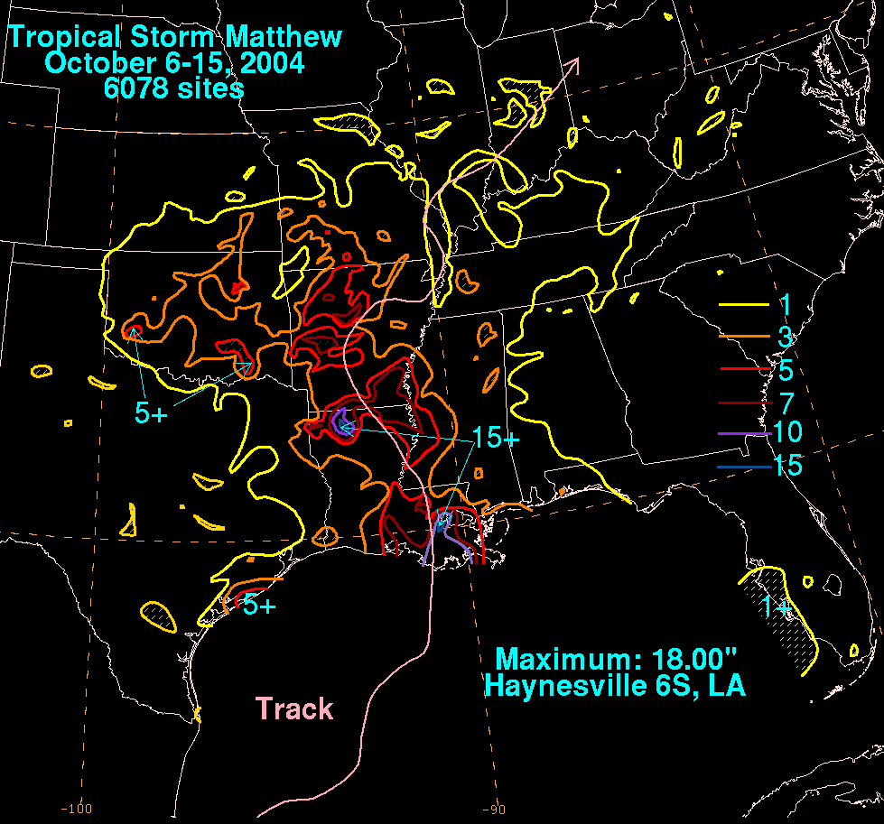
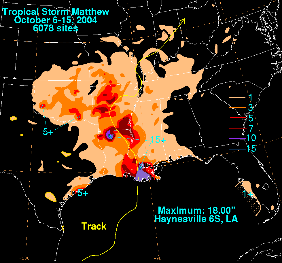
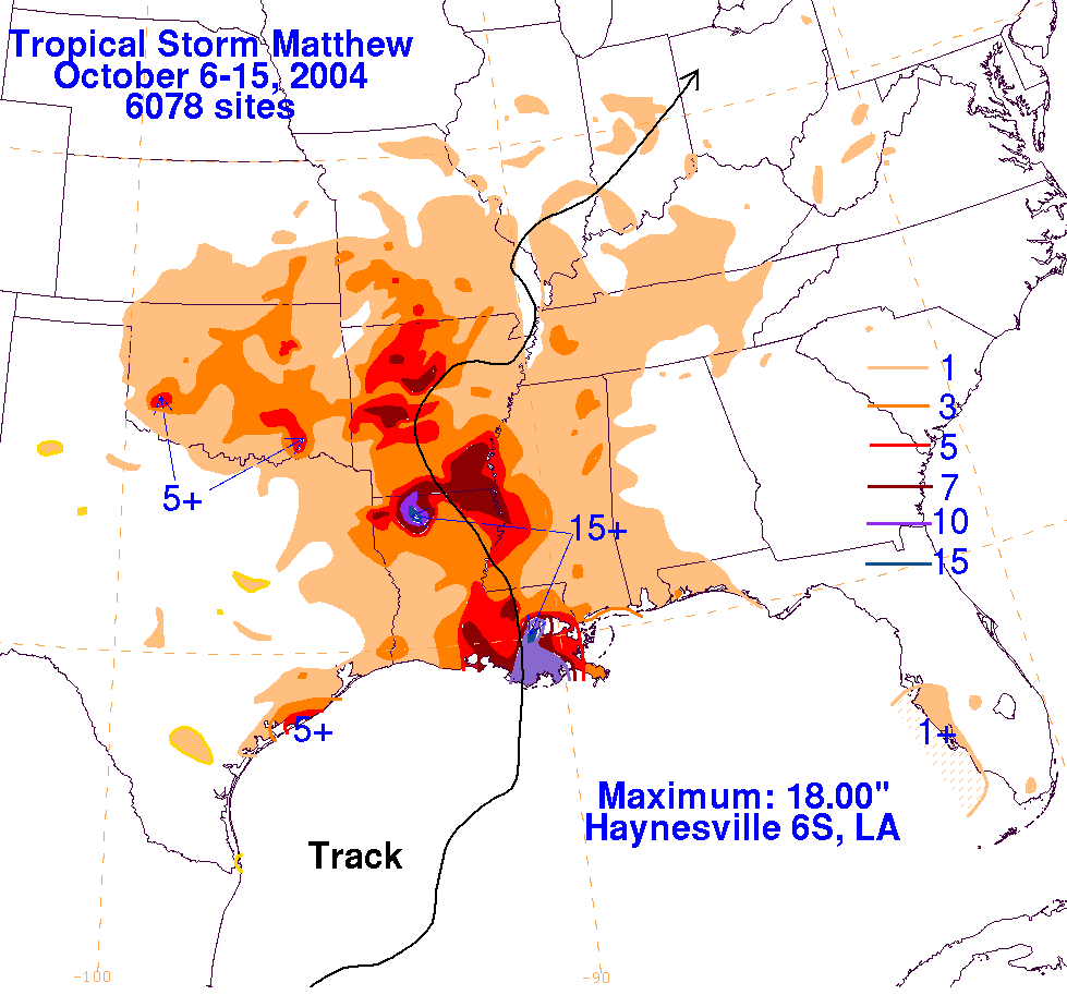
afternoon of 9 October. Matthew's center made landfall just west of Cocodrie, Louisiana early in the morning on
10 October. Maximum estimated winds were then 40 mph. Thereafter, Matthew weakened to a depression before
crossing the upper jet and becoming an occluded cyclone. It continued moving northeastward across the Mid-
Mississippi and lower Ohio valleys before becoming absorbed by a frontal wave in the Great Lakes on the
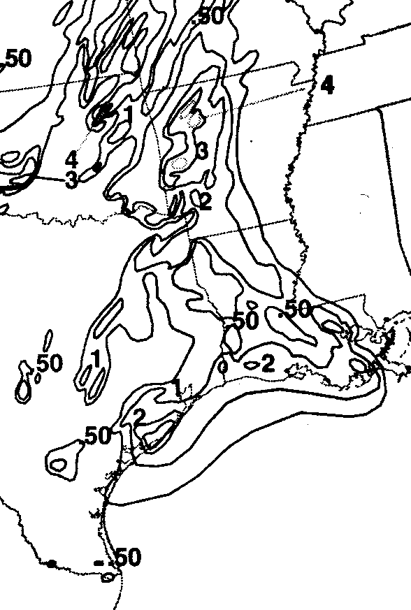
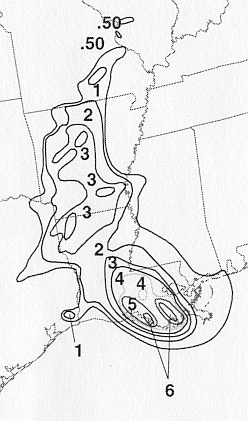
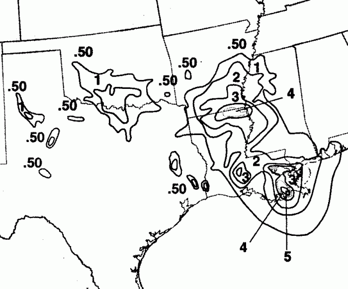
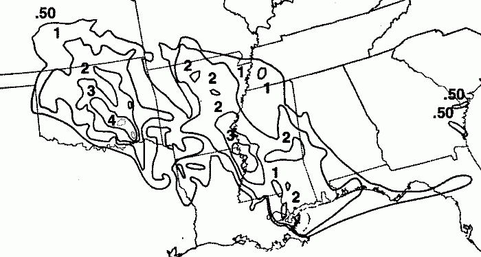
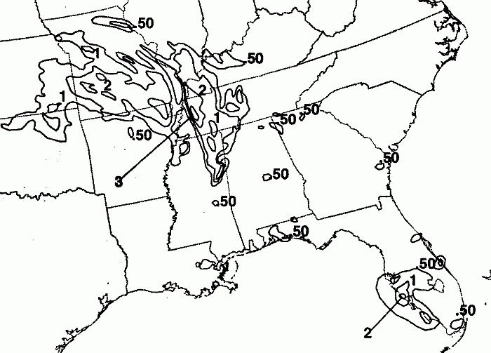
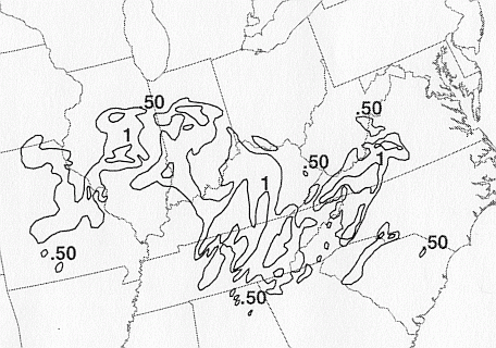
morning of the 14th. The storm total rainfall maps below were constructed using data from data provided from
NWS River Forecast Centers, rainfall statements from the NWS office in Shreveport, Louisiana, as well as
additional reports received by the National Hurricane Center.
 |
 |
 |
Below are the calendar for Daily Precipitation Maps. Note that the 24-hour periods end at 12z that morning.