Tropical Storm Matthew - September 23-26,
2010
A tropical wave moved offshore the African coast on September 11th. A disturbance formed along this wave axis and became
Tropical Storm Julia on the 12th. The southern portion of the wave continued to the west, showing minimal development until
it was located east of the Windward Islands on the 20th. On the 21st, the wave moved into the eastern Caribbean sea, spawning
a surface low by the 22nd. Thunderstorm activity with the system remained poorly organized until the evening of the 22nd, when
it developed along curved bands. By the morning of the 23rd, the system became well enough organized to be considered a
tropical depression 490 miles east of the Honduras/Nicaraguan border. The system strengthened, becoming a tropical storm later
in the day. Matthew moved west to west-northwest at near 20 mph as a strong ridge developed to the north, moving across northern
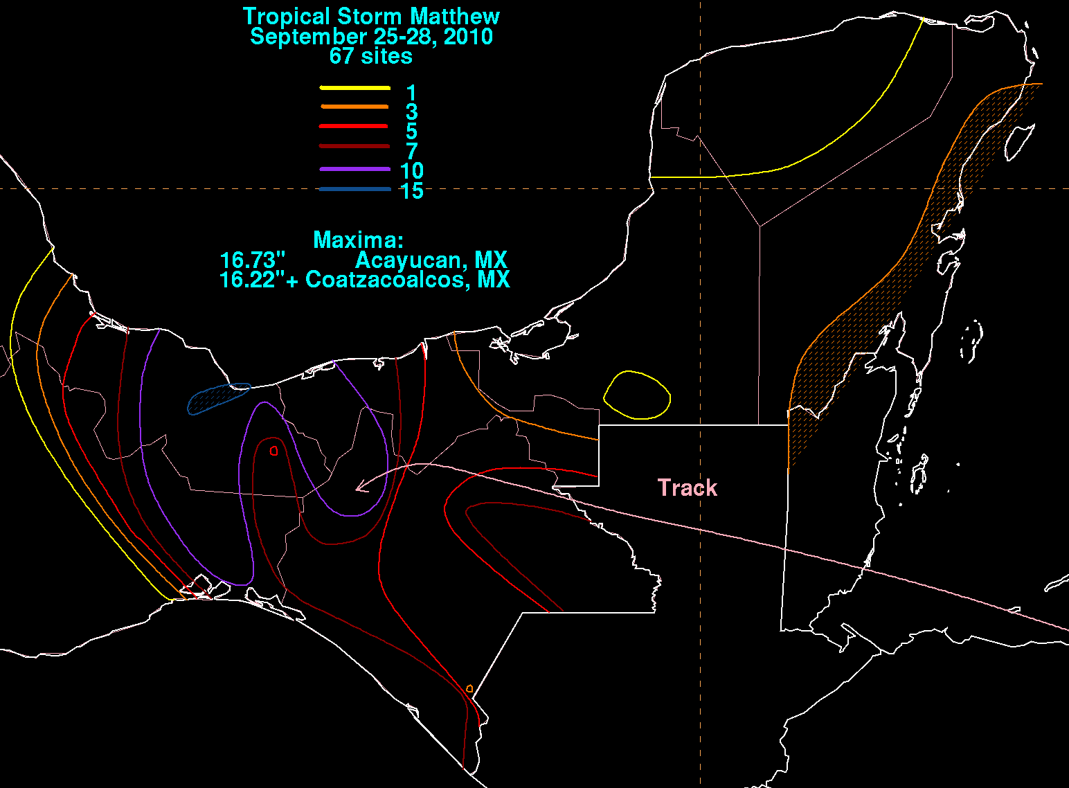
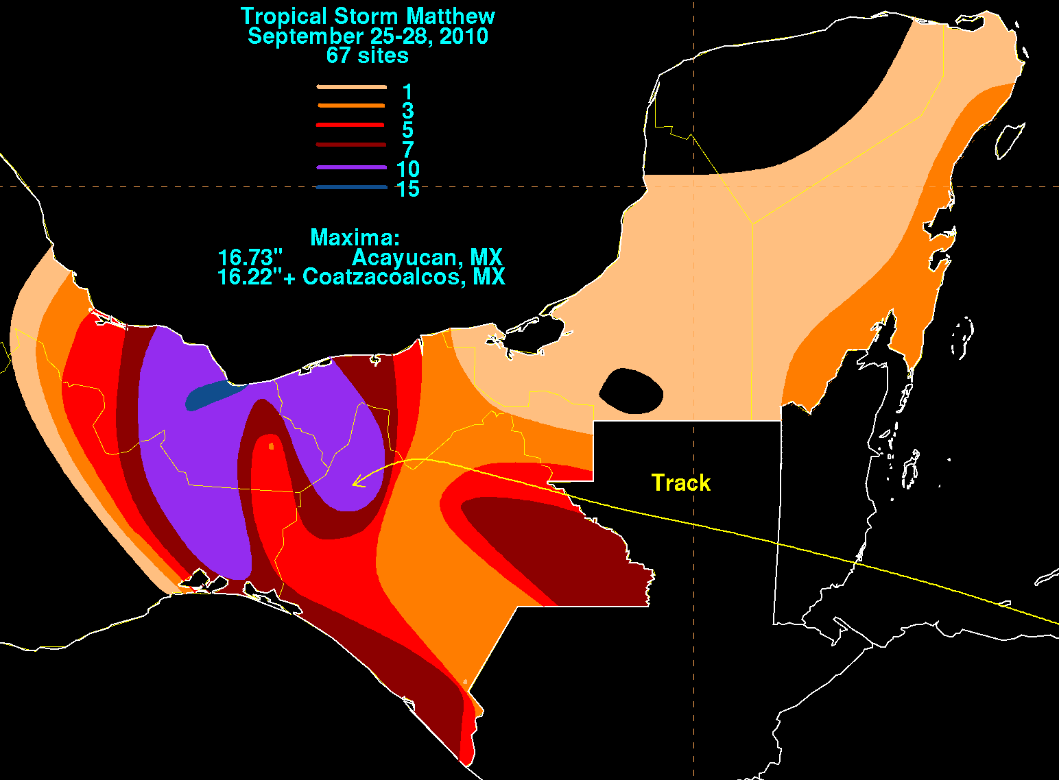
Honduras. The storm moved into the Gulf of Honduras and moved ashore Belize during the morning of the 25th. Weakening into
a tropical depression that afternoon, Matthew moved across northern Guatemala and into the Isthmus of Tehuantepec before stalling
and dissipating on the 26th. Below are its associated rainfall graphics, using data and graphics provided by the Comision Nacional
del Agua, the parent agency of Mexico's national weather service.