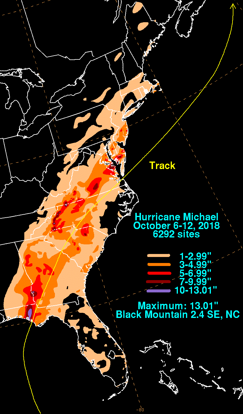
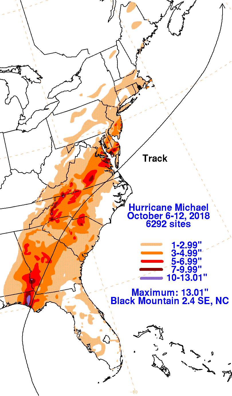
An area of disturbed weather across the western Caribbean sea developed, absorbing the remains of Kirk during the first couple days of October. The broad area of low pressure moved out of Central America into the northwest Caribbean sea by the 6th. Despite westerly vertical wind shear, the system organized into a tropical depression early on the 7th south of Cozumel. Moving north-northeast, the depression strengthened into a tropical storm on the morning of the 7th and a hurricane by the morning of the 8th. The hurricane intensified while moving west of Cuba, before plateauing as it moved into the southeast Gulf of Mexico. On the morning of the 9th the upper level environment improved, with rapid intensification resuming while heading north-northwest. Michael turned to the north on the 10th before turning northeast just prior to landfall in the Florida panhandle. The hurricane became the strongest on record for the Florida panhandle. The hurricane weakened while moving into Georgia and South Carolina. The lowest pressure measured in Georgia was 947.5 hPa at Donalsonville Airport -- the lowest known value on record for the state from a cyclone, tropical or extratropical, at the time. While moving across North Carolina, Michael became extratropical which enhanced winds east of the Blue Ridge as well as rainfall across Virginia. The storm moved into the North Atlantic, rapidly crossing the ocean between the 12th and 14th before weakening near western Europe on the 15th.
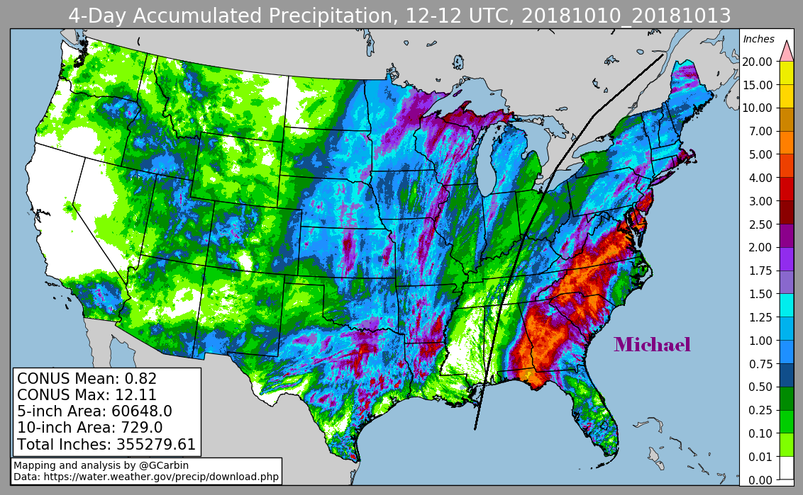
The first three graphics below show the storm total rainfall for Michael, which used rain gage information from the National Weather Service River Forecast Centers, Forecast Offices, and CoCoRAHS. The fourth graphic uses the offical National Weather Service multi- sensor rainfall estimates which include radar-derived information.
 |
 |
 |
 |