A broad low pressure area formed in the western Caribbean sea on
October 13th from the remains of Tropical Depression
12-E, which had previously crossed southeast Mexico and northern
Central America. The low drifted northward while
slowly organizing through the 16th. On the 17th, its surface
center became dislocated to the west of the system's main
convective area due to increasing westerly vertical wind shear.
The surface low became elongated yet deepened at it
moved northward through the Gulf of Mexico into the
Southeast. An occluded cyclone moving across the Tennessee
Valley absorbed its surface circulation on the 19th.
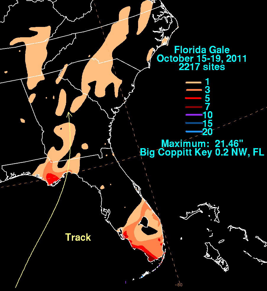
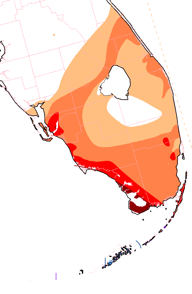
The track within the graphics below was extracted from real-time
surface analyses produced at the Hydrometeorological
Prediction Center and the
National Hurricane Center. Rainfall information was provided by
National Weather Service
River Forecast Centers, a public information statement from Key West,
Florida, and CoCoRAHS.
 |
 |
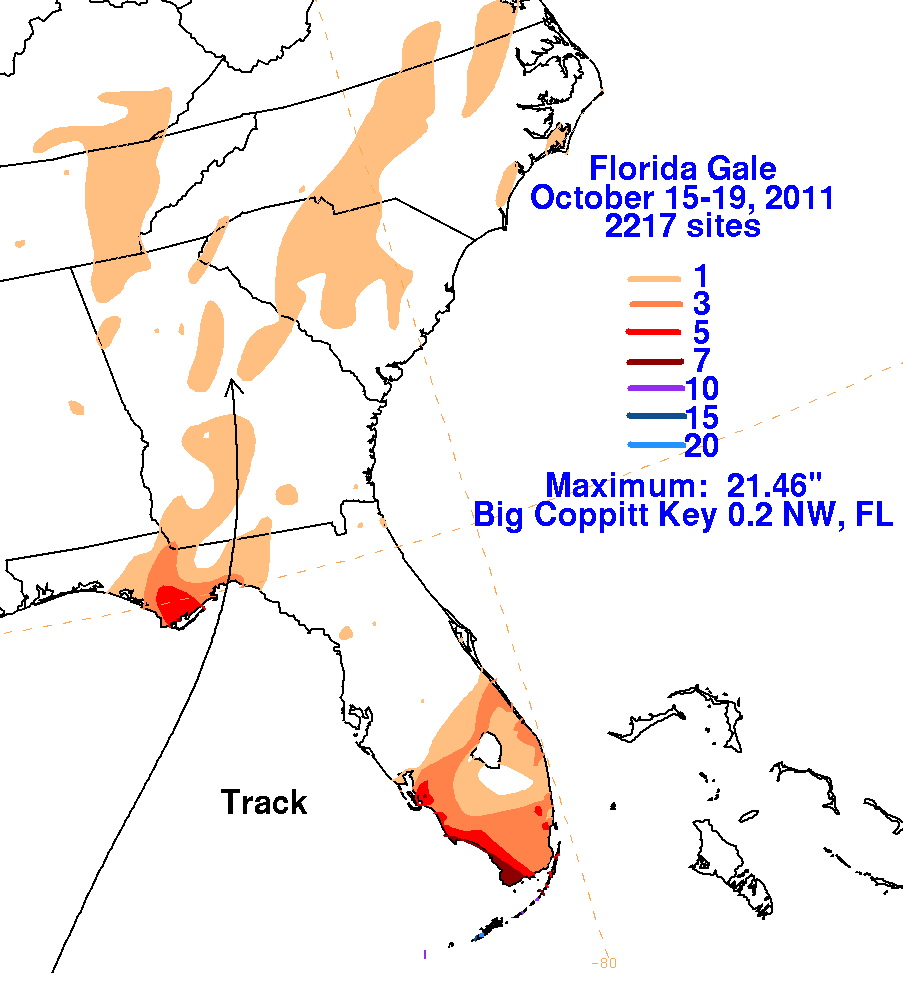 |
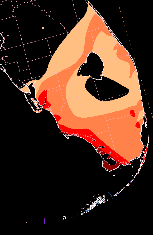
saw their wettest five day period since January 1983 from this system.
 |
 |
 |