A tropical wave emerged off the African coast on August 22nd. It was accompanied by a broad area of low pressure as it moved
west across the tropical Atlantic, steered by a subtropical ridge to its north. The tropical wave would fracture, with a portion
moving north to evolve into Tropical Storm Kate. The southern portion crossed the Windward Islands on the 28th and 29th,
briefly showing signs of organization in the southern Caribbean Sea on September 1st before moving inland across Central
America on the 2nd. The tropical wave split once more, with the southern portion evolving into Hurricane Olaf in the northeast
Pacific on the 7th. The northern portion moves slowly northwest across the Yucatan Peninsula on the 3rd and 4th. Emerging into
the Gulf of Mexico on the 5th, it drifted northward, slipping between two mid-level highs to its northwest and southeast. On the
8th, a deep-layer trough moved into the western Gulf of Mexico which accelerated the system northeast. By sunrise, deep convection
helped the system become better defined at the surface and Minday formed that afternoon southwest of Apalachicola, Florida. That
evening, Mindy made landfall upon St. Vincent Island. The cyclone weakened to a tropical depression on the morning of the 9th as
it passed quickly through northern Florida and southeast Georgia. By afternoon, Mindy emerged into the subtropical northwest Atlantic
but vertical wind shear prevented convective organization. Mindy's low would move quickly northeast along a frontal zone until
it dissipated in the far north Atlantic during the early morning hours of the 14th.
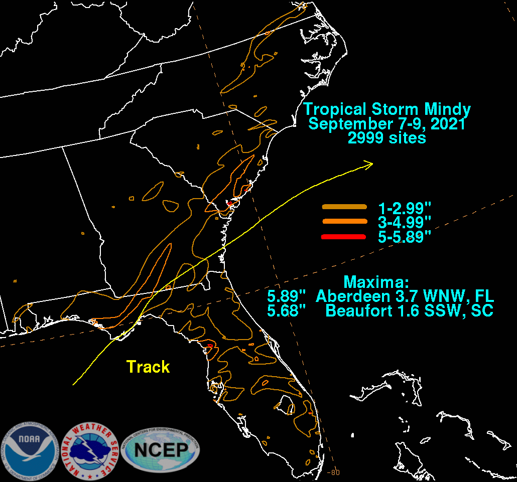
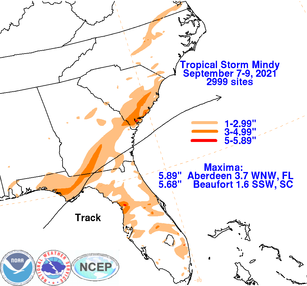
The graphics below show the storm total rainfall for Mindy, which used rain gage information from the National Weather Service River
Forecast Centers, Forecast Offices, and CoCoRAHS.
 |
 |
 |