A tropical wave moved off the coast of Africa on October 3rd. It began to flare up some thunderstorm activity in
the Caribbean Sea on the 8th, but thunderstorms didn't fully expand in coverage until it interacted with a monsoon
depression/Central American Gyre over northern Central America on the 13th. Low pressure areas formed on both
sides of the Central American isthmus, with the circulation in the southern Gulf not able to sustain cold topped
convection until its Pacific counterpart moved into southern Mexico. An upper level trough moving across Texas and
northern Mexico helped to steer the broad low northward and support a front to its north. The system became gale-
force on the 17th, though organized thunderstorm activity didn't occur with the system until it crossed the central Gulf
of Mexico on the 18th. Nestor was designated as a tropical storm that afternoon once its center became well defined.
As the distance between the upper level trough, the front at its leading edge, and Nestor decreased, the storm began to
transition into an extratropical cyclone, a process that was complete by the morning of the 19th just before its
center moved east-northeast into the Florida Panhandle. The low moved through the Southeast, emerging offshore
Virginia late on the 20th before being consumed by another nearby low to its north.
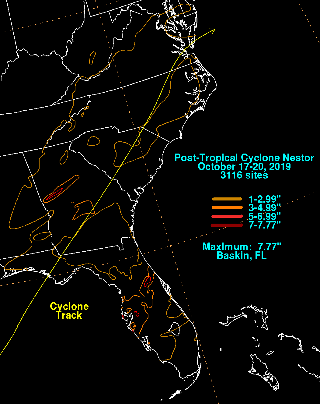
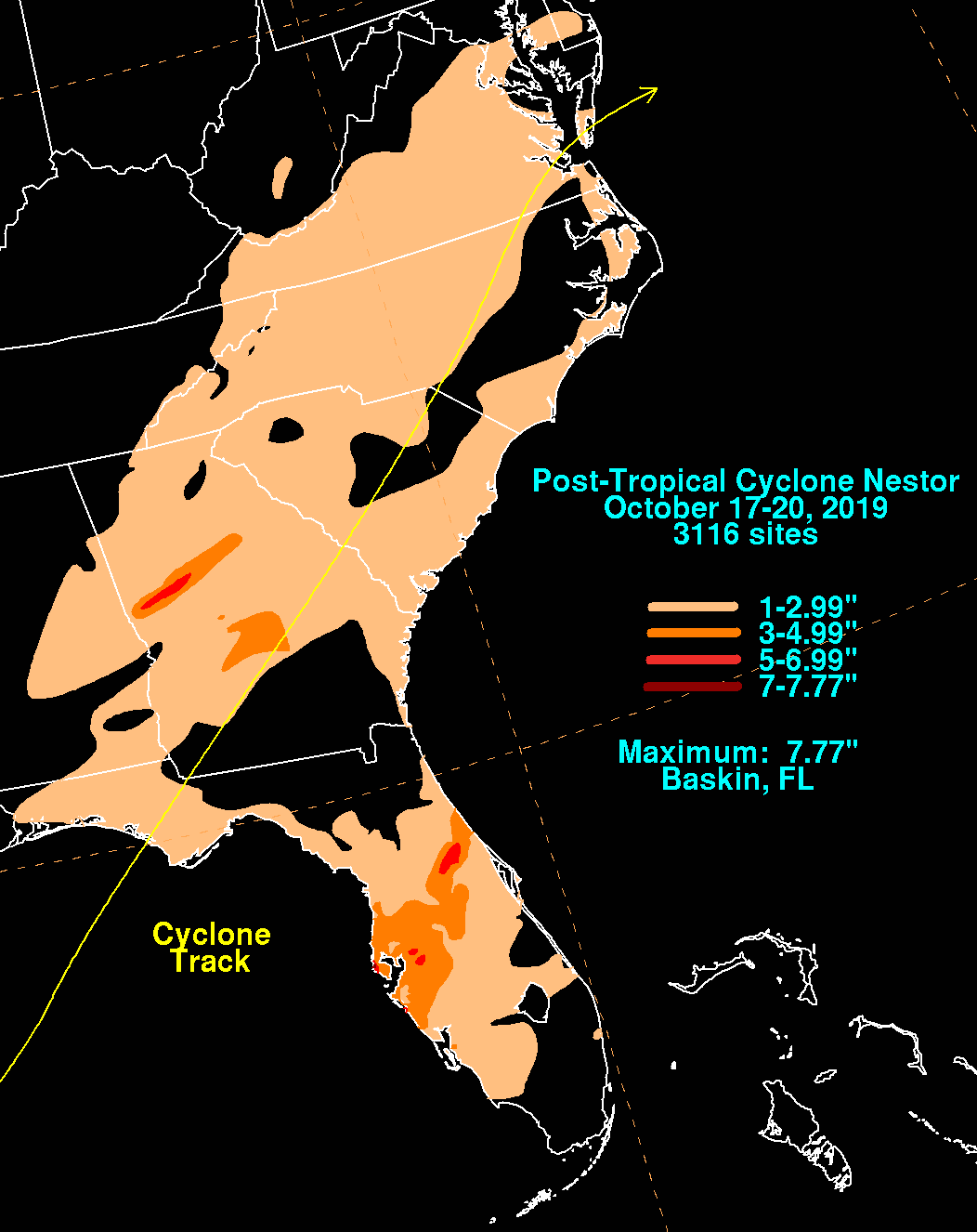
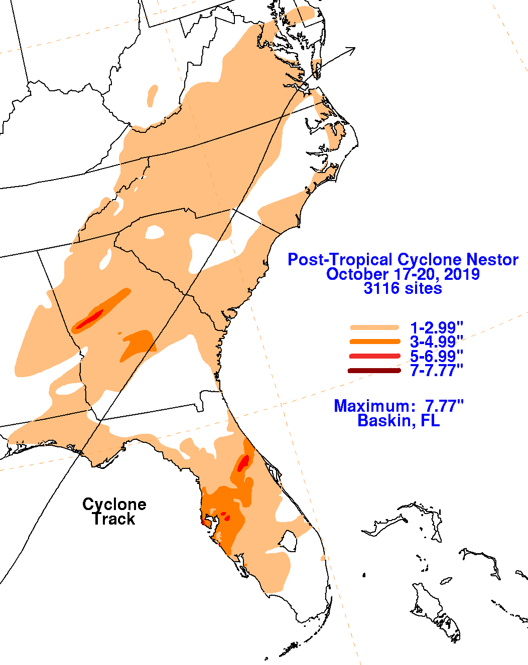
The graphics below show the storm total rainfall for Nestor, which used rain gage information from the National Weather
Service River Forecast Centers, Forecast Offices, and CoCoRAHS.
 |
 |
 |