An area of disturbed weather formed on the 11th west of Panama and
drifted
slowly westward.
The wave that spawned this system emerged off the coast of Africa on
August 30th and 31st and
helped spawn Erika. Light winds aloft and very warm water
temperatures
allowed Nora to
develop into a tropical depression by early the 16th, a tropical storm
later that day, and a
hurricane late on the 17th. The cyclone moved west-northwest,
steered by the climatological
500 hPa anticyclone over northwest Mexico. From the 18th to the
20th, Nora stalled. A storm
system in the West most likely eroded the western part of the mid-level
ridge, causing the stall.
Weakening ensued as Nora sat over the same patch of water, upwelling
the waters in its vicinity.
The ridge to its north rebuilt as the Western cyclone spun into the
Midwest, allowing Nora to
assume a parabolic course around its periphery, restrengthening to
a category four hurricane.
Nora then moved roughly along Linda's path...a hurricane that preceded
Nora by several days.
This caused renewed weakening in the cooler waters upwelled by
Linda.
A cutoff low formed
northwest of the cyclone on the 23rd, allowing Nora to turn northward
and accelerate. The
cyclone remained at hurricane status during both landfalls....near
Point Eugenia and the Mouth
of the Colorado river.
Weakening to a tropical storm, Nora crossed into the Desert
Southwest
of the United States.
Sustained winds of tropical storm force were recorded at Yuma.
Although weakening to a
tropical depression as it moved across California and Arizona, the
circulation aloft did not
have time to spin down. Strong winds, nearing hurricane force,
downed many trees across
southwestern Utah, at an elevations of 10,000 feet and higher.
Heavy rains along the
Mogollon Rim closed in on 12 inches in the Harquahala mountains....with
numerous locales
reporting 3 to 4 inches...more than many of them normally see in a
year. Some lighter rains
fell across the central Rockies, with some moisture making it into
the northern Plains. Below
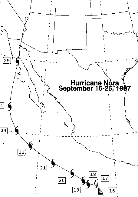
is the track of the cyclone, provided by TPC/NHC.
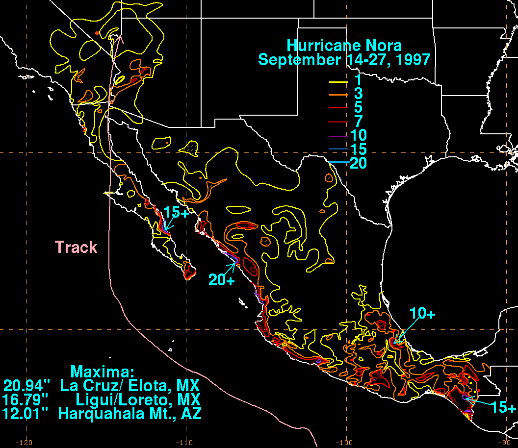
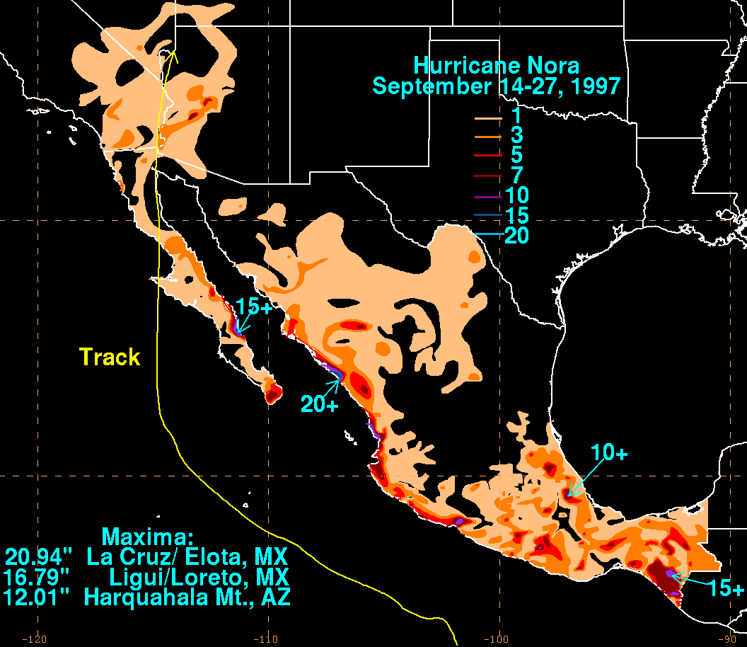
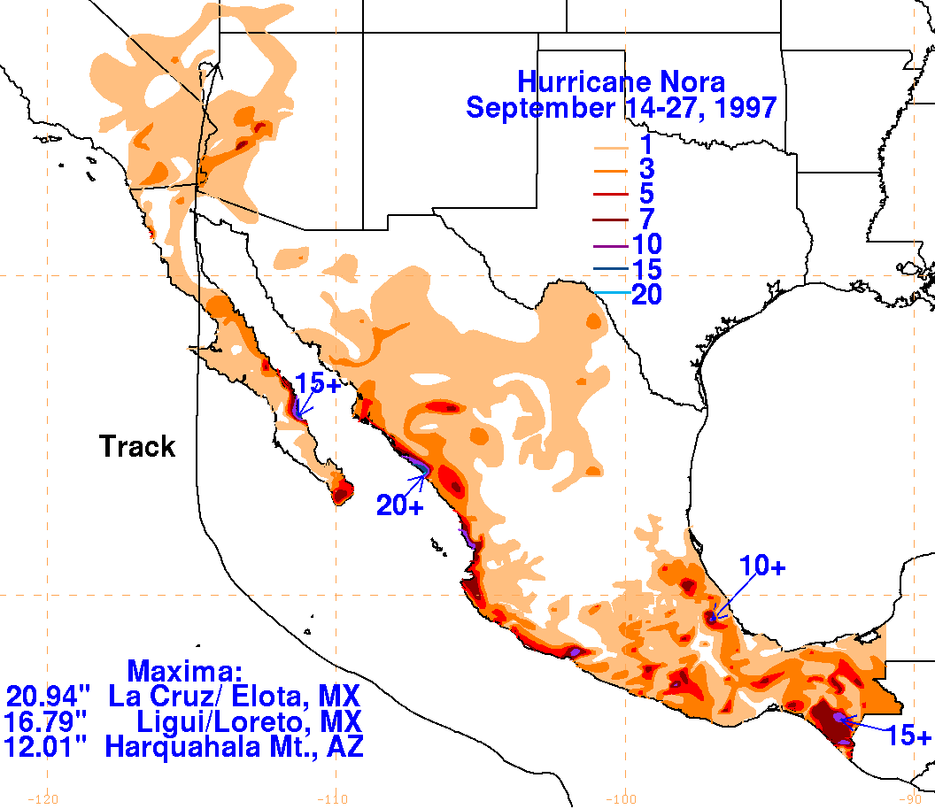
Below are the storm total rainfall maps for Nora, created using
precipitation
totals collected from the National Climatic
Data Center, the Maricopa County ALERT
system, the NHC tropical cyclone report, and the Comision del Agua, part
of the Mexican National Weather Service. The maximum in the
United States is located in
the
higher terrain of
southwest Arizona to the right of the track. In Mexico, the
highest amounts in western portions of the country were
near the entrance to the Gulf of California. In eastern Mexico,
the combination of the precursor Nora disturbance
and an upper low over the Gulf of Mexico led to heavy amounts just west
of Guatemala.
 |
 |
 |
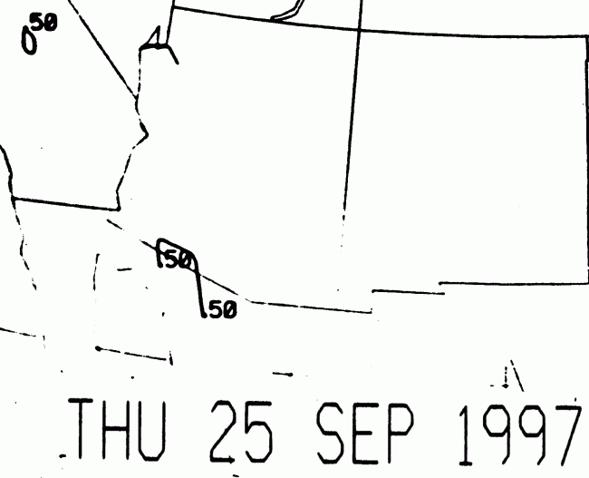
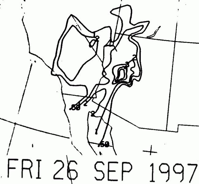
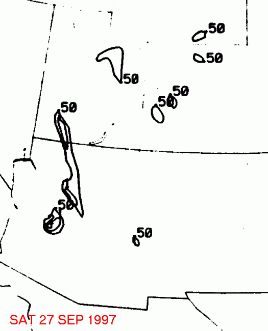
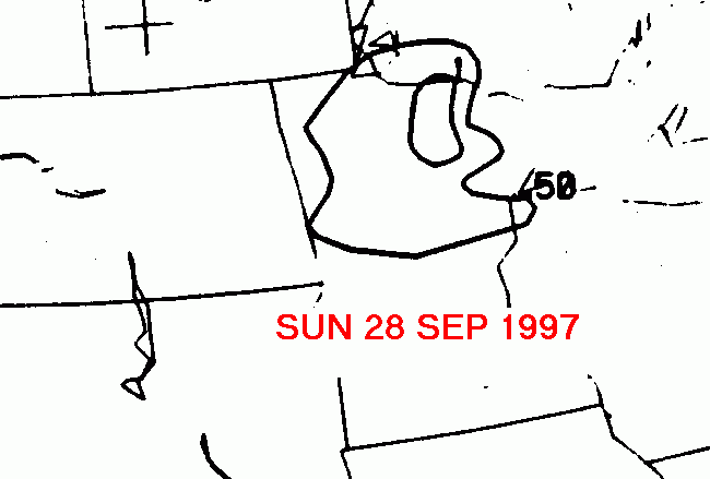
Below is the calendar for Daily Precipitation Maps. Note that
the 24-hour periods end
at 12z that morning.