Twelve hours after Max became a tropical storm, a disturbance was developing
near 14.5N 104.5W. It initially moved west-northwest at 10 mph before slowing
down and changing to a more northwest course. Just after midnight on the 9th,
the system had become a tropical storm. The eye became well defined by that
afternoon as Norma quickly intensified into a hurricane. Norma reached category
3 strength just after noon on the 10th. Norma slowly recurved northward in advance
of southwesterly flow aloft over northwest Mexico, passing a mere 150 miles east
of Socorro Island.
Weakening as it accelerated towards western Mexico, Norma began moving quicker
to the north-northeast, striking Mexico just north of Mazatlan early on the morning of
the 12th. While its low level center initially dissipated around sunrise, a new low pressure
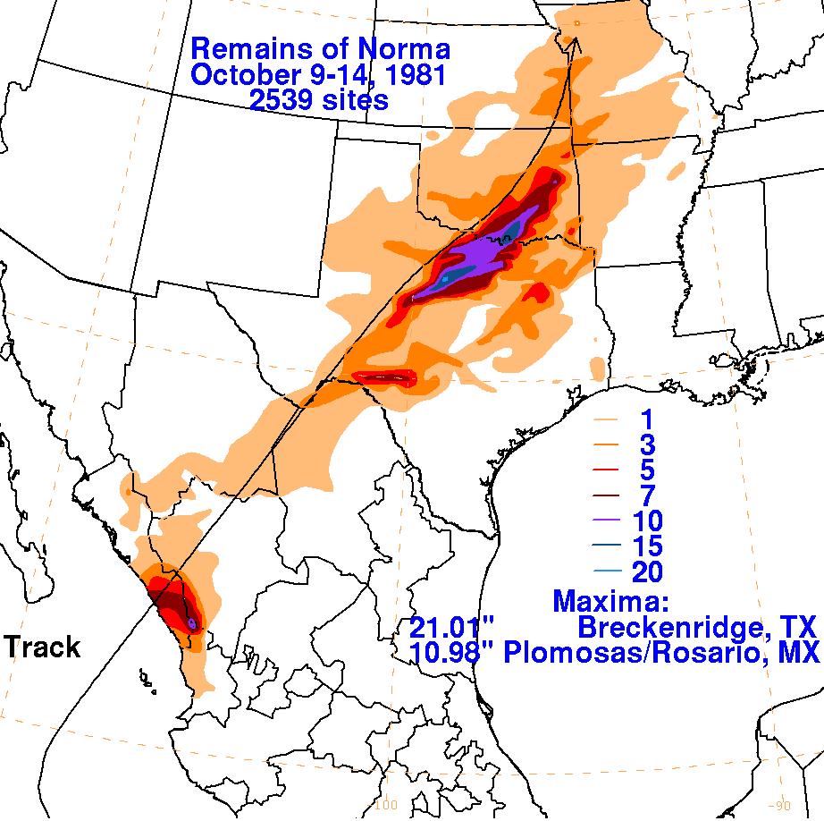
area formed ahead of its upper level portion across West Texas and turned northeastward
in advance of a frontal system, dumping heavy rains to the east of its track. This low
became absorbed by a frontal wave near Kansas City by the 14th.
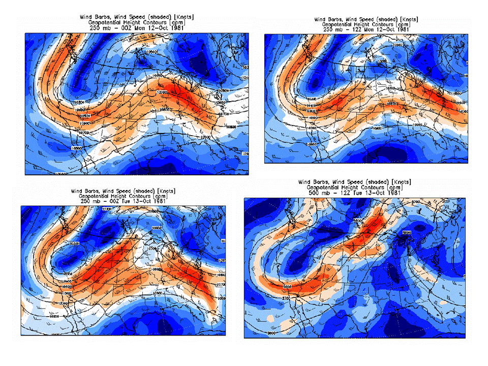
Below are some of the 250 hPa level maps which show the environment near Norma
as it recurved into the United States, prepared by Wes Junker from the North
American Regional Reanalysis.
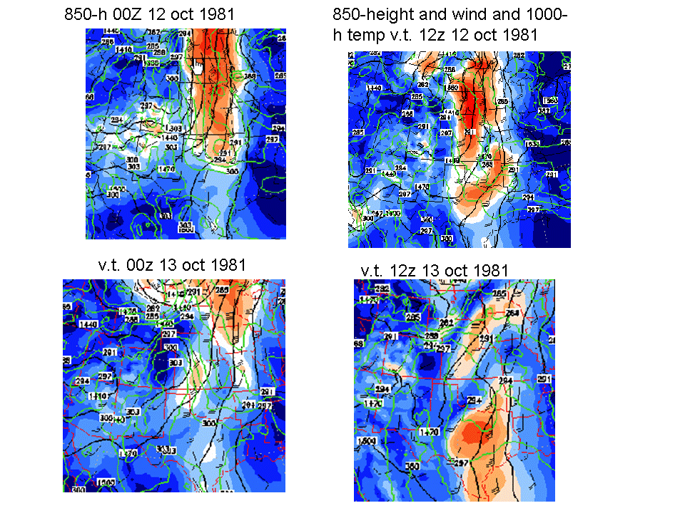
Below are some of the 850 hPa level maps which show the environment near Norma as
it recurved into the United States, prepared by Wes Junker from the North American Regional
Reanalysis.
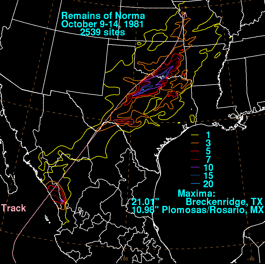
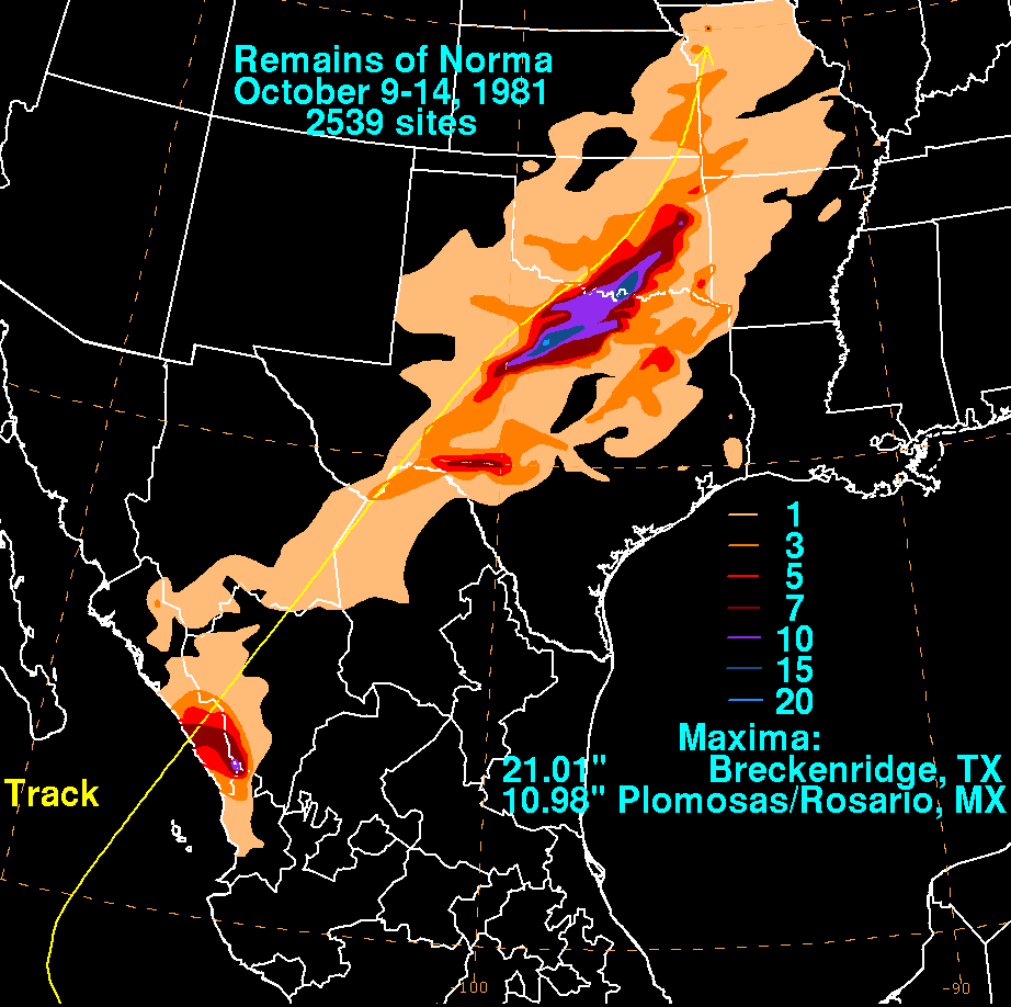
The storm total rainfall maps below were constructed using data provided by the National
Climatic Data Center in Asheville, NC and the Comision Nacional del Agua, the parent agency
of Mexico's national weather service. Note the maximum was near to just right of the cyclone's
track.
 |
 |
 |