An upper low retrograded westward across the subtropical Atlantic,
spurring the development of a surface trough
by December 6th. By late on the 9th, an area of low pressure
formed as convection developed northeast of the
upper low while northeast of the Leeward Islands. Convection
became organized and deep enough for the cyclone
to be considered a subtropical storm on the 10th, due to the presence
of an upper level low close to the center and
gale-force winds extending a significant distance north of the
center. By late on the 11th, the radius of its maximum
winds contracted enough for the system to be considered a tropical
storm as it moved into Hispaniola. Below are
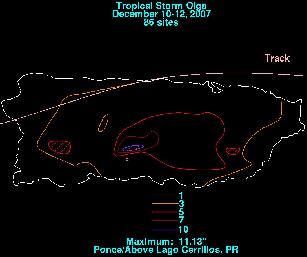
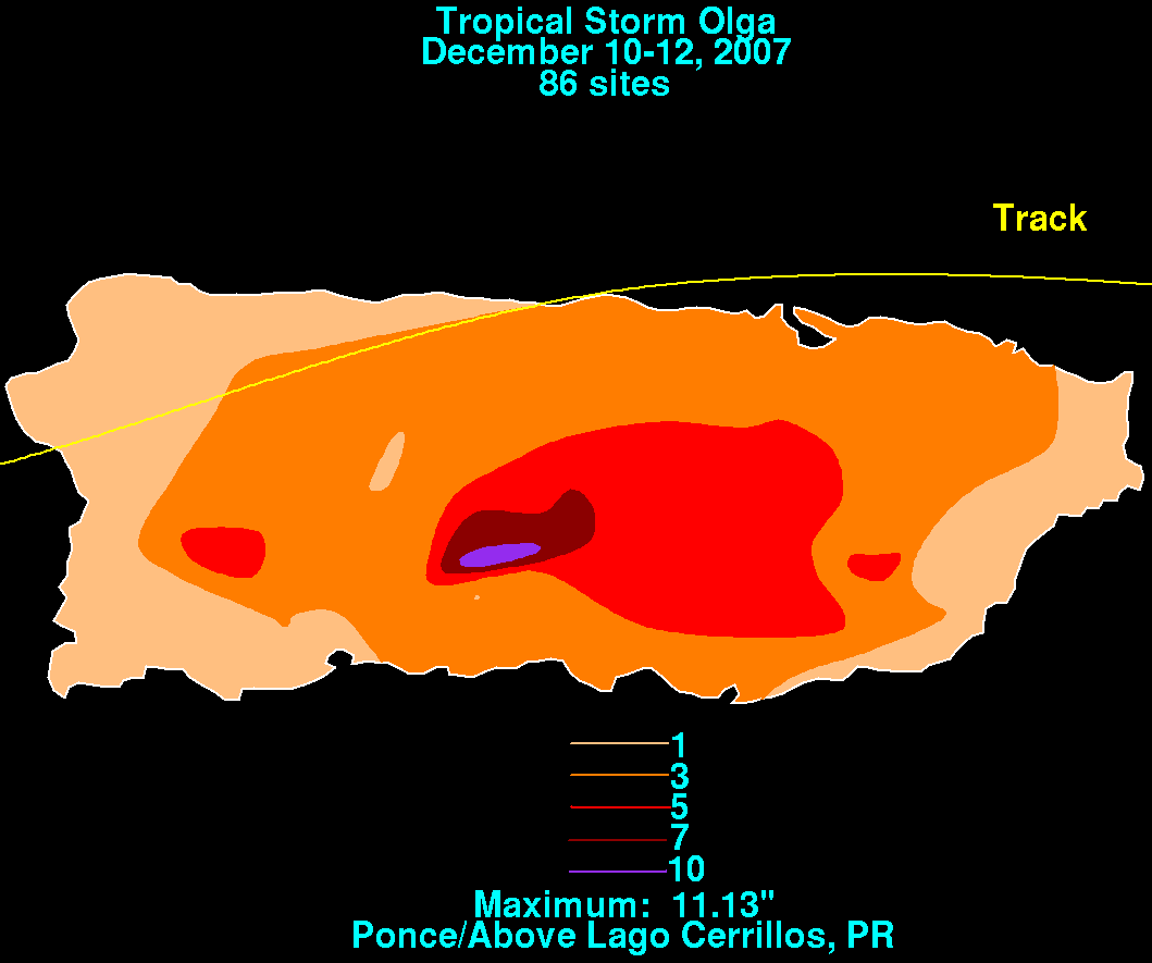
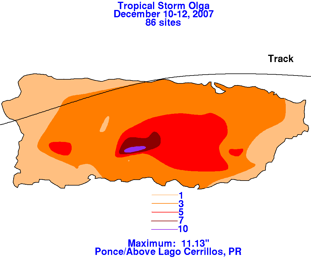
rainfall maps for Puerto Rico for Olga, constructed from data provided
by the Southeast River Forecast Center in
Peachtree City, Georgia and the U. S. Geological Survey.
 |
 |
 |
Upper level wind shear and interaction with the mountains of the
Dominican Republic
and Haiti led to weakening,
with Olga dropping to tropical depression strength on the 12th and
becoming a
remnant low later in the day due to
a lack of central convection. The surface low remained
intact, slowly weakening as it moved through the northeast
tip of the Yucatan peninsula into the Gulf of Mexico. An upper
level trough and associated cold front began approaching
Olga, which led to temporary strengthening of the surface circulation
as intermittent convection developed northeast of
its center. The low came ashore the Florida coast early on
the morning of the 16th near
Clearwater Beach with a central
pressure near 1002 hPa and sustained winds of 45 mph with gusts to 78
mph. The cyclone then weakened as it crossed
the peninsula, dissipating as it reached the east coast near Daytona
Beach.
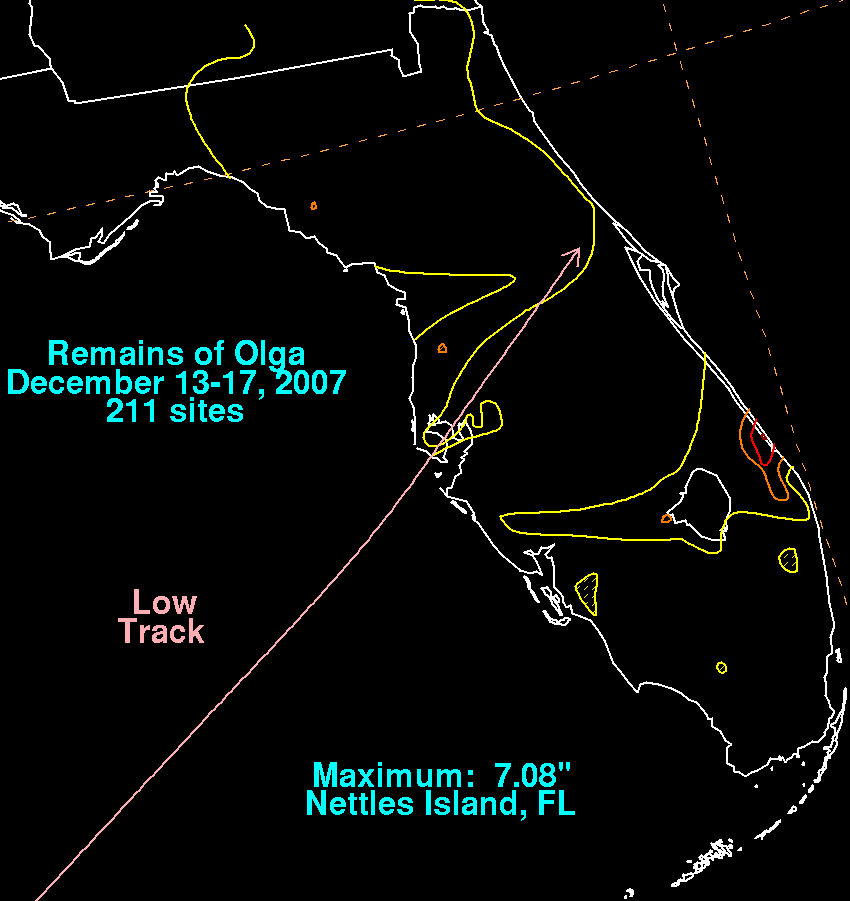
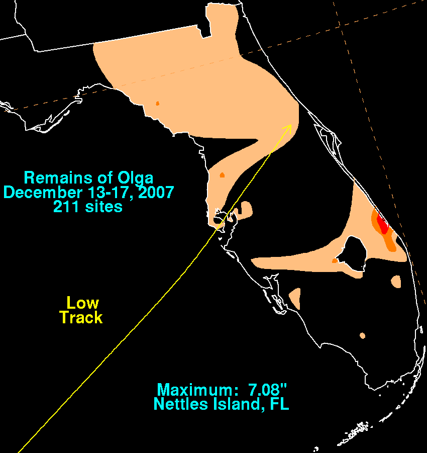
Below is the storm total rainfall graphic for Florida, using
rainfall information which was obtained from the
Southeast River
Forecast Center in Peachtree City, Georgia. The maximum in
eastern Florida occurred between the 13th and 14th along
the surface trough that extended northeast from Olga. The maximum
north of Tampa Bay occurred northeast of the center
during the time of landfall. The rainfall across the northern
peninsula was primarily due to the cold front approaching Olga
from the northwest.
 |
 |
 |