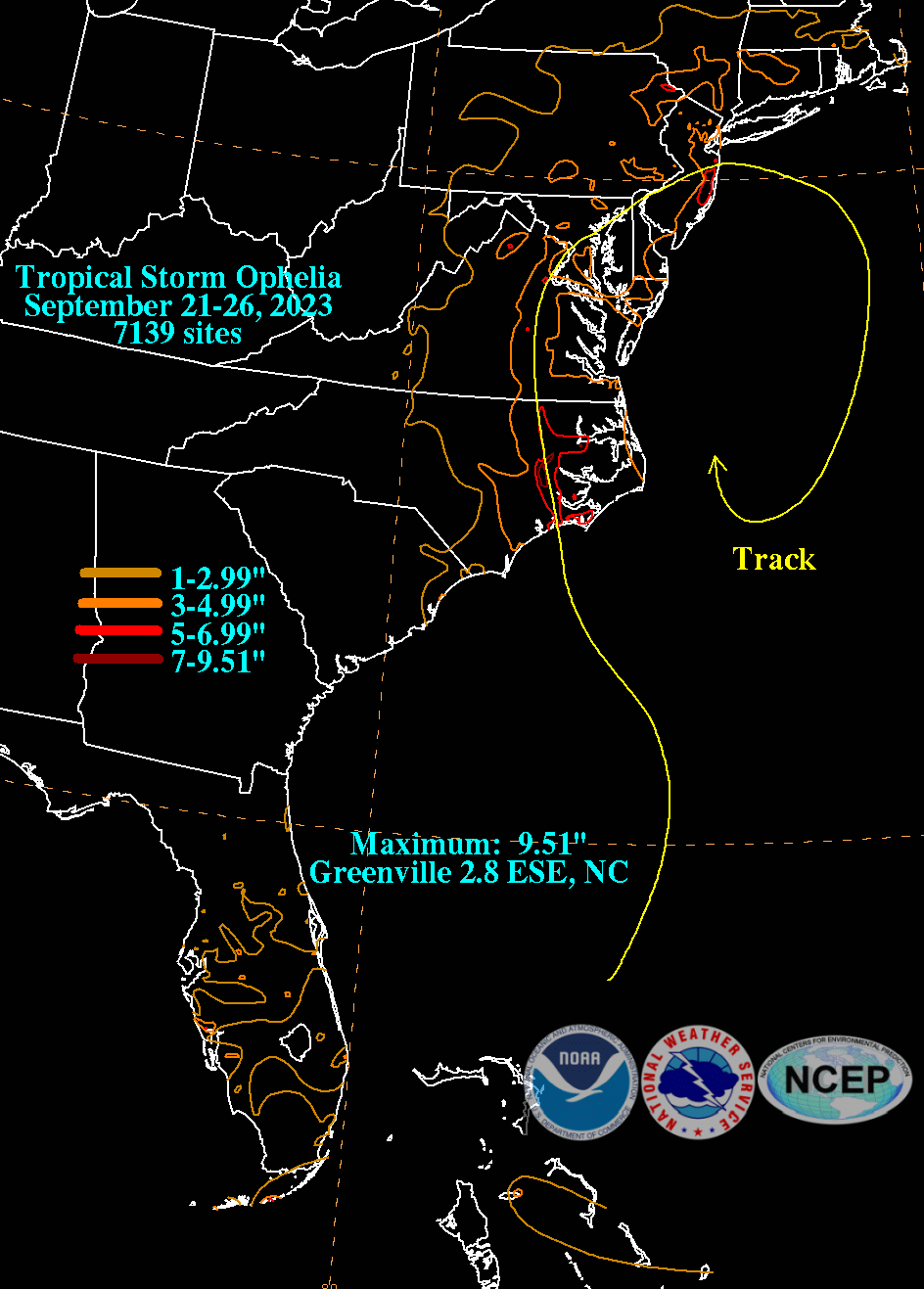
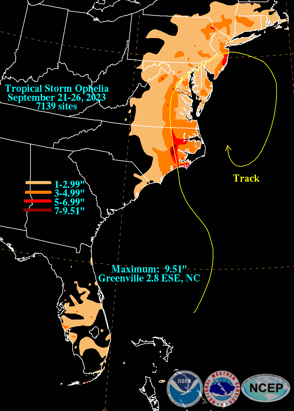
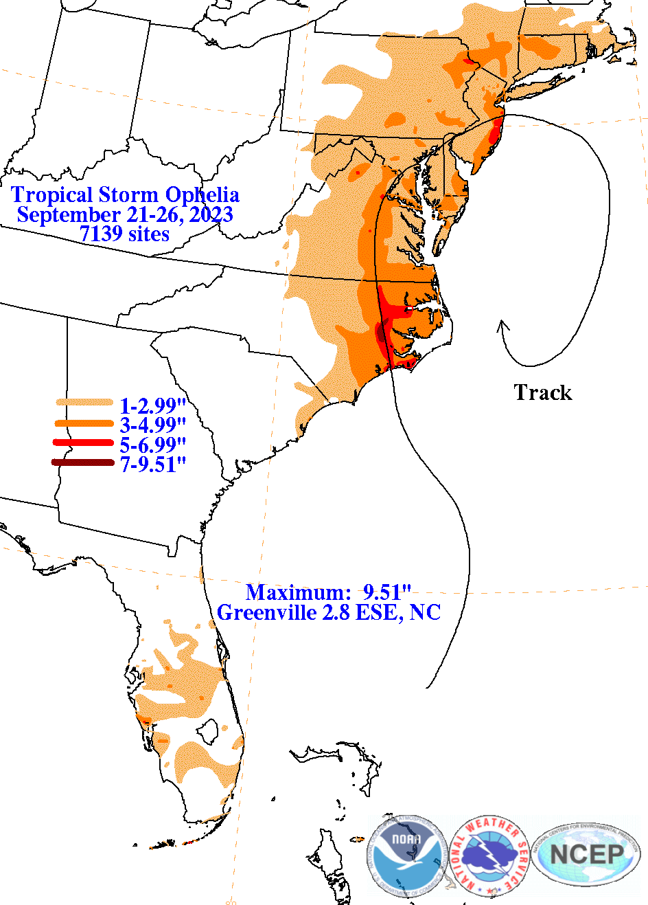
On September 20th, a large area of disorganized showers and thunderstorms developed east of Florida within an offshore trough of low pressure. A broad non-tropical low pressure system formed within the area on the 21st. The system deepened on the morning of the 22nd, as it moved generally northward, still attached to a front. It was generating sustained tropical storm-force winds within its broad, asymmetric wind field, and the deep convection was concentrated to the north of the center of the low. Later on the 21st, the low occluded and naturally detached from the nearby fronts, and was designated as Tropical Storm Ophelia, despite obvious hybrid nature which Ophelia never fully shed. The storm made landfall on the morning of the 23th near Emerald Isle, North Carolina with storm-force winds. Inland, Ophelia weakened as it moved northward through the state, and became a tropical depression that evening, after it crossed into southeast Virginia. By the night of the 23rd, the system had lost its few tropical characteristics, becoming a post-tropical cyclone. On the 24th, its remnant circulation moved eastward off the New Jersey coast, as rains from the system swept northward into New England. The low then turned southward over succeeding days, and was eventually absorbed by a new low pressure area that formed along the frontal boundary to its south and southeast.
The graphics below show the storm total rainfall for Ophelia, which used rain gage information from National Weather Service River Forecast Centers, xMACIS2, National Weather Service Forecast Offices, and CoCoRAHS.
 |
 |
 |