An area of disturbed weather formed between the eastern Caribbean sea and the central tropical Atlantic on September 30th,
associated with two tropical waves. Initially, a low developed well to the east, which moved into strong westerly winds aloft
and dissipated. Meanwhile, the western tropical wave in the series moved westward into Puerto Rico on October 2nd, forming
a surface low southwest of the Leeward Islands on the 3rd. The system drifted in place for a couple days as an upper level low
retrograded to its north. After the upper cyclone moved west of its longitude, the low moved northward through the United States
Virgin Islands on the 5th. As the system swung northwest and moved underneath the upper level low, the system became a
subtropical storm on the 6th. Otto drifted northwest initially, before it turned northeast well to the east of the Bahamas. The
storm's core warmed a bit, with its wind field contracting and its central convection deepening, and Otto became a tropical storm
on the 7th and a hurricane on the 8th. The hurricane accelerated northeast, become an extratropical cyclone on the 10th. While
approaching the Azores, Otto slowed down its frontal progression and turned southeast as it shed its frontal zones. The cyclone
became an exposed swirl of low clouds with some occasional thunderstorm activity on its east side as it drifted towards the Canary
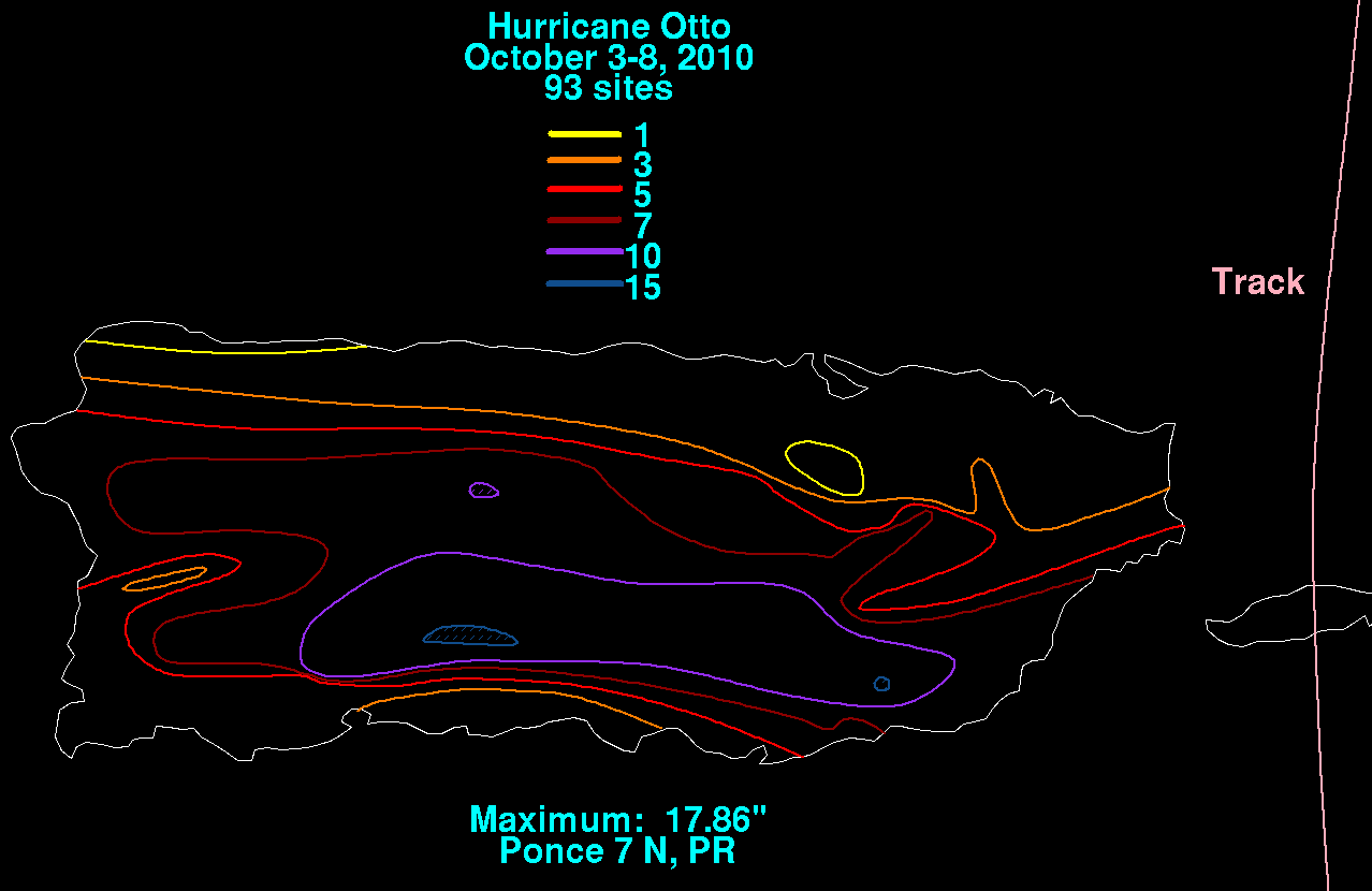
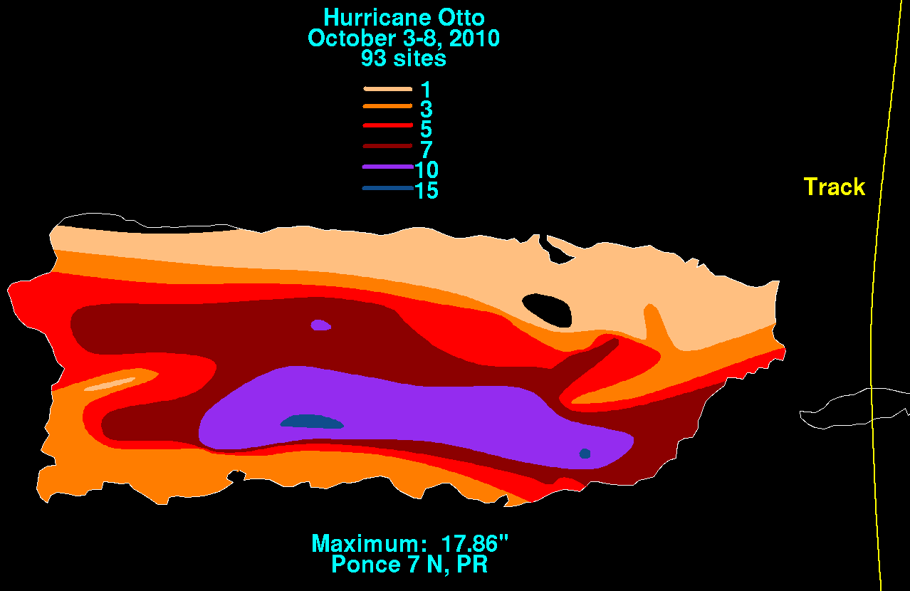
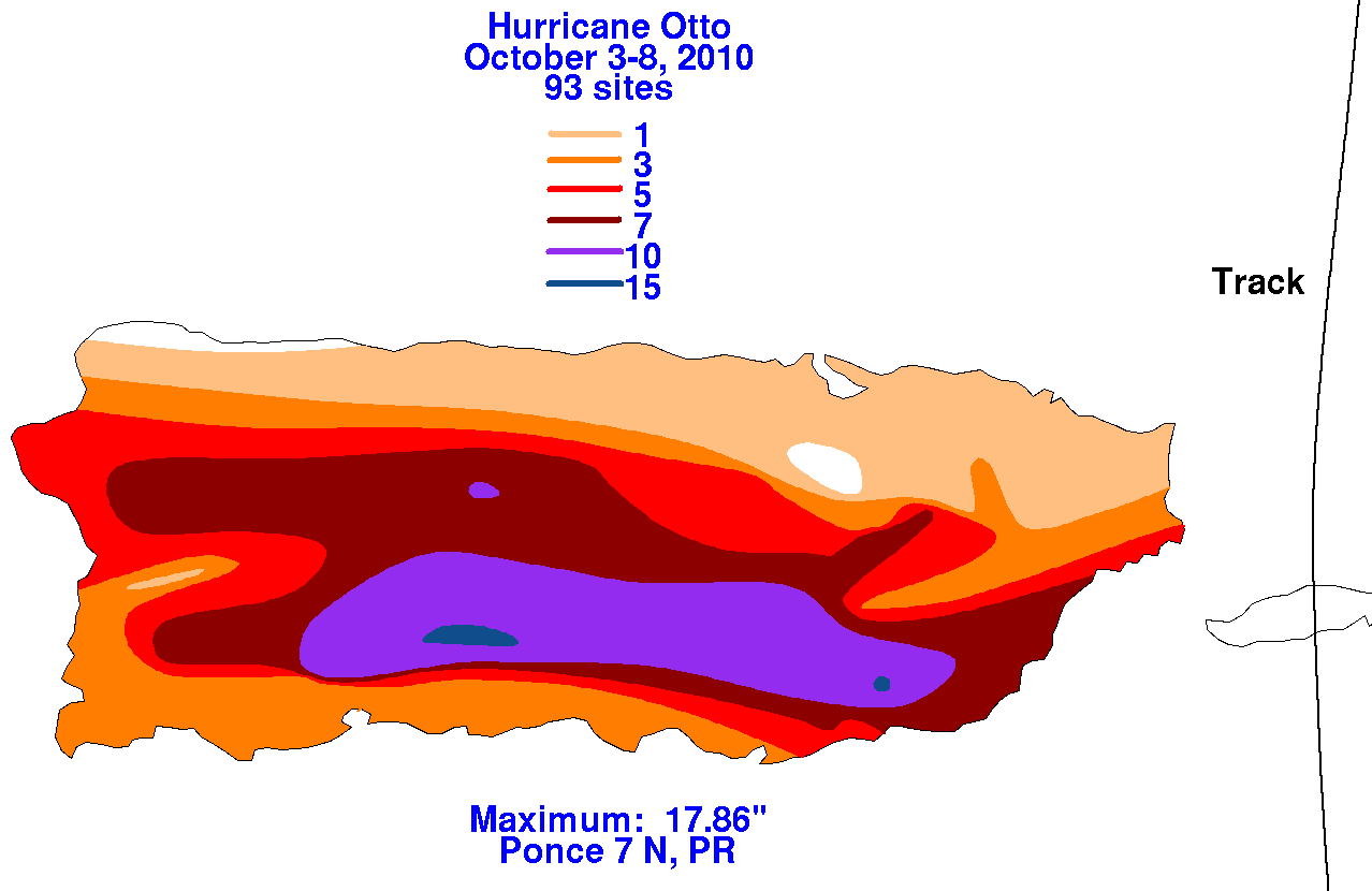
Islands on the 14th and 15th. Below are the associated rainfall graphics for Otto, using data supplied by the Southeast River
Forecast Center in Peachtree City, Georgia.
 |
 |
 |