The tropical disturbance that became the 23rd tropical cyclone of the season passed into the
Pacific Ocean through Central America on the 27th of September. Moving westward south of
a warm core ridge, the disturbance became a tropical depression late on the 27th roughly 200
miles southwest of Guatemala. Paralleling the Mexican coastline, the system became a tropical
storm late on the 29th, about 350 miles west-southwest of Acapulco. By the afternoon of the
30th, reconnaissance aircraft observations revealed Paine's strengthening into a hurricane.
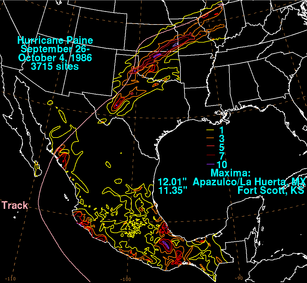
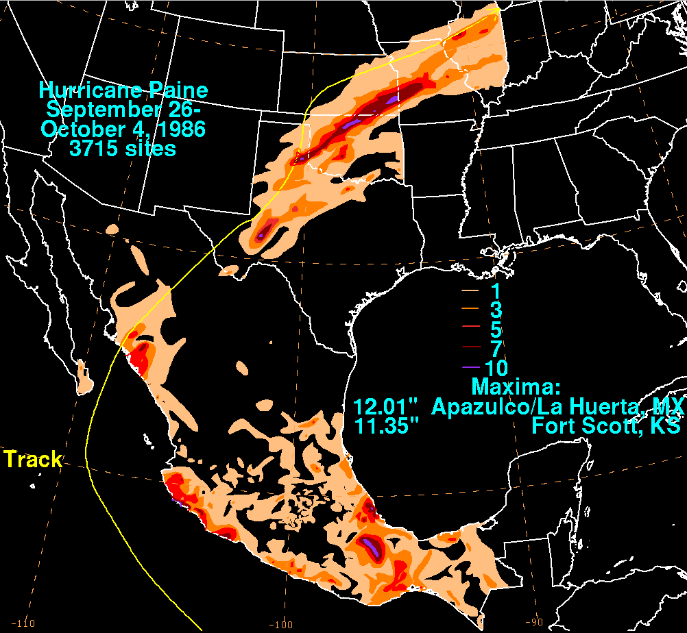
Peaking as a low-end category 2 hurricane, Paine entered the mouth of the Sea of Cortez
on the evening of the 1st. The hurricane accelerated north-northeast, crossing the coast near
San Jose (Boca del Rio) while still a hurricane. The system moved rapidly across Mexico,
bringing significant rains from west Texas across Oklahoma and Kansas into the Mid-
Mississippi Valley. Flooding was reported due to recent rains, particularly near Oklahoma
City.
The storm total rainfall map below was constructed using data provided by the National
Climatic Data Center in Asheville, NC and the Servicio Nacional del Agua, the parent agency
of Mexico's national weather service.
 |
 |
 |