A tropical wave emerged off the African coast on September 22nd. It moved west with disorganized showers and thunderstorms in
tow as it crossed the tropical North Atlantic. Moving through the Caribbean between October 1st and 6th, its thunderstorm
activity increased on the 7th upon reaching Central America. Emerging into the northeast tropical Pacific, convection
consolidated with the system on the 8th and 9th, with a tropical depression forming on the night of the 9th southwest of
Acapulco. Moving west-northwest, parallel to the coast, Pamela became a tropical storm on the morning on the 10th and a
hurricane on the night of the 11th. Reaching the edge of the subtropical ridge, Pamela recurved, with vertical wind shear
reducing it back to a tropicl storm on 12th to the south of Baja California. Turning northeast, convection reflared near
center making Pamela a hurricane upon approach to southwest Mexico on the 13th. Landfall occurred between Mazatlan and Bahia
Tempehuaya that morning. Moutainous terrain and vertical wind shear reduced Pamela back to a tropical storm and depression
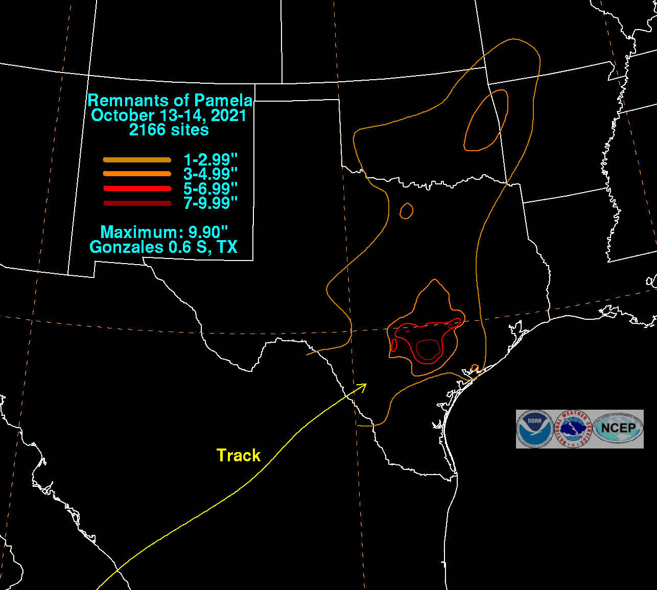
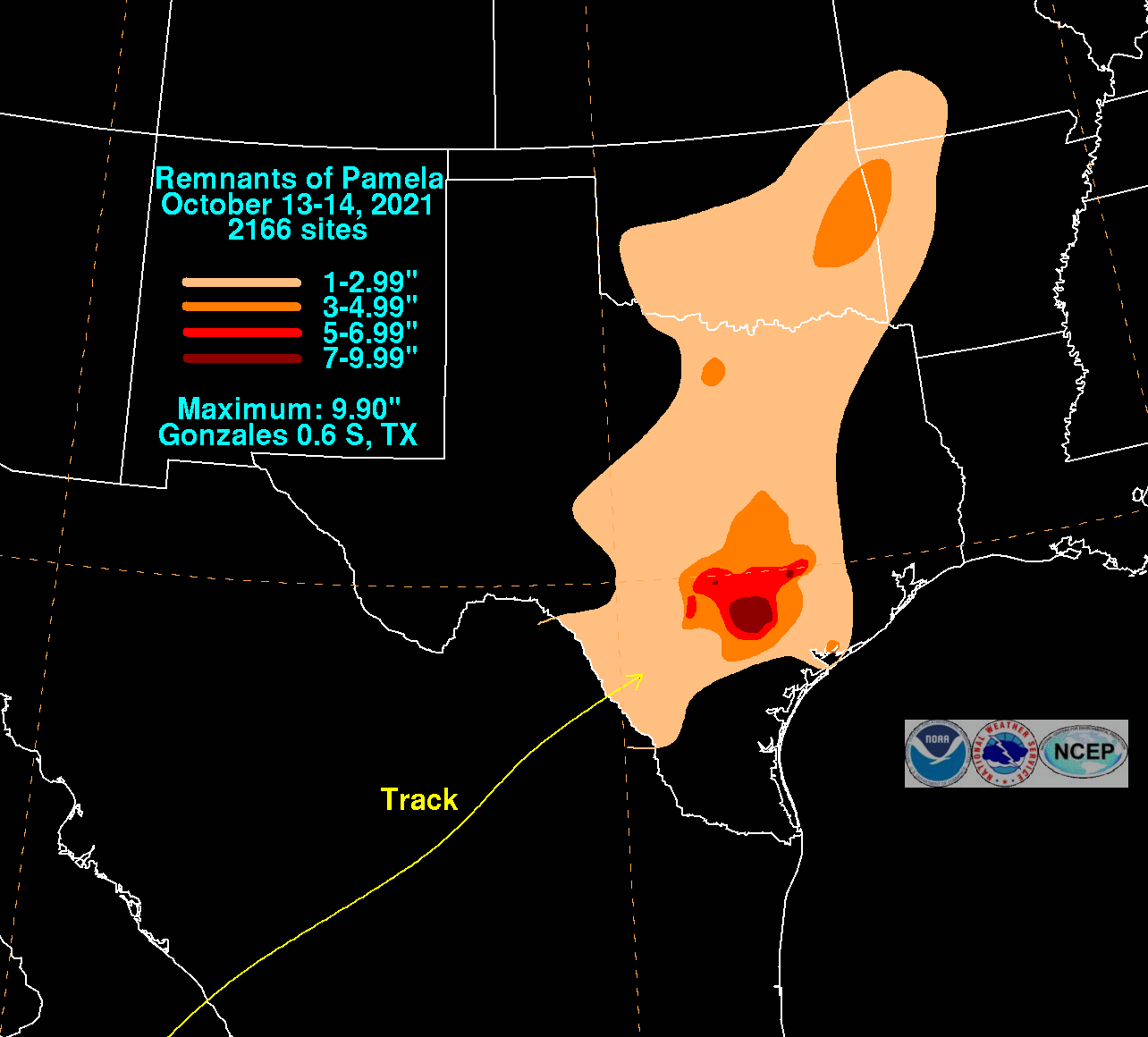
as it moved across central and northern Mexico. Its moisture spread into Texas, causing heavy rainfall.
The graphics below show the storm total rainfall for Pamela, which used rain gage information from the National Weather Service River
Forecast Centers, Forecast Offices, and CoCoRAHS.
 |
 |
 |