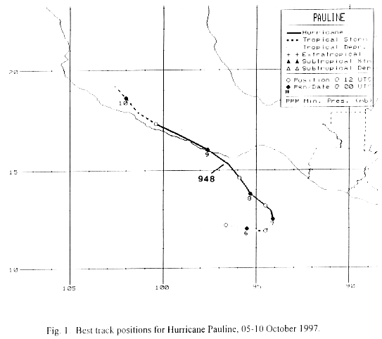
Pauline was spawned by a tropical wave which moved off the African coast into the tropical Atlantic ocean on
September 16th. The southern portion of the wave moved westward through the Atlantic, Caribbean Sea, and
Central America over the next ten days. Moving slowly westward, by October 3rd, a surface trough developed
to its north and northwest. An area of thunderstorms developed and drifted eastward. The system quickly
organized into a tropical depression on the 5th, and then a tropical storm and hurricane on the 6th while located
about 200 miles south of Puerto Angel, Mexico. As the trough to its north and northwest weakened, the subtropical
ridge across the Southeast United States turned Pauline to the northwest, while rapid development continued. The
cyclone became a category 4 hurricane on the 7th. As it approached mainland Mexico, its circulation began to
interact with the mountains and started weakening. Pauline struck near Puerto Escondido late on the 8th as a
category two hurricane. It moved west-northwest, with its surface circulation dissipating late on the 9th. Its
mid-level circulation came to a halt across southwest Mexico, as it lured Olaf back towards the coast.
Below is its track, supplied by the National Hurricane Center.
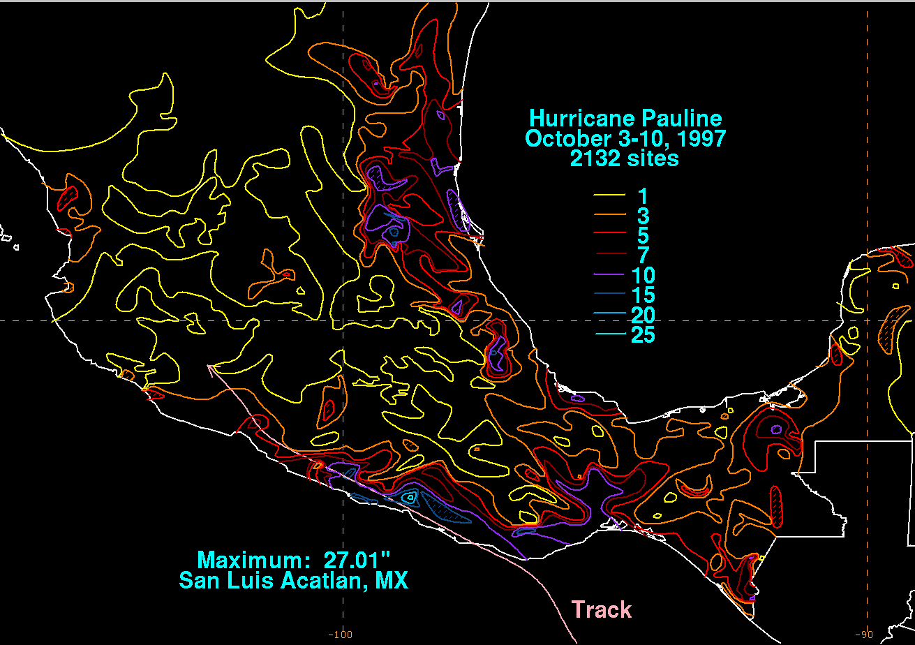
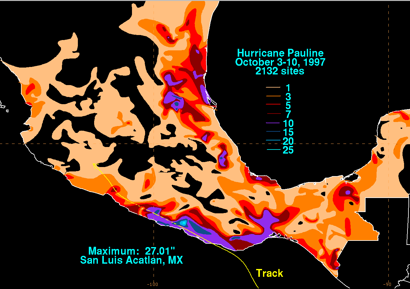
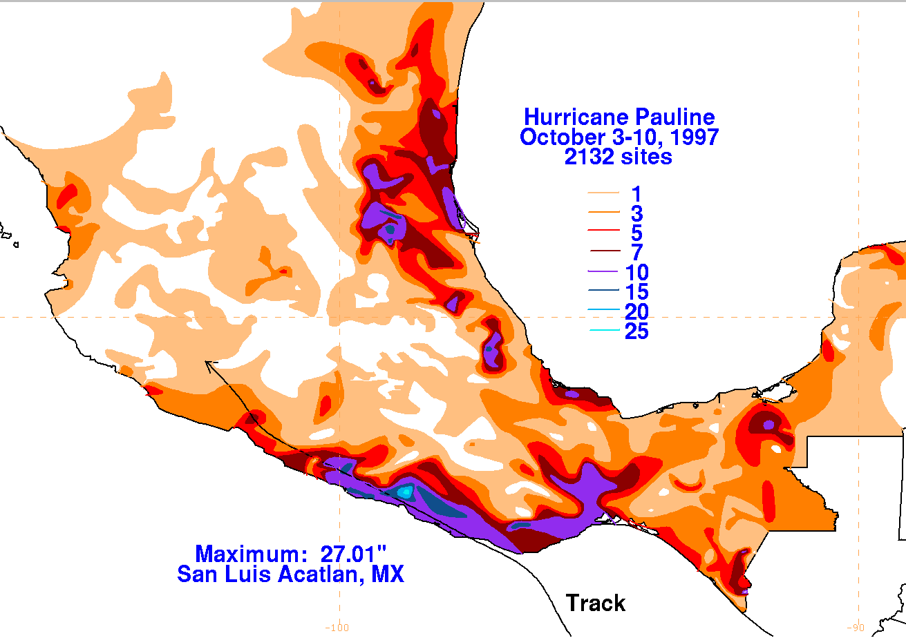
The graphics below show the storm total rainfall for Pauline, which used information from the Comision Nacional
del Agua, parent agency of Mexico's National Weather Service. One general maximum lies along its track, while a
secondary maximum in east-central Mexico occurred after the center moved inland on October 8 and 9.
 |
 |
 |