A tropical wave emerged off the African coast on September 13th and 14th, which caused a burst of strong thunderstorms near the
coasts of Senegal and Guinea-Bissau as it emerged. While a mid-level circulation was evident on satellite imagery on the 14th and
15th, there was no further increase in organization and the low pressure area was broad. On the 17th and 18th thunderstorms
became more concentated, and by the evening of the 18th, it had become a tropical depression 525 miles east of the Leeward Islands.
Becoming a tropical storm that night, it peaked in intensity on the afternoon of the 19th east of the northern Leeward Islands.
A strong low- to mid-level ridge to its north coupled with increasing vertical wind shear caused by a nearby upper low led to
Peter's weakening, with tropical depression status being regained on the afternoon of the 21st. By late on the 22nd, it was quite
weak and its remnants turned north and northeast, briefly reorganizing east of Bermuda, and the system dissipated 500 miles
south of Cape Race, Newfoundland on the 29th.
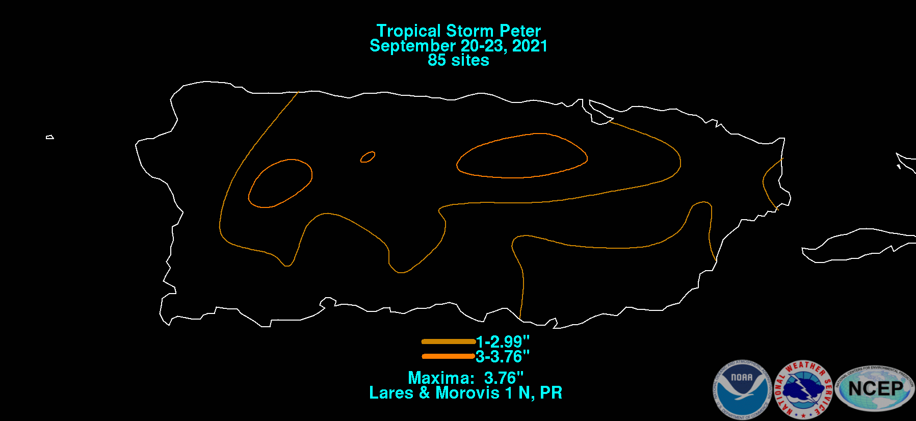
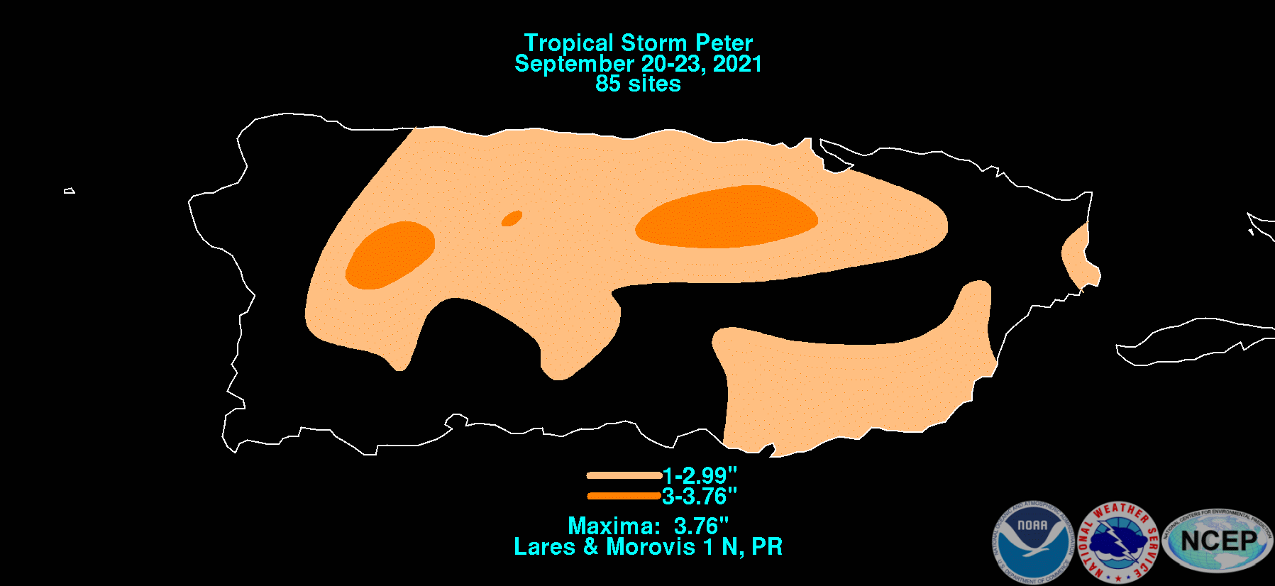
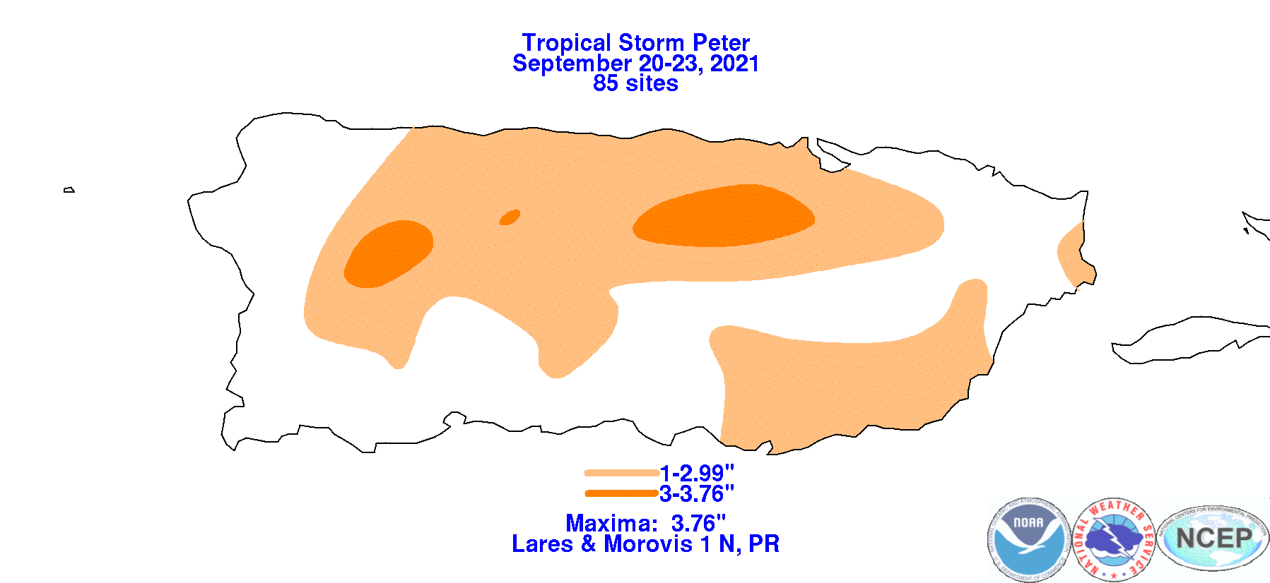
The graphics below show the storm total rainfall for Peter, which used rain gage information from the National Weather Service River
Forecast Centers, Forecast Offices, and CoCoRAHS.
 |
 |
 |