On September 15th, a tropical wave was moving across western Africa. Emerging into the Atlantic a few days later, a broad surface low formed on the 20th after it interacted with another nearby disturbance. The center became well-defined on the 23th west of Cabo Verde, allowing the system to be classified that day, which soon became a tropical storm while moving westward across the tropical Atlantic. Soon afterward, vertical wind shear impacted Philippe, from which it would not recover. The poorly organized tropical storm would occasionally burst central convection while more active thunderstorm activity would be active within its periphery. Making matters more complex was the formation of nearby Tropical Storm Rina, which caused a binary interaction scenario which turned Philippe to the southwest on the 28th. At this point, the circulation was broad with multiple competing centers. As September lead to October, Philippe moved west-northwest again, with the center making landfall on Barbuda on the evening of October 2nd. Soon afterward, Philippe turned northwest and then north, becoming post-tropical while approaching Bermuda to the east of a strengthening non-tropical low. OPC surface analyses indicate that the more western cyclone moved into Maine on the night of the 7th, with the moisture connection to Post-Tropical Cyclone Philippe leading to heavy rainfall across the Northeast United States and southeast Canada. Philippe's surface low moved across Nova Scotia on morning of the 8th, moving across New Brunswick that afternoon, and dissipating as it rotated into southeast Quebec on the night of the 8th. As most rainfall in Maine was focused near the more western cyclone, no tropical cyclone rainfall graphic was prepared for New York or New England. It remains possible that a separate graphic may be generated for southeast Canada for Post-Tropical Cyclone Philippe.
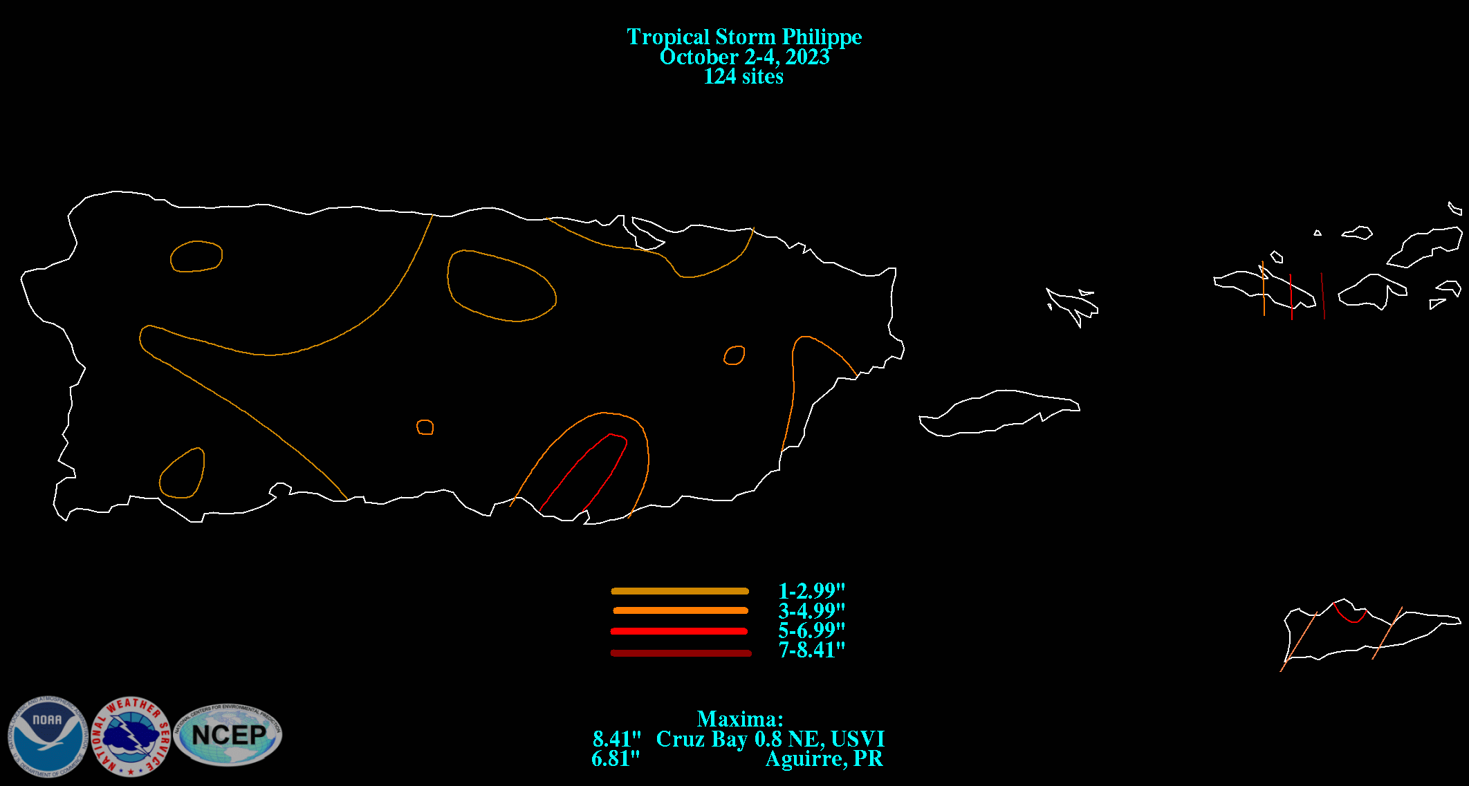
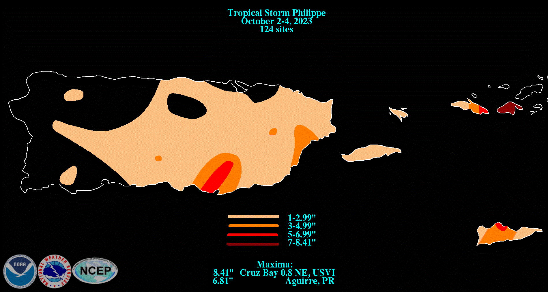
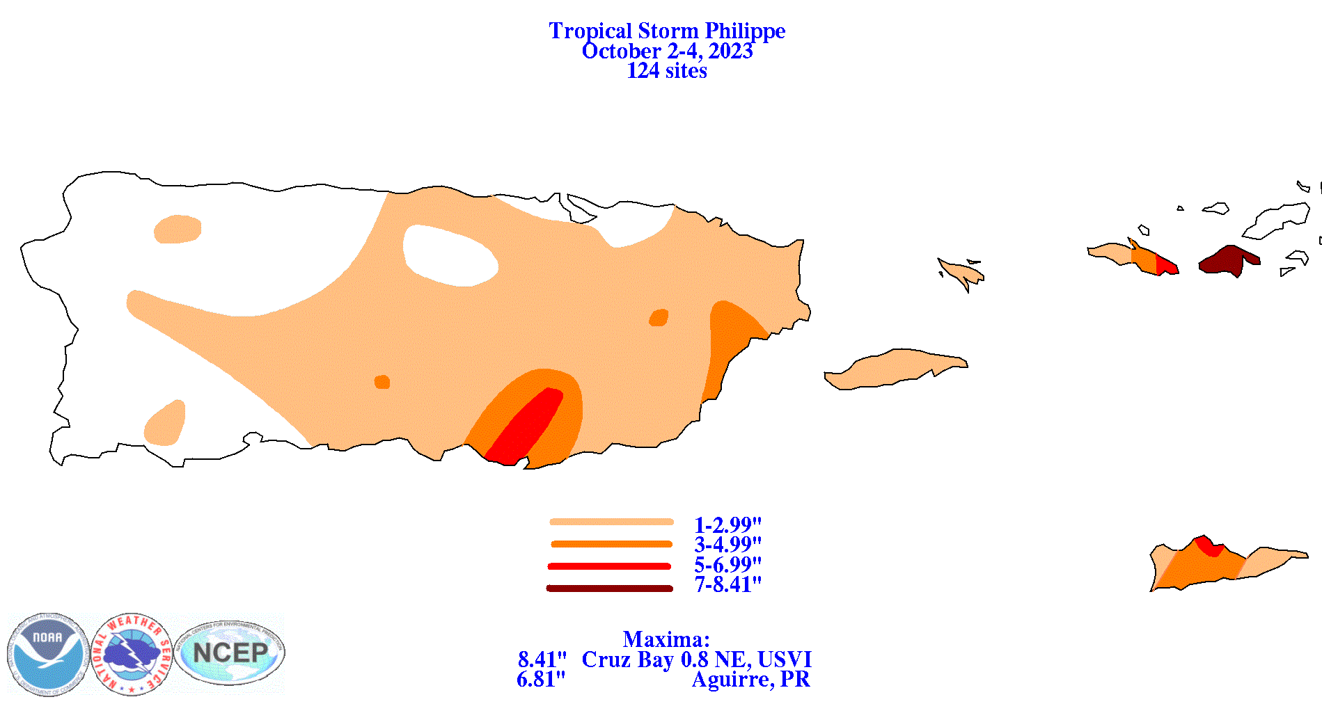
The graphics below show the storm total rainfall for Philippe, which used rain gage information from National Weather Service River Forecast Centers, xMACIS2, the San Juan National Weather Service Forecast Office, and CoCoRAHS.
 |
 |
 |