A tropical disturbance moved west-southwest out of the Gulf of Tehuantepec on September 24th, becoming
the 21st tropical depression of the year on the afternoon of the 25th a few hundred miles southeast of Acapulco.
Continuing its west-southwest motion, the system slowly strengthened. After Polo turned northwest it intensified
more significantly, becoming a hurricane and reaching its maximum intensity early on the morning of October 1st.
An upper level trough moved towards Baja California and turned the hurricane sharply to east, and the system
began to experience vertical wind shear as well as move over cooler waters, which caused weakening. On the
night of the 2nd the center of Polo crossed southern Baja California as a tropical depression. The system continued
to move north of due east, and made its final landfall as a tropical depression about 175 miles northwest of Mazatlan.
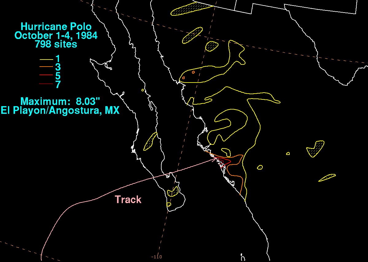
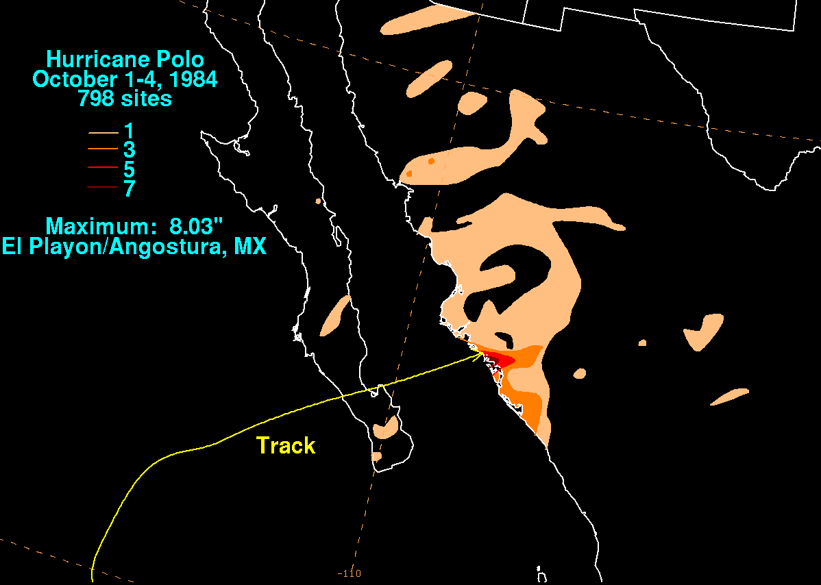
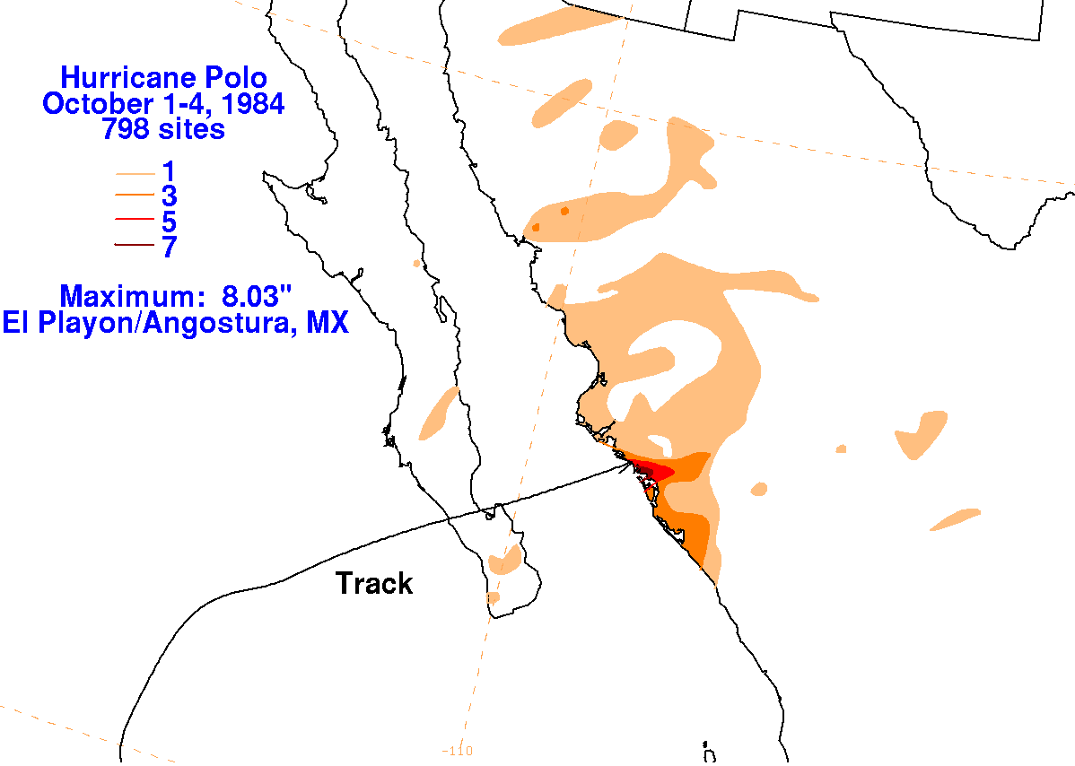
The graphics below show the storm total rainfall for Polo. Data was provided by the Comision Nacional
del Agua, parent agency of the Mexican national weather service. Note the maximum near the point of landfall.
|
|
 |
 |