A tropical disturbance formed east of Clipperton Island on September 29th. Moving west-northwest, it
became a tropical depression on the morning of the 30th. Intensification continued and Priscilla became a
tropical storm on October 1st and a hurricane on the 2nd. An upper trough across southern California lured
the cyclone northward near the 120th meridian, and the cyclone weakened as it experienced vertical wind
shear and moved into cooler waters. After peaking in strength on the 3rd, Priscilla regained tropical storm
strength on the 5th and tropical depression intensity late that night. Although the surface low dissipated,
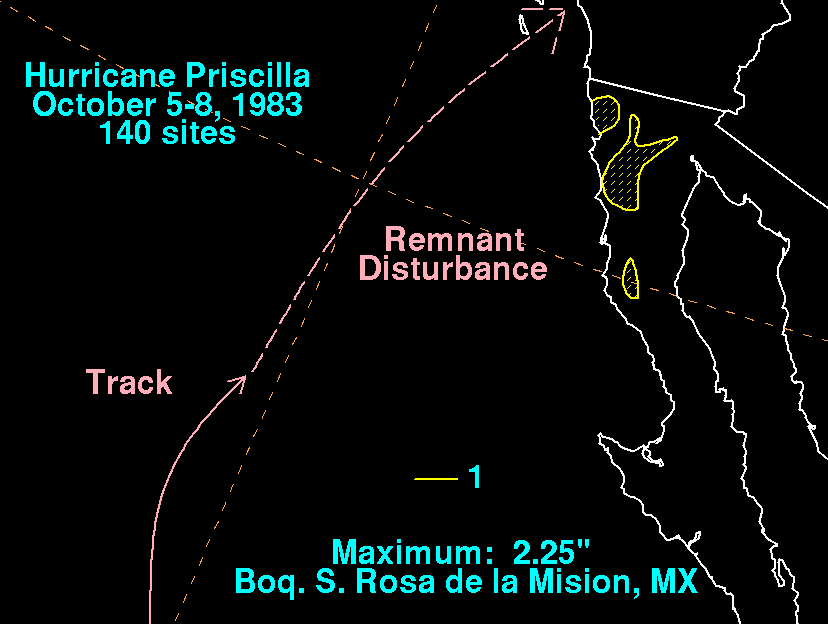
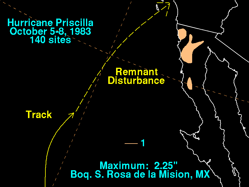
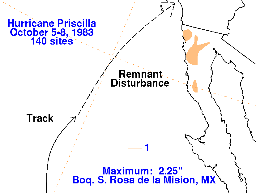
its remnant cloudiness/precipitation spread over northern Baja California and into the Desert Southwest.
The storm total rainfall maps below were constructed using data from the Comision Nacional del Agua, the
parent agency of Mexico's national weather service.
 |
 |
 |