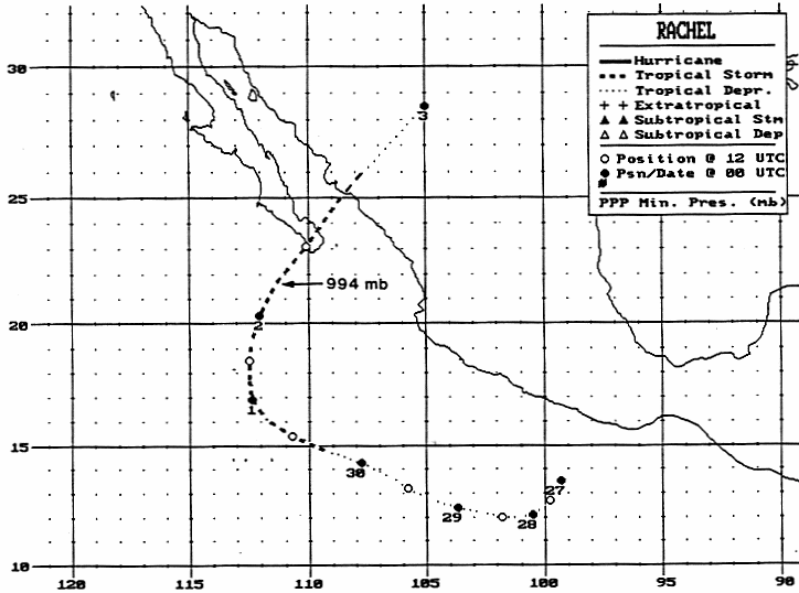
A tropical wave moved off the west coast of Africa in mid-September. It moved uneventfully across
the tropical Atlantic and Caribbean before crossing into the eastern Pacific on the 22nd and 23rd.
A tropical disturbance organized, and developed into a tropical depression on the afternoon of the
26th. Slow development ensued, and Rachel became a tropical storm on the night of the 29th about
500 miles south of Cabo San Lucas. An upper cyclone over California led to the cyclone's recurvature,
Accelerating as it moved northeast, Rachel moved across southern portions of Baja California Sur on
October 2nd. Its final landfall on the Mexican mainland was between Los Mochis and Culican. Its
remains accelerated northeast across western Texas. Below is the track of this storm, provided by
the National Hurricane Center.
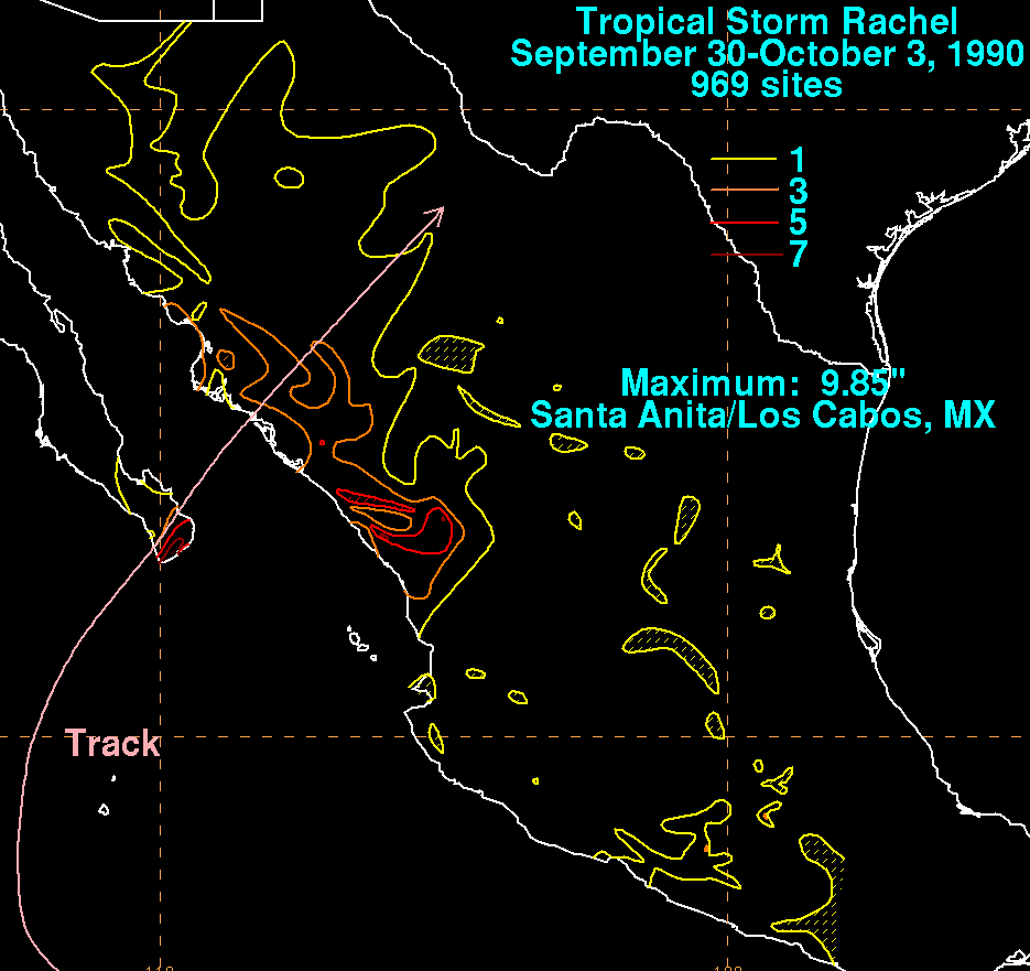
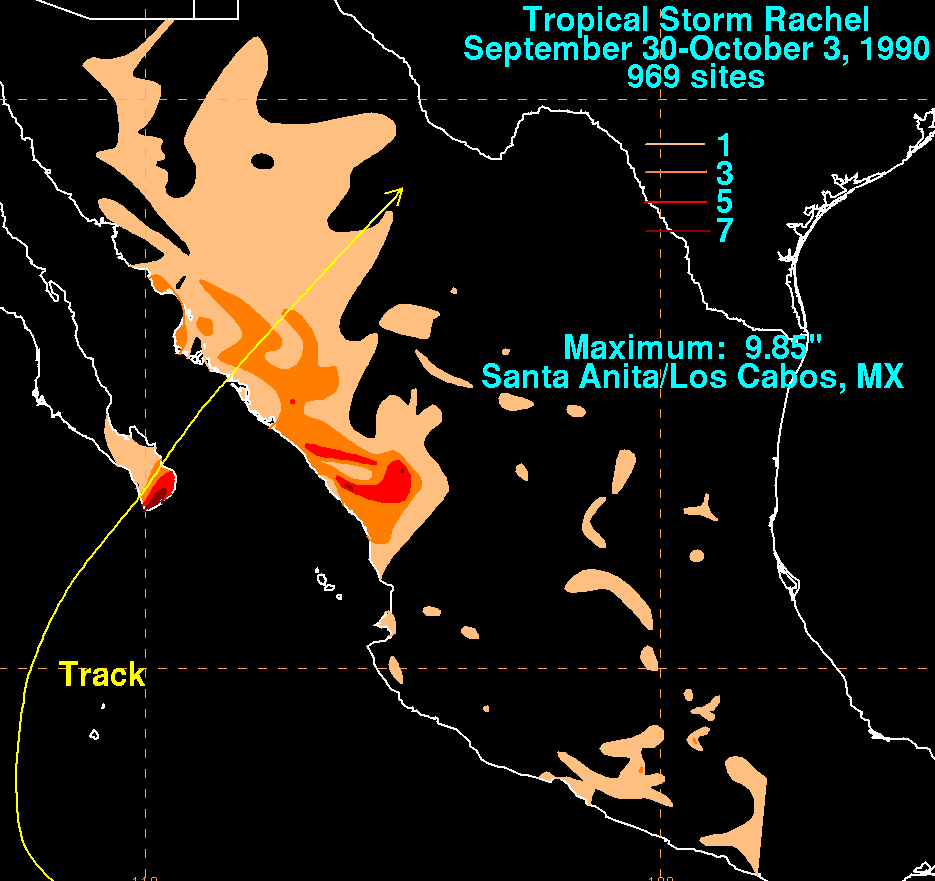
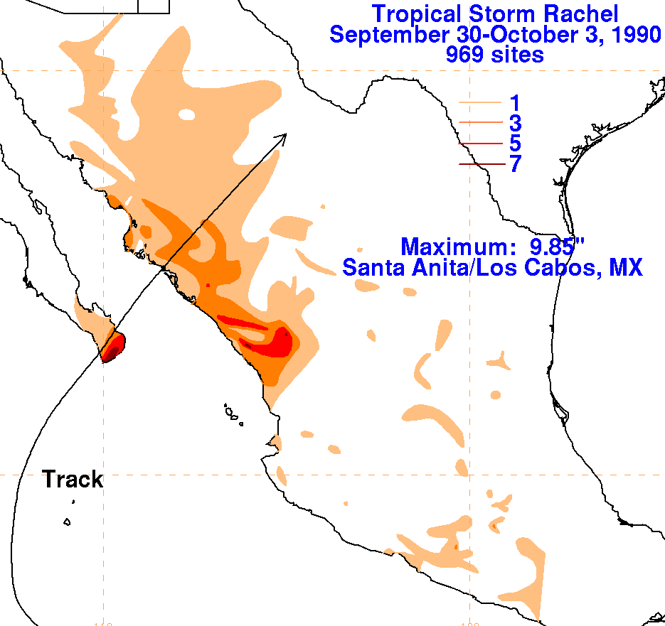
The storm total rainfall maps below were constructed using data from
the Comision Nacional del Agua,
the parent agency of Mexico's
national weather service. The maxima fell near and to the right
of Rachel's
track.
 |
 |
 |