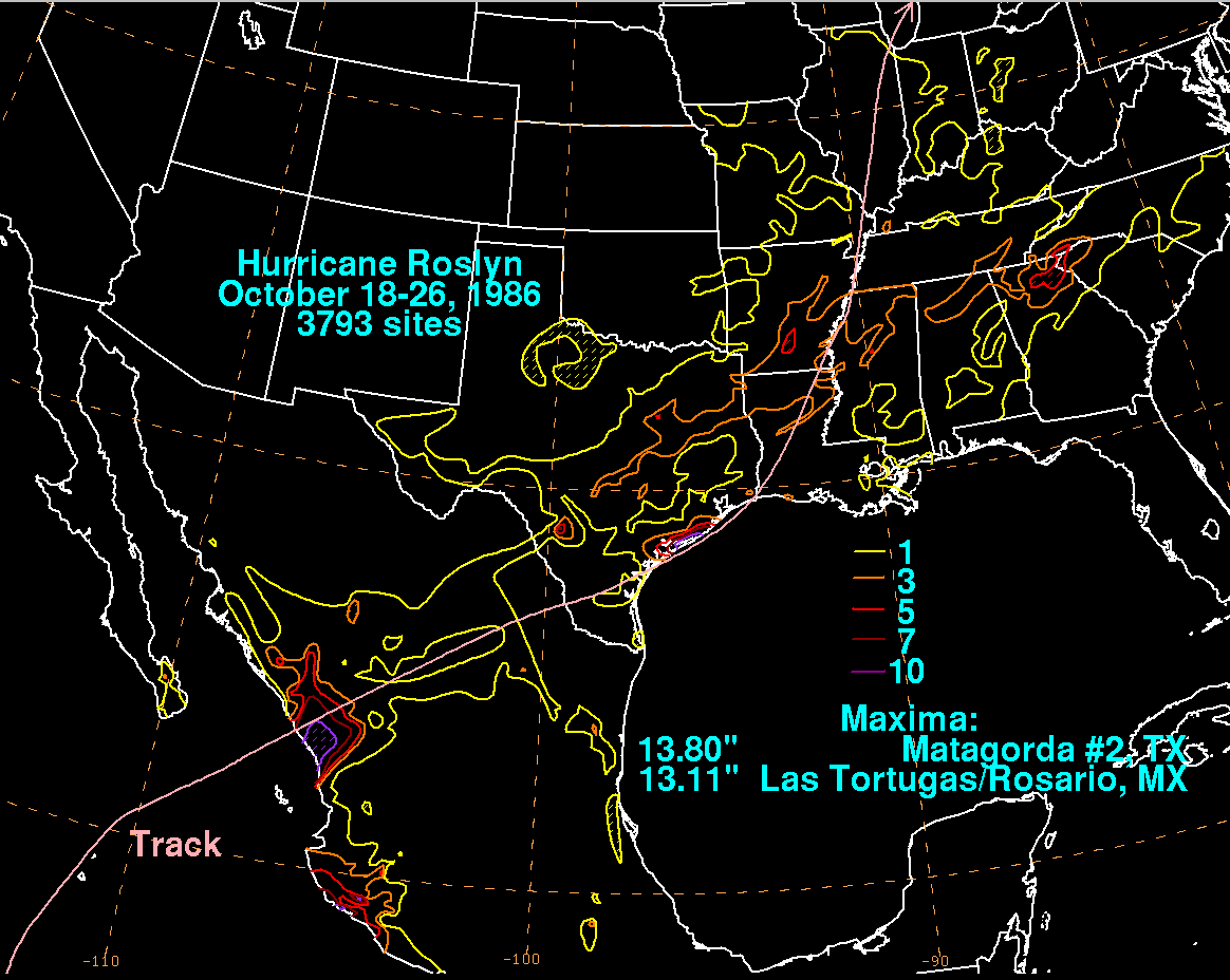
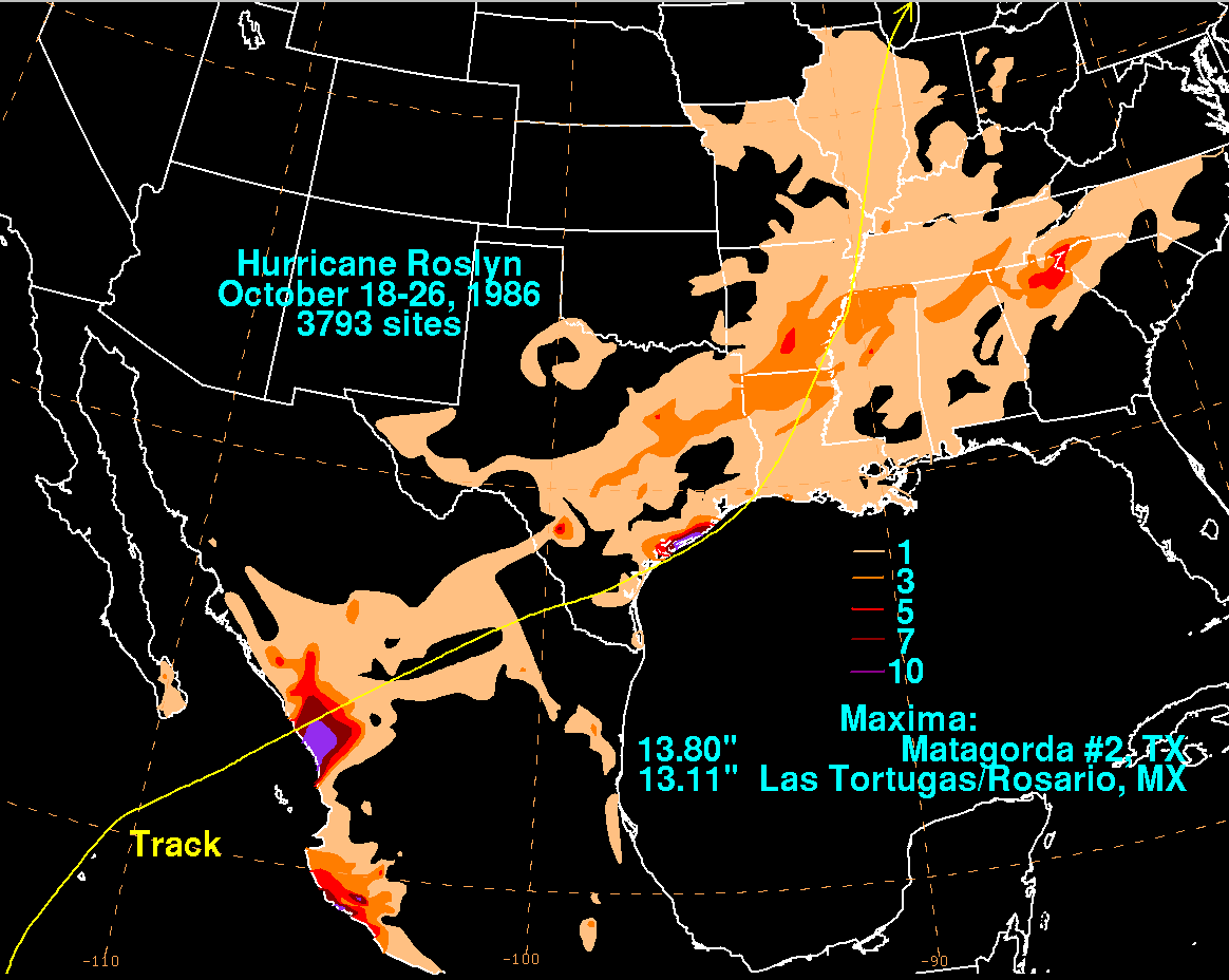
Tropical Depression 24 originated as a tropical disturbance which
moved westward offshore
Nicaragua. During the early afternoon of the 15th, ship reports
indicated the formation of a
tropical depression near 10.2N 92.7W. The cyclone moved at a
quick pace to the west-
northwest south of a warm-core ridge. Early on the morning of the
16th, Roslyn became a
tropical storm. By the morning of the 17th, it had developed into
a hurricane south of Acapulco.
A virgorous upper trough was deepening offshore Baja California, and
Roslyn began to recurve
within a few hundred miles of Manzanillo. Striking Mazatlan as a
marginal hurricane on the 20th,
its upper level portion moved northeast thereafter spurring
cyclogenesis in the western Gulf of
Mexico along the frontal zone, causing heavy rains along the Middle
Texas coast. The surface low
occluded and moved northward through the Mississippi Valley, spreading
light to moderate rains
along its path. However, its upper level portion continued moving
eastward, spreading rains across
the Deep South. The storm total rainfall map below was constructed
using data from
the
National
Climatic Data Center and the Comision Nacional del Agua, the parent
agency of Mexico's national
weather service.
 |
 |
 |