Possibly of Cape Verde origin, this system was first witnessed
between St. Martin and St. Thomas on
August 5. Moving west-northwest, the cyclone passed by the Mona
Passage bringing squalls of wind
and rain to San Juan, Puerto Rico. The system strengthened and
turned northward before reaching the
Bahamas. Building high pressure to its north caused a resumption
of its west-northwest track, sometimes
referred to as a stairstep. At hurricane intensity, the system
moved westward near the mouth of the Savannah
river on the 11th near Beaufort, South Carolina, with hurricane-force
winds buffeting the coast between
Savannah and Charleston. The system slowly weakened as it drifted
through the Southeast, bringing heavy
rains to Georgia, the Carolinas, northeasternmost Tennessee, and
southern Virginia. These heavy rains led
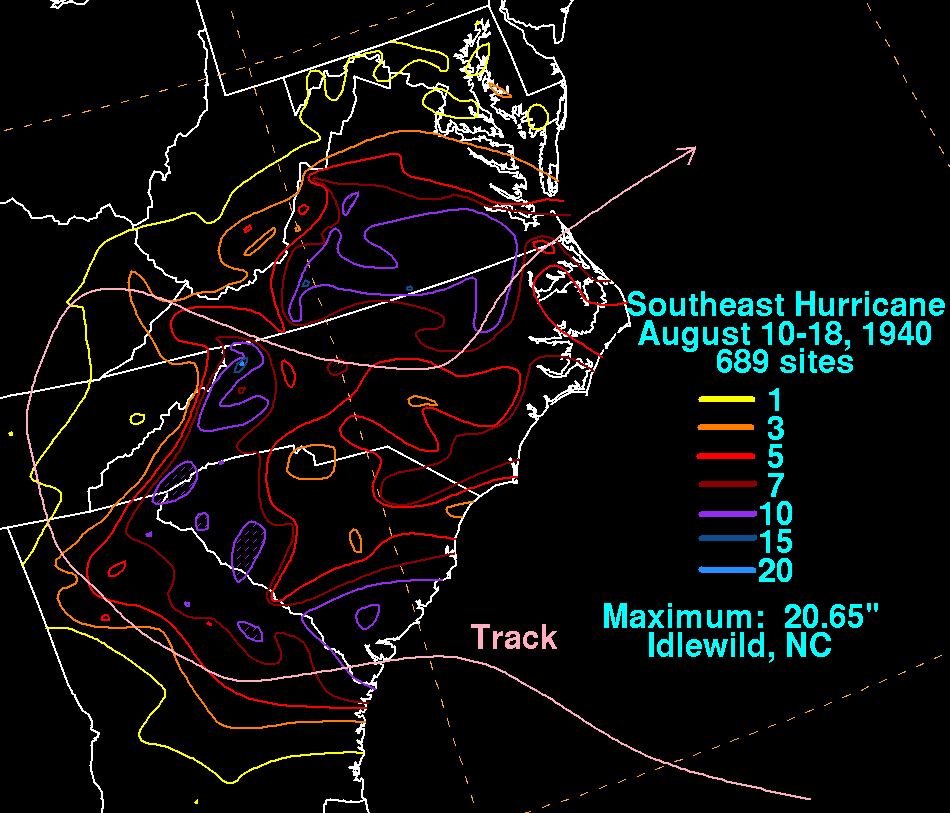
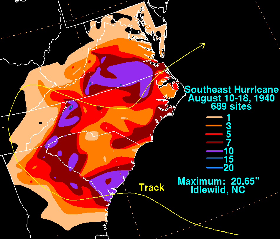
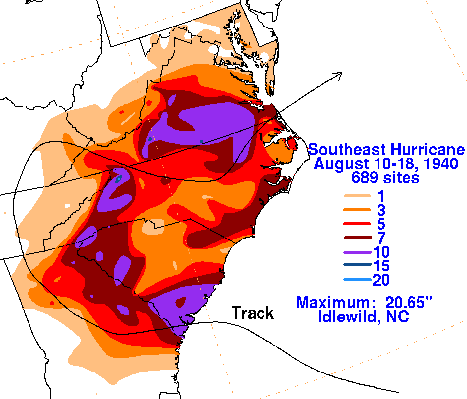
to flash floods and landslides in the southern Appalachians. Its storm
total rainfall maps are below.
Rainfall information was gleaned from
the National Climatic Data Center in Asheville, North Carolina.
 |
 |
 |