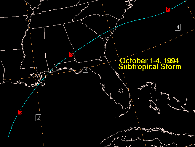
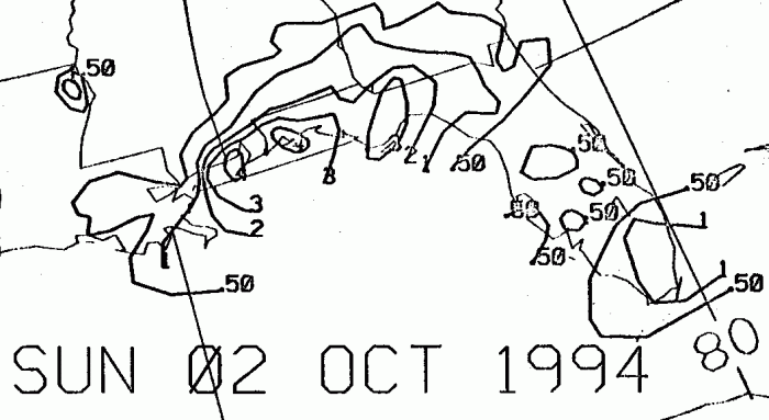
An upper tropospheric trough in the subtropical jet spawned a broad
low pressure area in the Gulf of Mexico on
October 1st along a very weak frontal boundary. It
intensified
as it moved over the tepid waters of the Gulf,
becoming a subtropical storm soon after formation, with high winds
well away from the center. The system tracked
east-northeast across northern Florida and the Southeast on the 2nd
and 3rd, bringing heavy rains to the region.
As it reached the Altantic coast, the system became an
extratropical
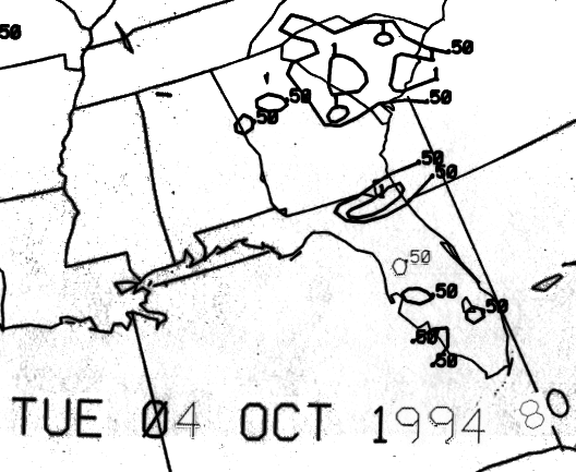
frontal wave. Below is the track of the
subtropical storm.
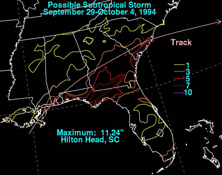
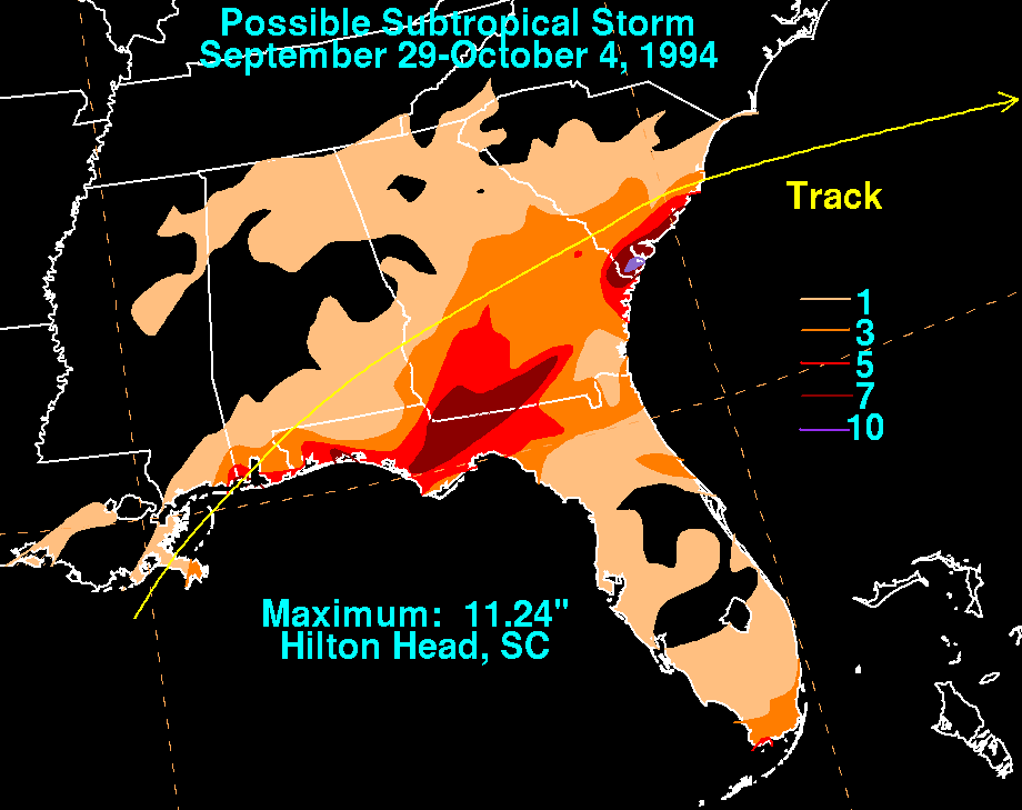
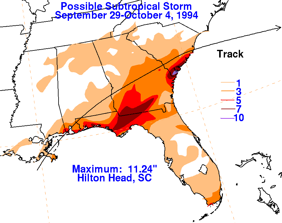
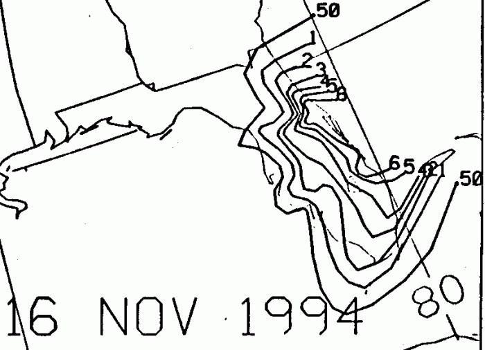
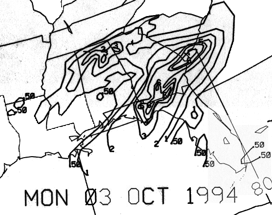
The storm total rainfall map below was constructed using data
from the National Climatic Data Center. Note the rainfall
maxima across north Florida and near the coast of the Georgia/South
Carolina border, a bit to the east of the track.
 |
 |
 |
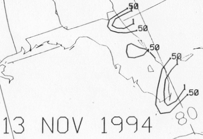
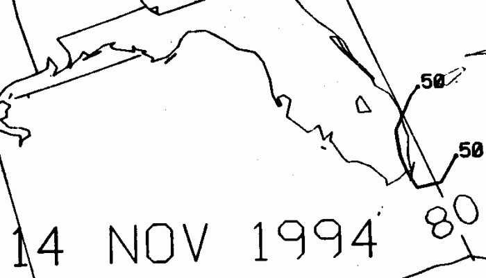
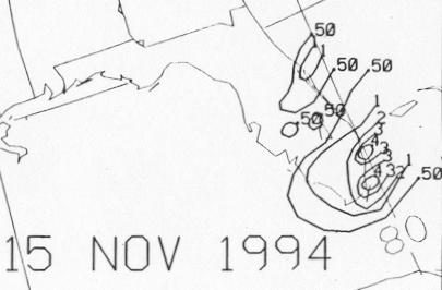
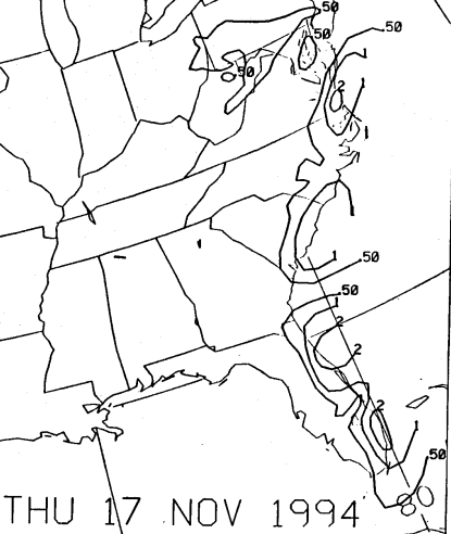
Below are the calendar for Daily Precipitation Maps. Note that
the 24-hour periods end
at 12z that morning.