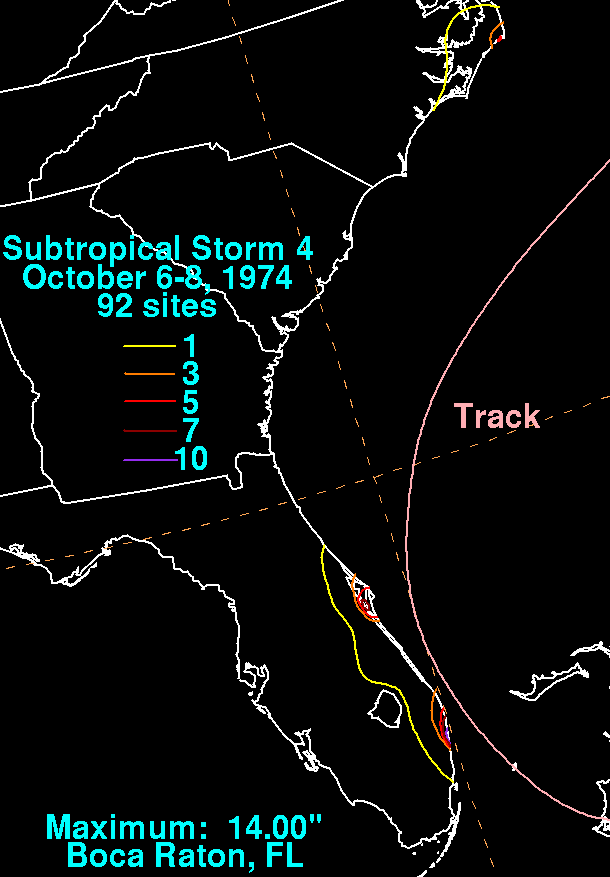
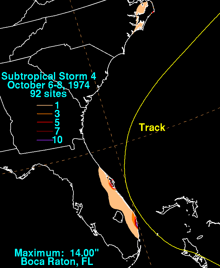
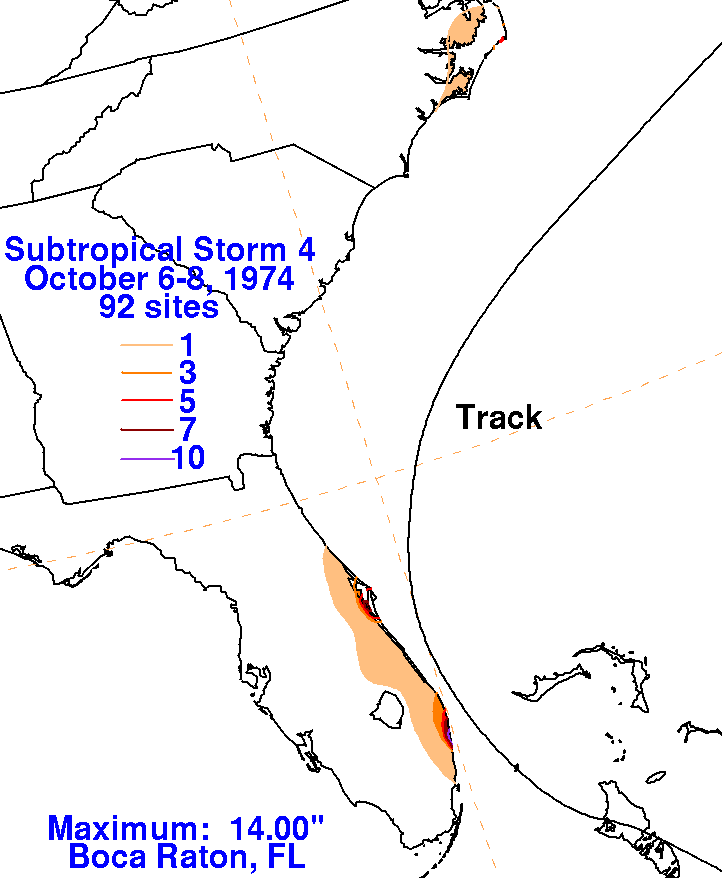
A low pressure area formed over eastern Cuba on October 3rd along a
stationary front. By the afternoon of the
5th, the low had retrograded into the central Bahamas, bringing gale
force winds to the Bahamas and Florida coast.
Weakening as it recurved northeast offshore the Carolinas, the low
became a frontal wave. Locally heavy rains fell
across portions of the Gold coast and the Outer Banks of North Carolina
to the left of its track. Below is the
storm total rainfall map for Subtropical Storm 4. Data was
provided by the National Climatic Data Center in
Asheville, North Carolina and the National Hurricane Center in their
annual report from 1974.
 |
 |
 |