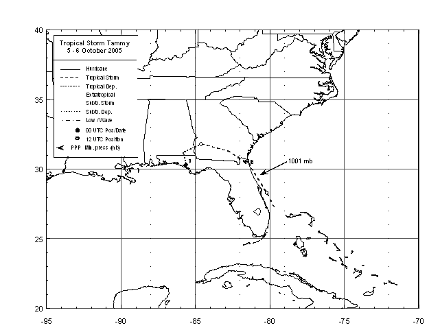
Tammy was a short-lived tropical storm that developed just east of the central
Florida coast as a result of complex interaction between an upper level low and
a tropical wave. Early on the 5th of October, Tammy quickly developed into a
tropical storm about 20 miles east of Cape Canaveral, Florida. The cyclone
moved steady north-northwest parallel to the Florida East coast most of the day
before turning northwest as it made landfall near Mayport very late that day with
maximum sustained winds of 50 mph.
Tammy moved westward over southern Georgia merging with a larger nontropical
low in the eastern Gulf of Mexico as it moved through the Florida Panhandle. Below
is its track, provided by the National Hurricane Center.
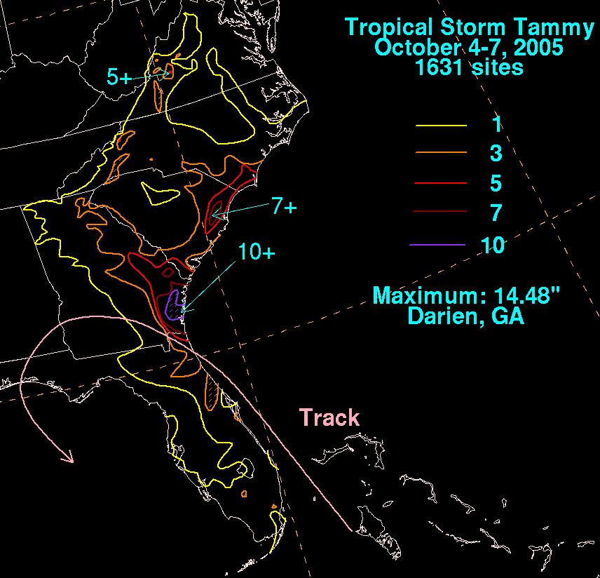
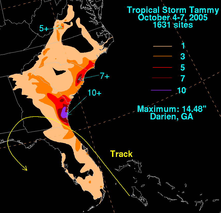
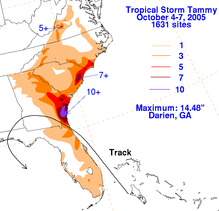
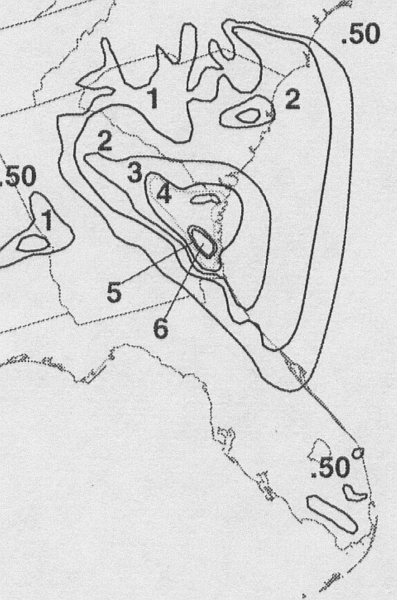
Northeast Florida and southeast Georgia experienced minor flooding with Tammy.
It should be noted that another low formed east of the merged cyclone and swung
into coastal Mid-Atlantic and New England producing 6-10 inches of rainfall along
its path. Since it was a different discrete low pressure area, this rainfall is not
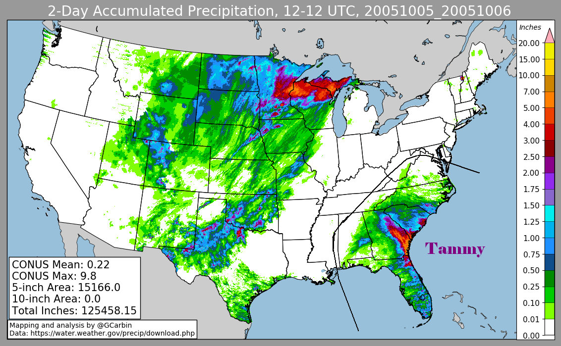
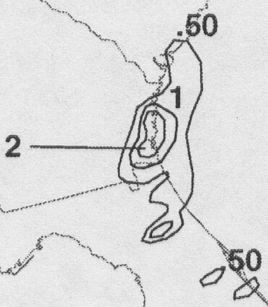
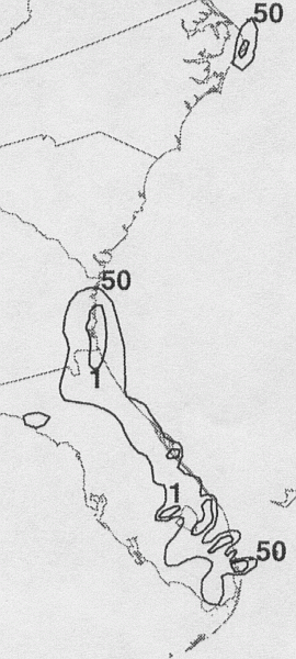
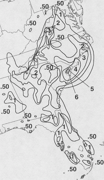
being associated with Tammy. The first three of the storm total rainfall maps below were
constructedusing rain guage data provided from NWS River Forecast Centers, as well as additional reports
received by the local forecast offices from their post-tropical cyclone reports. The fourth included radar-derived information.
 |
 |
 |
 |
Below is a calendar
showing daily rainfall from this cyclone as of 1200 UTC, or 8 a.m. EDT.
| Sun |
Mon |
Tue |
Wed |
Thu |
Fri |
Sat |
| 4 |
5 |
6 |
7 |