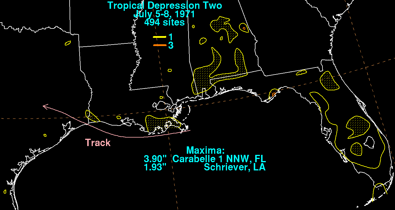
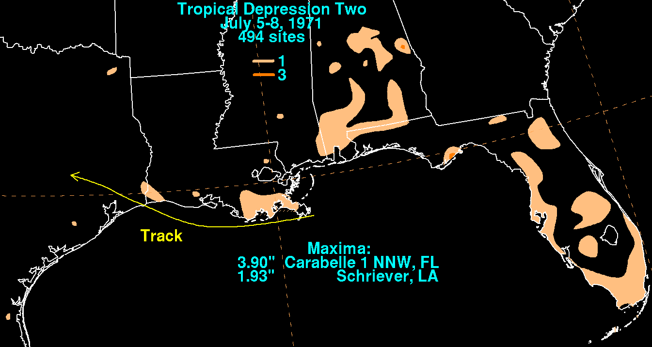
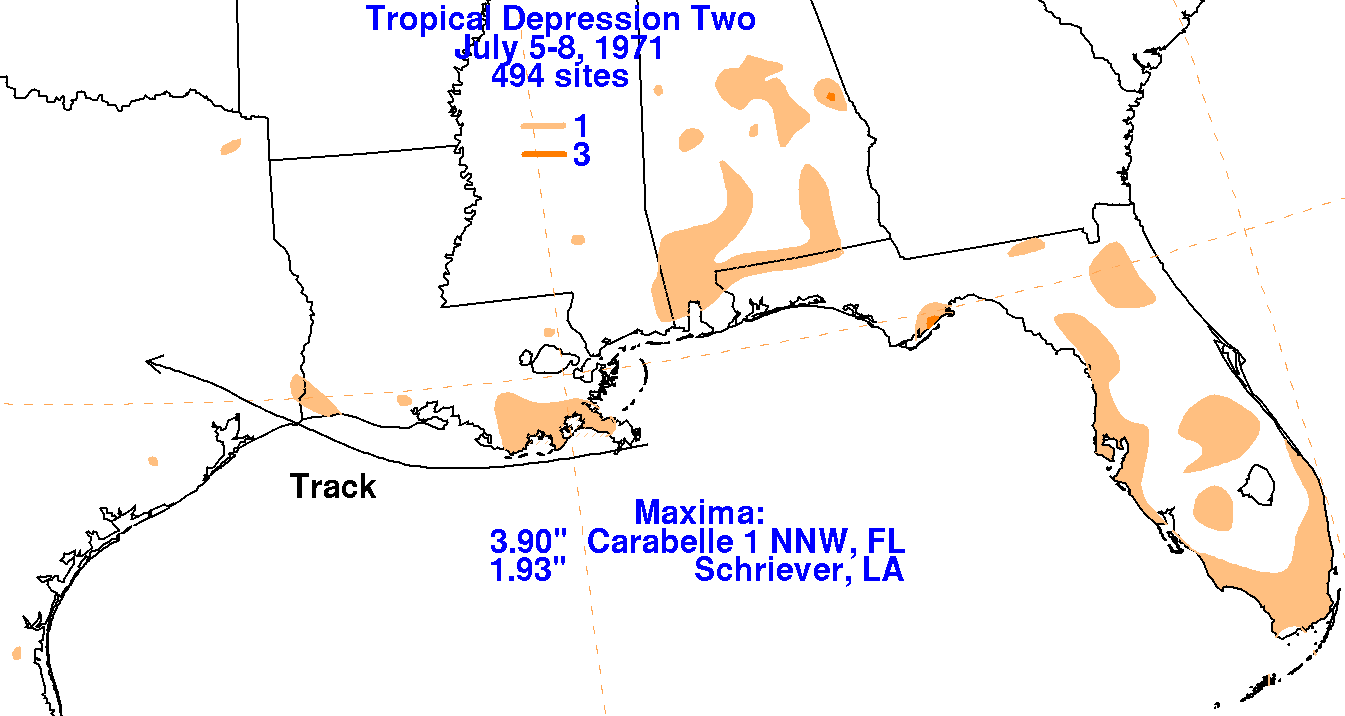
A surface low formed offshore the Mouth of Mississippi river by the
morning of the 6th. Urged westward
by a building surface high to its northeast, and strengthening
mid-level ridging to its northwest, the system
became a tropical depression by the 6th and paralleled the Louisiana
coast before moving inland into the
upper Texas coast, and dissipating across southeast Texas on the
morning of the 8th. The graphics below
show the storm total rainfall for the tropical depression, with data
provided by the National Climatic Data
Center in Asheville, North
Carolina.
 |
 |
 |