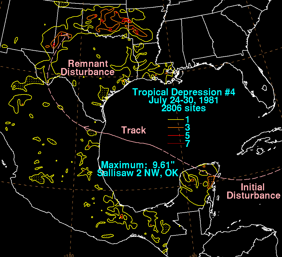
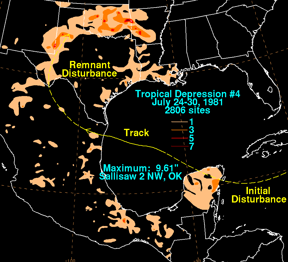
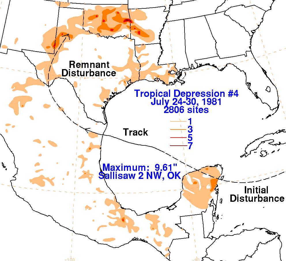
A tropical disturbance formed south of Cuba, in association with a
tropical wave. The system moved westward
towards the northeast Yucatan peninsula, when it began to interact with
an upper level low to its west. A surface
circulation formed, and this system became a tropical depression on
July 26th. Moving west-northwest, the depression
made landfall across northeast Mexico, and its surface circulation
quickly dissipated. Its circulation aloft maintained
integrity, and recurved into western Texas. Thunderstorm activity
formed near its center, as well as along a draping
stationary front across northern Texas and Oklahoma, causing additional
convective development. The remnant
circulation dissipated by the morning of the 30th. Below are the
storm total rainfall
maps for the
depression, using data
provided by the National Climatic Data Center and the Comision Nacional
del Agua, parent agency of Mexico's national
weather service. The main portion of the track was provided
by the
National Hurricane Center, then extended based on
satellite imagery archived at the National Climatic Data Center.
 |
 |
 |