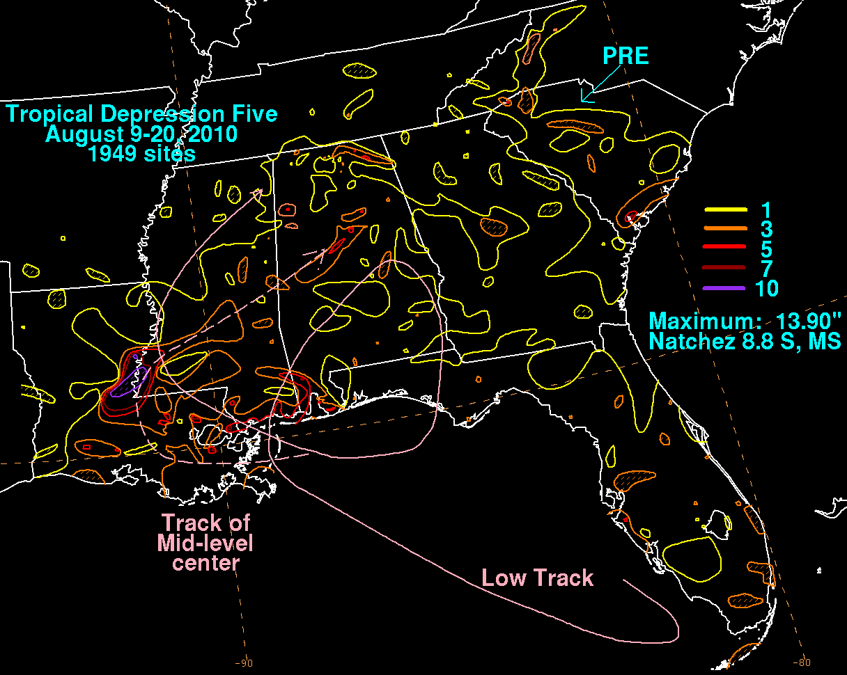
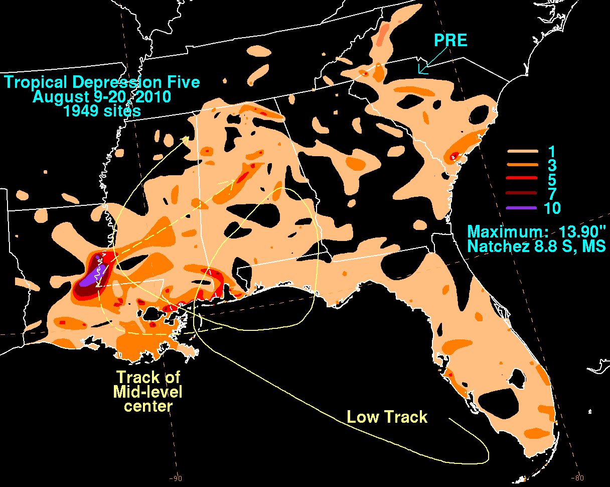
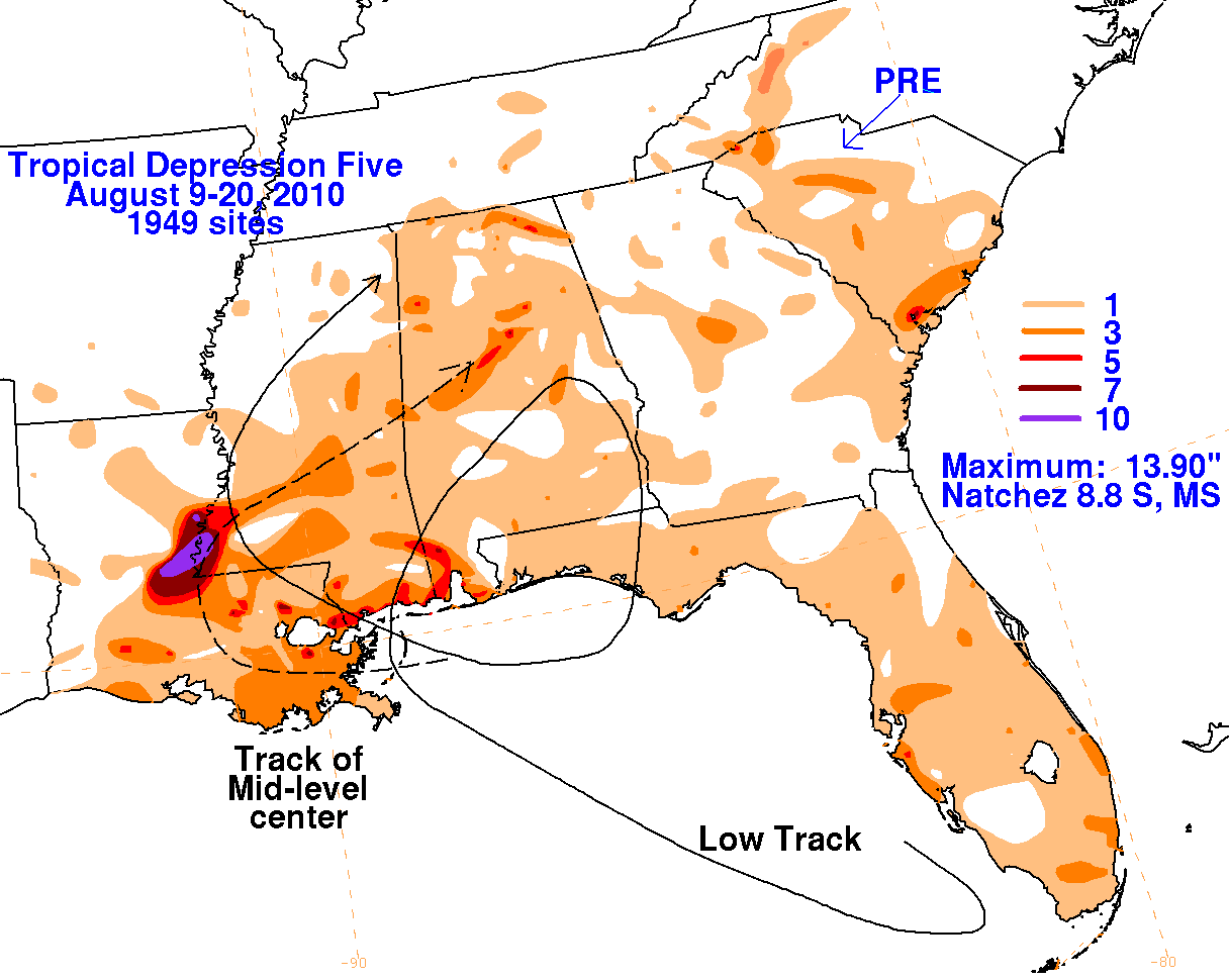
An old frontal boundary was dissipating across Florida, which spawned a new area of low pressure in the southeast
Gulf of Mexico on August 9. After initially drifting southward, the system turned west-northwest and gathered shower
and thunderstorm activity. By the 10th, it became well-enough organized to be considered a tropical depression. The
convective pattern weakened while its wind circulation became larger on the 11th, with the system losing its well-defined
center and becoming a remnant low. The low moved into southeast Louisiana on the 12th as it became better defined and
organized deeper convection near its center. The cyclone made a slow anticyclonic loop across the Southeast, breifly
hooking up with a backdoor cold front which dropped into Alabama on the 14th. By the 15th, convection organized in
the Gulf of Mexico on the southwest side of its circulation. This new mid-level center paralleled the course of the low
low center into the northern Gulf of Mexico and caused much of the rain associated with this low as it moved back into
the central Gulf coast on the 17th. After moving inland, the low weakened and was absorbed by a frontal wave to its
northwest. However, its former mid-level circulation drifted east-northeast across Mississippi and Alabama, becoming ill-
defined on the 20th.
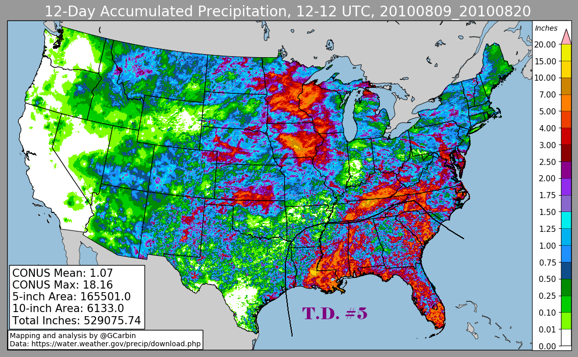
The graphics below show the storm total rainfall for Tropical Depression Five. The first three use rain guage data from the
National Weather Service River Forecast Centers and CoCoRAHS. The fourth includes radar-derived information.
 |
 |
 |
 |