A tropical wave moved across Central America into the far eastern
north Pacific ocean by August 28th. The
system moved westward with no signs of development until
September 1st, when an upper level low to its north
across the Gulf of Mexico caused an area of thunderstorms to form just
south of the Mexican coastline. An upper
trough developed across the southern Plains of the United States, which
slowly lured the northern portion of this
increasingly large disturbance northward through the Mexican
Isthmus. The southern portion moved westward,
developing into Hurricane Marie. For a short while, Marie acted
as a source of vertical wind shear from the west
for this system, halting further development.
By the 6th, the disturbance had emerged into the southwest Gulf of
Mexico and consolidated into a smaller system
which had enough organization to be classified as a tropical
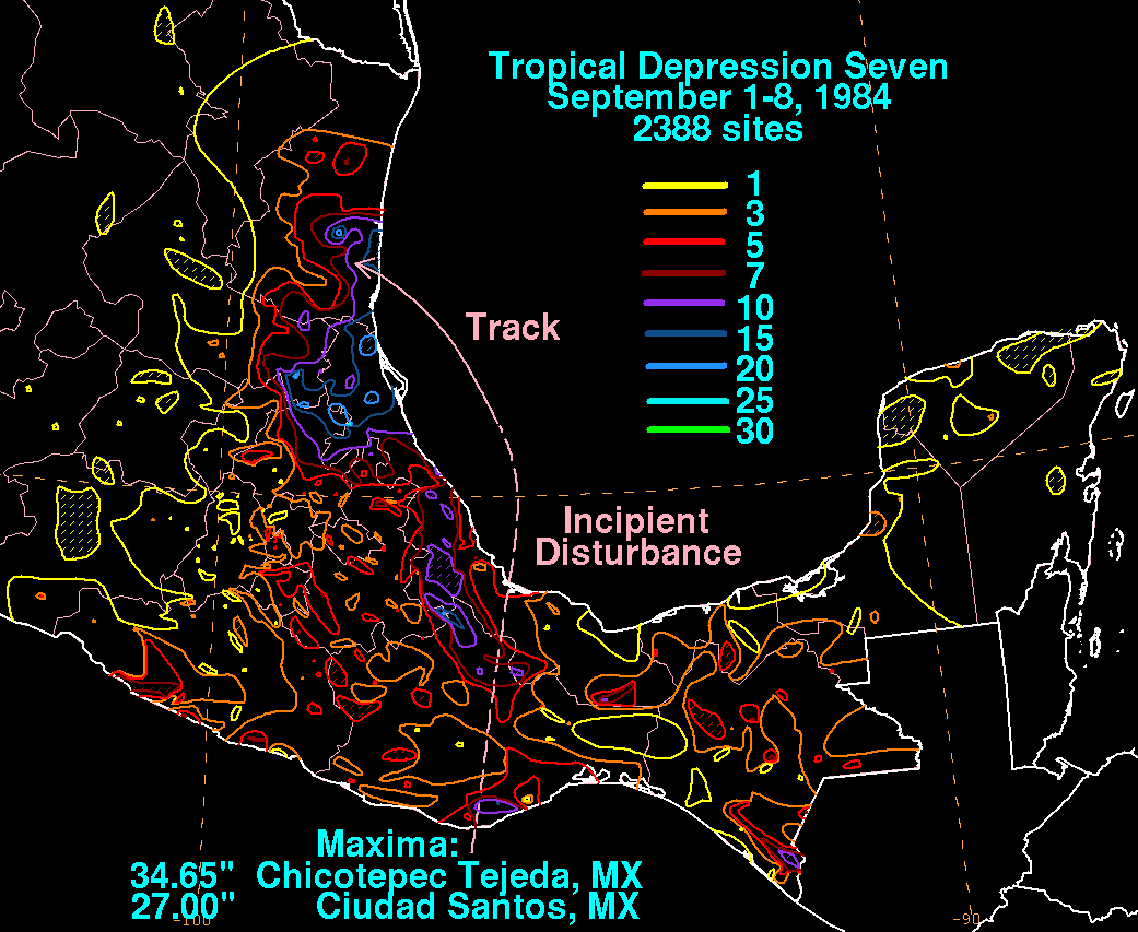
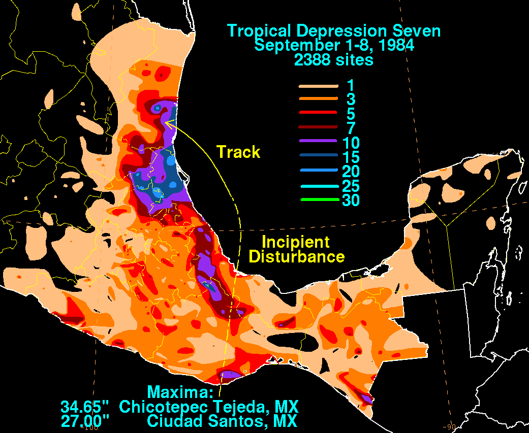
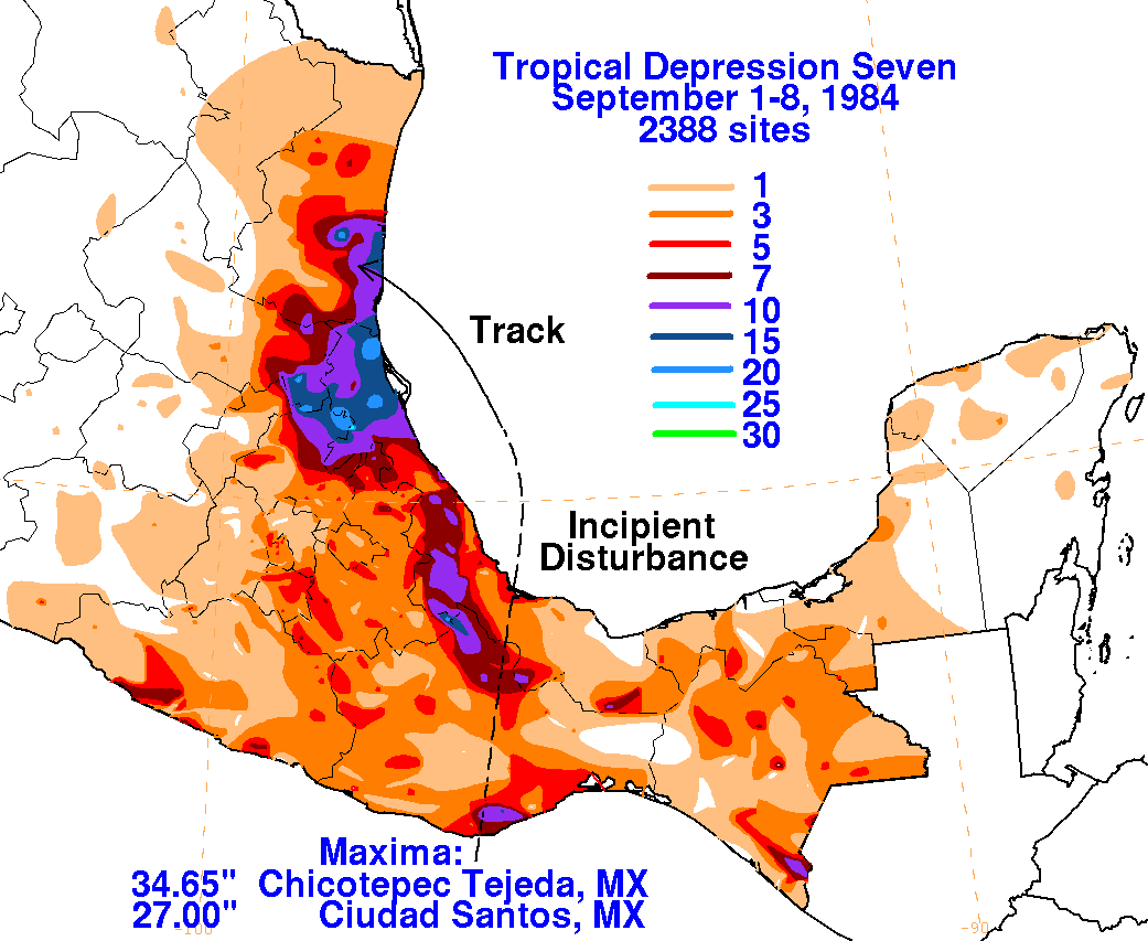
depression, the seventh of the season. The depression
moved north-northwest into northeast Mexico on the afternoon of the
7th, dissipating completely on the 8th. Below
is a storm total rainfall map for the tropical
depression, using data from the Servicio Nacional del Agua, the parent
agency of Mexico's National Weather Service.
 |
 |
 |