This tropical depression formed in the Bay of Campeche on August
26th from part of the same tropical
disturbance which spawned Tropical Storm Irwin in the eastern Pacific
ocean. The system moved slowly
northwest until landfall, moving ashore northeast Mexico on the 29th
and into the United States on the 30th.
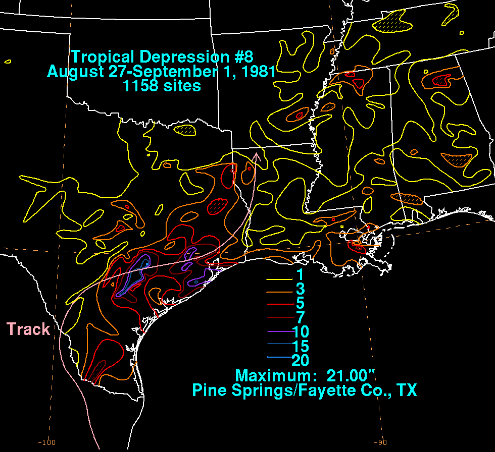
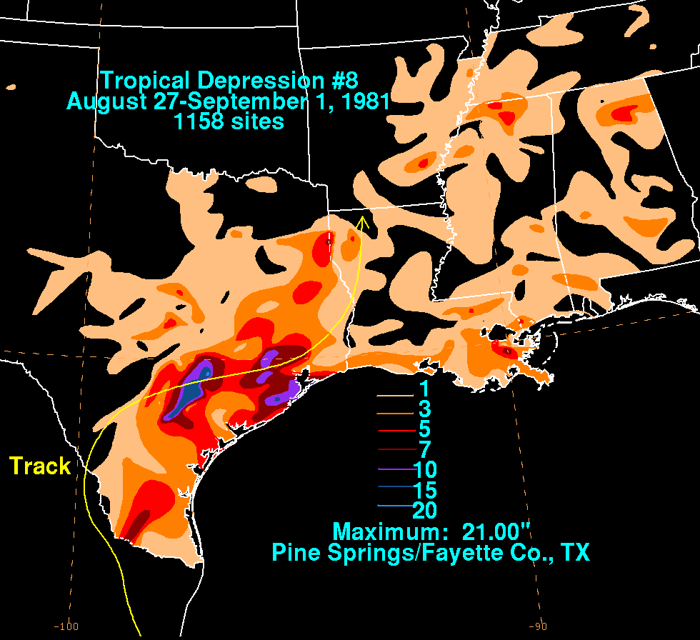
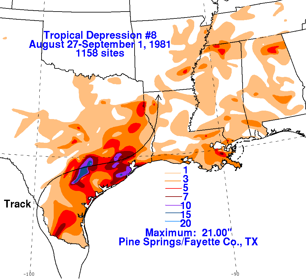
As an ill-defined surface low, a large thunderstorm complex formed near
its center that day, unleashing very
heavy rainfall in a band roughly 50 miles
(80 km) wide which stretched along a path 200 miles
(320 km) long
from Seguin to north of Houston. Five
died in the town of Shiner due to the flood. Downtown
Halletsville flooded
to a depth of 5 feet (1.5 m). Significant flooding
occurred along the Lavaca, Guadalupe, and Colorado rivers
in Texas. The cyclone spawned 14 tornadoes as well within a surface
trough which extended to its northeast.
Its surface circulation remained ill-defined as it produced another
round of heavy rainfall across northwest Louisiana
on the 1st. A mesoscale convective system formed along a cold front to
its northwest and approached the depression
from northeast Texas, dissipating what was left of the tropical
depression by the 2nd. Damage estimated totaled at
least $26 million (1981 dollars). Below are the storm total rainfall
maps for the
depression, using data
provided
by the National Climatic Data Center through their daily rainfall
totals and Storm Data publications. The track
was provided by the
National Hurricane Center, then extended to the northeast based on
archived HPC surface
analyses and Storm Data publications.
 |
 |
 |