A tropical depression formed between the Greater Antilles and
Bermuda on November 3rd. This system drifted northeast until the
4th,
when high pressure built in to its north. Thereafter, the system
moved north of due west until reaching the 76th meridian longitude,
when it turned west of due north due to an upper level low across the
Deep South. Operationally, the National Hurricane Center tracked
the
depression offshore North Carolina before dissipating it across the
western subtropical Atlantic, but the North American surface analysis
series shows that the low pressure system associated with the
depression moved northward into North Carolina and southeast Virginia,
before turning northeast across southern New England ahead of an
extratropical cyclone approaching the low from the west. The low
dissipated as it was leaving Maine on the morning of the 11th.
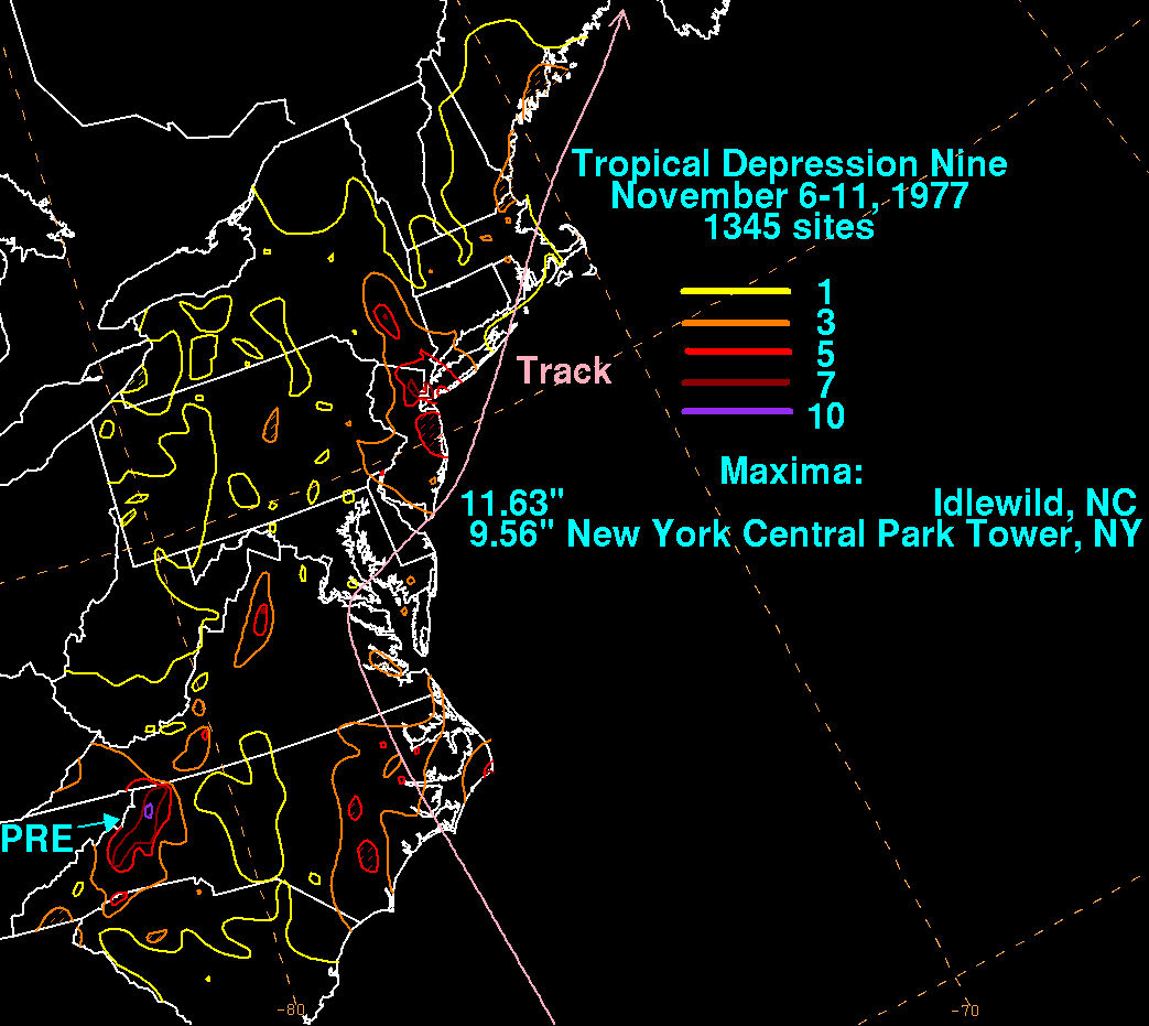
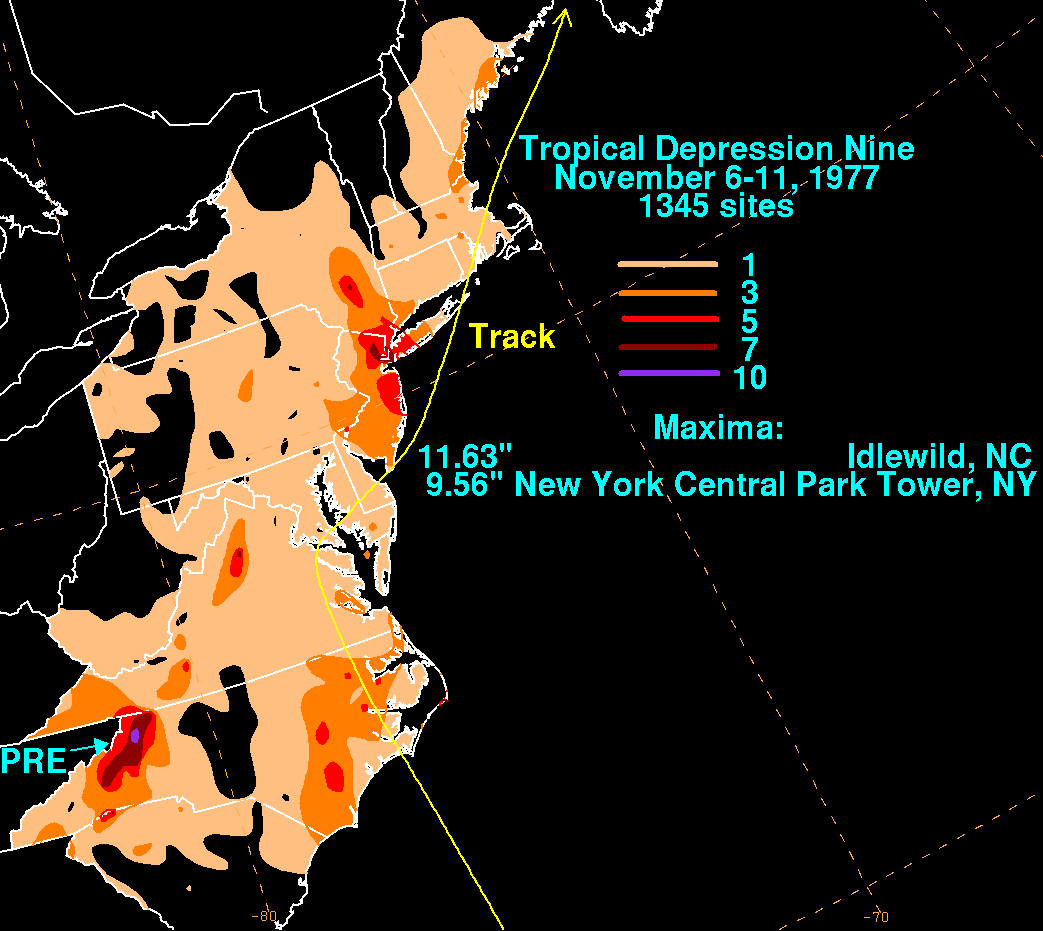
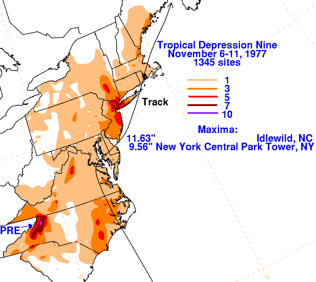
The storm total precipitation maps
for the depression are shown below, using data supplied by the National
Climatic Data Center
in Asheville, North
Carolina. Flooding across South Carolina, western North Carolina,
and western Virginia was caused by a
combination of a closed cyclone aloft over the Deep South drawing in
moisture from the tropical depression moving offshore
Florida, and can be considered a predecesor rainfall event to the
depression, which is indirect in nature. This flood event was
considered the worst across western North Carolina and western Virginia
since 1940.
 |
 |
 |