Tropical Depression Ten formed in part from a decaying frontal boundary that became
stationary off the Southeast U. S. coast on September 17th. By the 18th, an upper level
low formed over Florida and the eastern Gulf of Mexico as a tropical wave moved over
the Bahamas. A surface low was spawned by this combination of features near the western
Bahamas by afternoon. The system moved north-northwest into east-central Florida before
a high to its north blocked any further northward progression. Combined with steering from
the upper low to the west, the low crossed through central Florida emerging into the eastern Gulf
of Mexico west of Tampa by the 20th. On the 21st, thunderstorm activity increased near its
low level center, and the convection became organized enough around the surface low for it to
be considered a subtropical depression 45 miles southwest of Appalachicola. It gained tropical
character later in the day, becoming a tropical depression. The system moved northwest into
the extreme western Florida panhandle as a tropical depression late on the 21st near Fort Walton
Beach. Its central convection quickly weakened, but the surface low continued moving west-
northwest across the Deep South before losing identity as it crossed the Sabine River into Texas
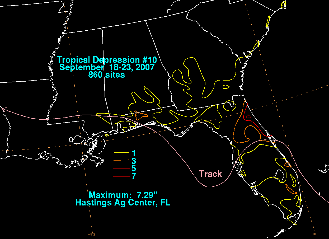
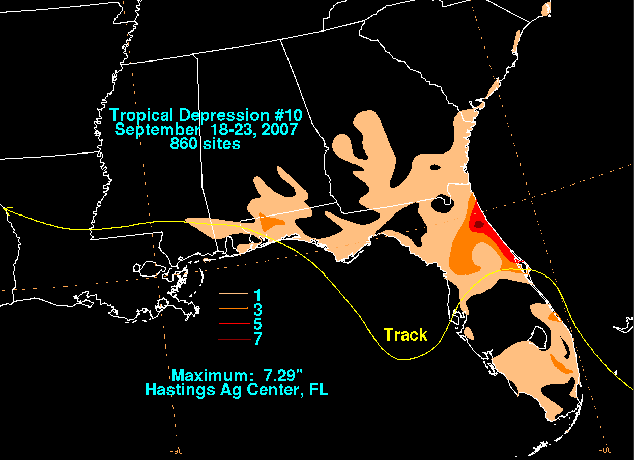
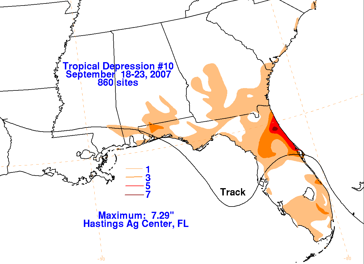
early on the 23rd. Below are the storm total graphics, prepared with data from the NWS River
Forecast Centers.
 |
 |
 |