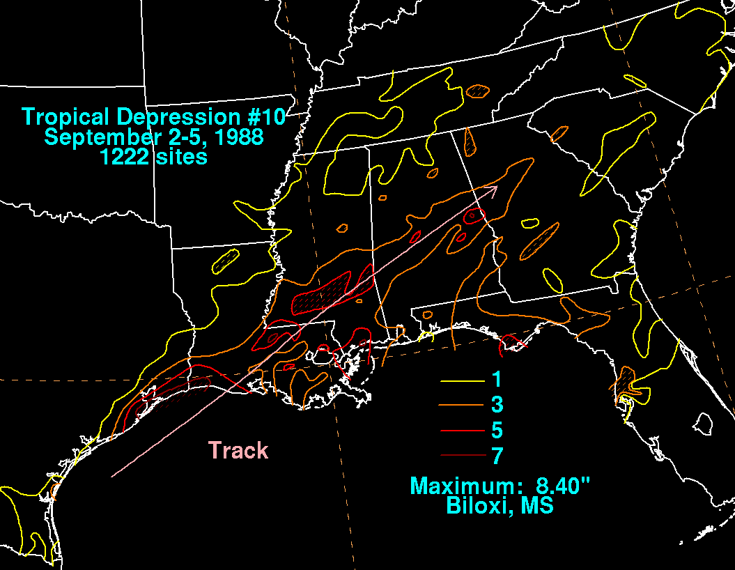
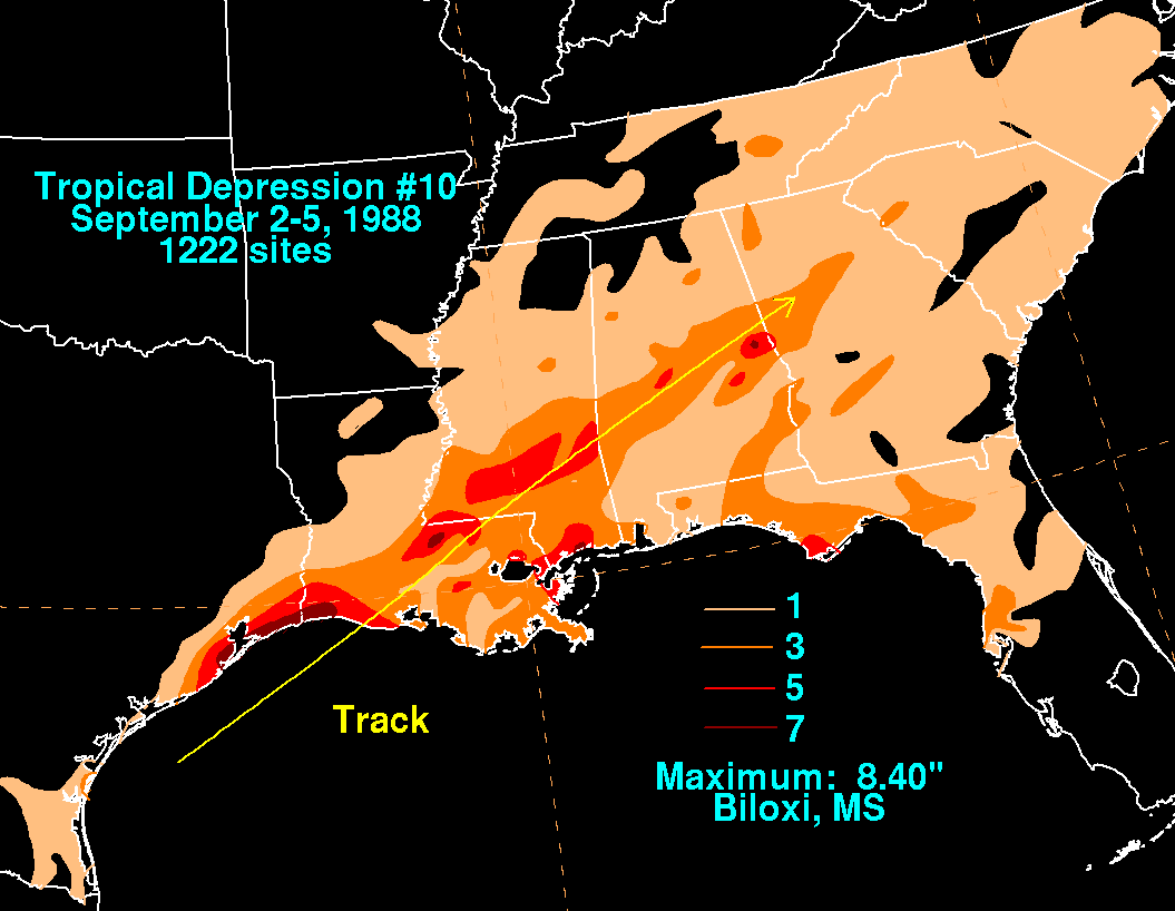
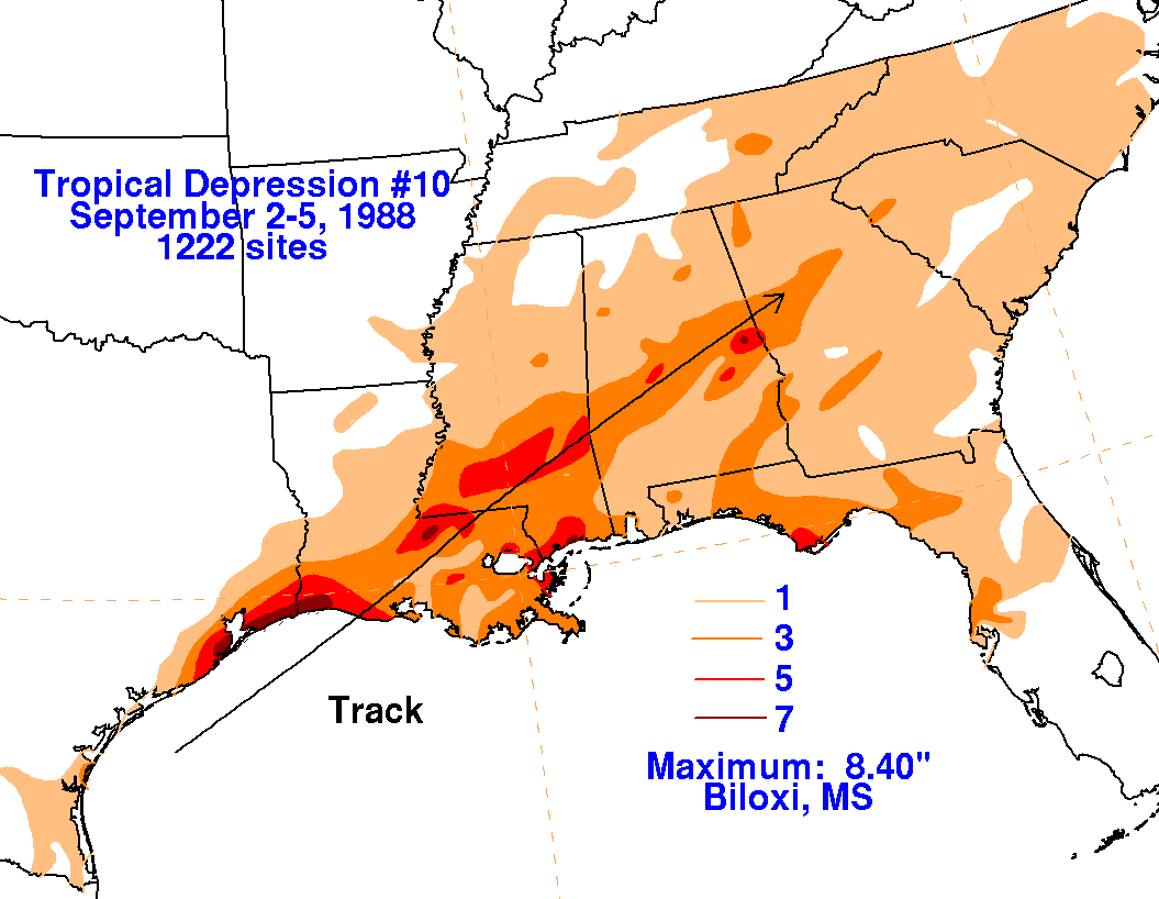
A broad low pressure area formed in the western Gulf of Mexico on
the 2nd, and convection became
organized enough for the low to be classified a tropical depression on
the afternoon of the 3rd. The
depression moved east-northeast, merging with a frontal zone on the 4th
just inland of the central Gulf coast.
The wave then dampened out during the succeeding 24 hours. Below
are storm total rainfall maps for the
depression, using data provided by
the National Climatic
Data Center.
 |
 |
 |