A tropical wave moved off the African coast on August 16th and traveled westward across the
Atlantic Ocean. As it neared the Caribbean Sea, the track became more west-northwest. On the
23rd, it moved under an upper-level cold low. By the 27th, the associated weather moved north of
the upper cyclone, which had spread across the Bahamas and Florida. On the 28th, the disturbance
moved into the eastern Gulf of Mexico, and organized into a tropical depression on the 29th about
200 nautical miles south-southwest of New Orleans, a tropical storm on the morning of the 30th,
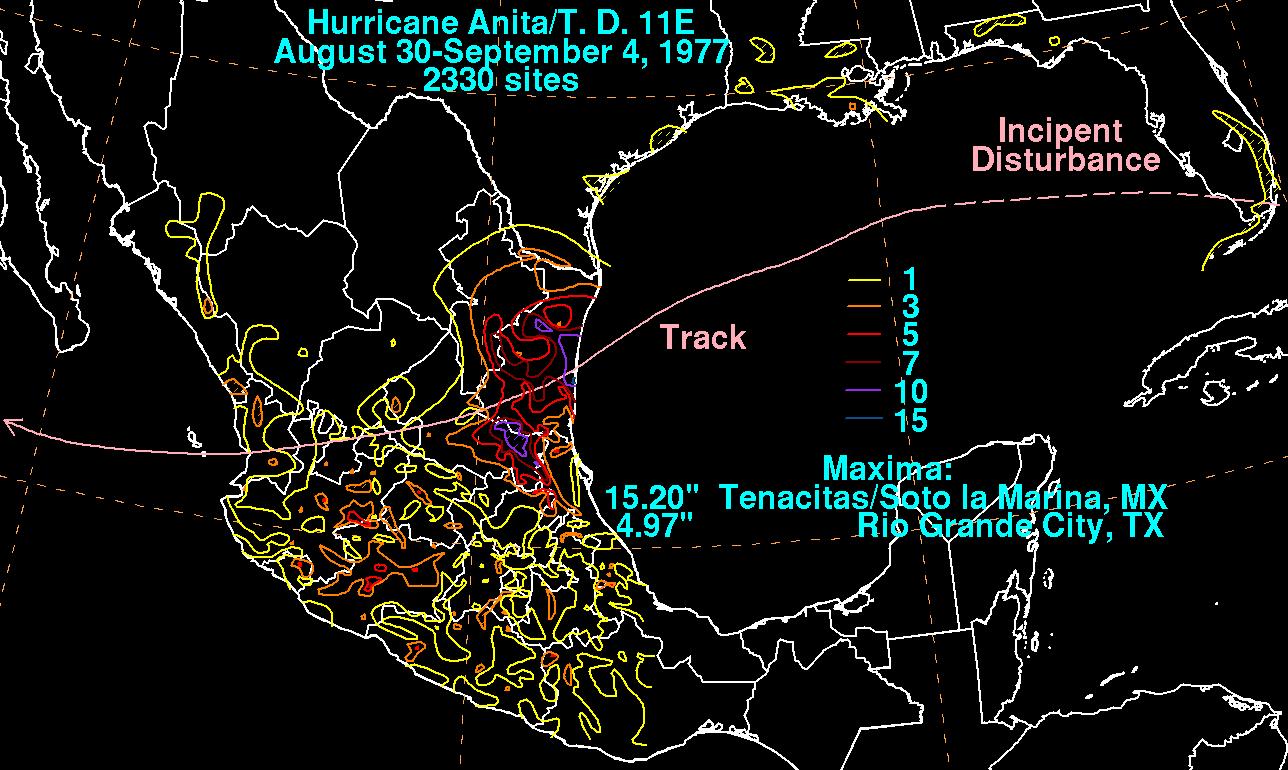
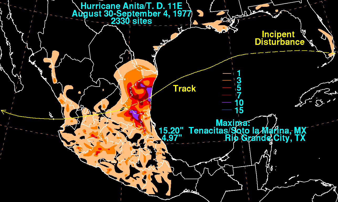
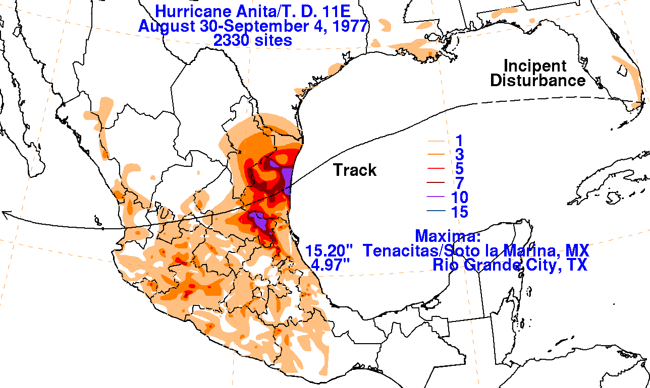
and a hurricane that night. Its track was west-southwest through much of the Gulf of Mexico with
some minor fluctuations in track, until Anita made landfall as a strong category 4 hurricane along
the coast of east-central Mexico 80 nautical miles north of Tampico, Mexico near the town of
Soto La Marina around dawn on September 2nd, which received 15.20" of rain. The system
emerged into the eastern Pacific and was redesignated Tropical Depression 11. The depression
moved quickly westward and dissipated after passing south of Baja California on the 4th.
The graphics below show the storm total rainfall for Anita. Rainfall information from the United
States was obtained from the National Climatic Data Center. Rainfall information from Mexico
was obtained from the Comision Nacional del Agua, the parent agency of their national weather
service. Note the maxima lie on either side of its track across northeast Mexico.
 |
 |
 |