A broad area of low pressure covered the south central Caribbean for several days. On the 30th of October,
satellite imagery indicated the low pressure area was becoming better organized. Surface observations indicated
it became a tropical depression on the 31st. Kingston, Jamaica reported sustained winds of 45 mph with gusts to
59 mph in a squall. Reconnaisance aircraft reported a central pressure of 1005 hPa. The pressure gradient between
a large high over the eastern United States and this low led to a large area of 25-35 mph in areas in between.
On the night of the 31st, an upper low formed over the northern Yucatan peninsula, luring a tropical
depression northwest, and created vertical wind shear over the system. By the morning of the 1st, much
of the thunderstorm activity lay northeast of the center. Over the next couple days, thunderstorms would
reflare near the center. Overnight on the 2nd/3rd, an intense burst moved into the lower Florida
Keys, and the system may have briefly become a tropical storm. Boca Chica reported sustained
winds of 46 mph with gusts to 64 mph. Cudjoe Key reported east winds of 46 mph with gusts to
69 mph. Reconnaisance aircraft in the system at the time reported a pressure drop to 998 hPa
and winds as high as 92 mph along with severe turbulance.
By the morning of the 4th, the remainaing low level swirl off western Florida interacted with a disturbance
aloft, and the resulting extratropical low moved across north Florida peninsula on the 4th which then shot
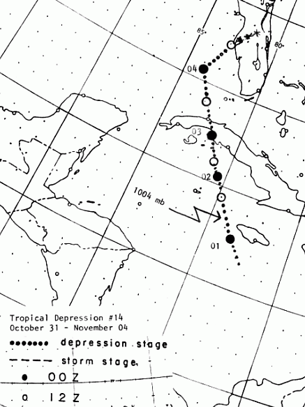
northeast offshore the Carolina Capes by the morning of the 5th. Its track is below, produced by the
National Hurricane Center.
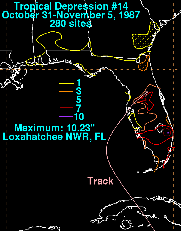
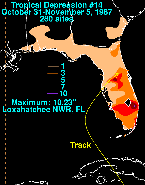
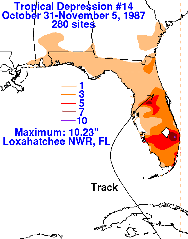
On the graphic below is the storm total rainfall for T.D. #14...data
provided
by the National Climatic Data
Center in Asheville, NC. The maxima fell near and to the right of
its track.
 |
 |
 |
