As Jeanne meandered through the Gulf of Mexico, a tropical depression formed north of Panama on
November 12th. Steered northward by deep southerly flow, the tropical depression initially increased
in organization on the 13th. When the remains of Jeanne interacted with an upper level low as they
passed by to its north on the 14th, the cloud pattern between Jeanne and the depression merged, with
a line of thunderstorms moving across the Florida peninsula between the two systems and the depression
undergoing increased westerly vertical wind shear. By the 15th, the winds aloft briefly relaxed. The
depression regained convective organization as it moved ashore western Cuba early on the 16th. By early
on the 17th, vertical wind shear increased from the northwest, and the center parted from the system's
related thunderstorm activity once more. After the system moved through the Florida peninsula,
thunderstorms increased near the system once more as it pulled northeast offshore the Southeast United
States.
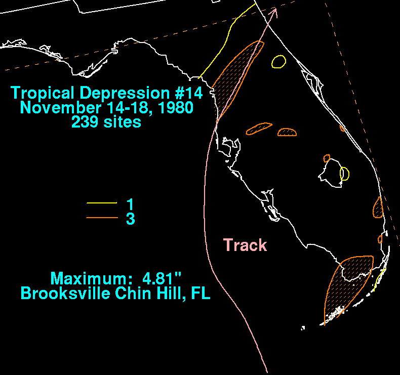
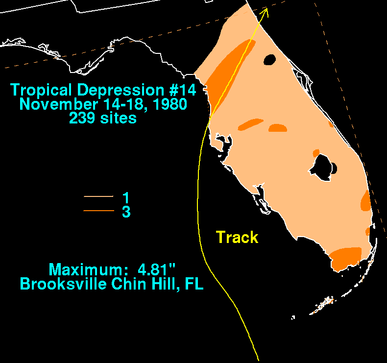
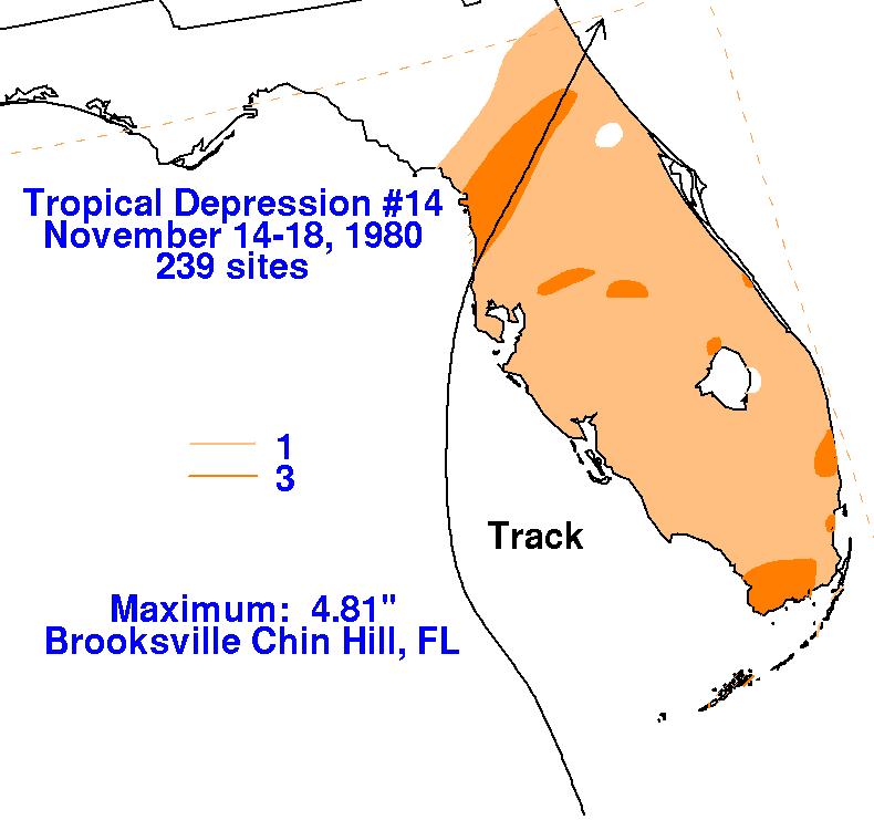
Below are the storm total rainfall
maps for the
depression, using data
provided by the National Climatic
Data Center through their daily rainfall
totals. Its track was provided by the National Hurricane
Center.
The heavy rains over the Florida Keys and extreme southern Florida were
in associated with the system's
central convection between the 16th and 17th, while the heavy rains
over the northern peninsula were
partially due to the remains of Jeanne and a nearby upper level low on
November 14th.
 |
 |
 |