A tropical depression formed in the eastern tropical Atlantic on September 25th. The system moved
westward for several days with a slight increase in organization. By October 1st, vertical wind shear
from the northwest began to impact the system as it moved north of the Leeward Islands, leaving an
exposed circulation center which moved north-northwest towards an area of enhanced cloudiness
associated with the subtropical jet stream. The remnant low merged with this cloud pattern, and
moved north-northeast ahead of a frontal zone to the southeast of Bermuda while continuing to weaken.
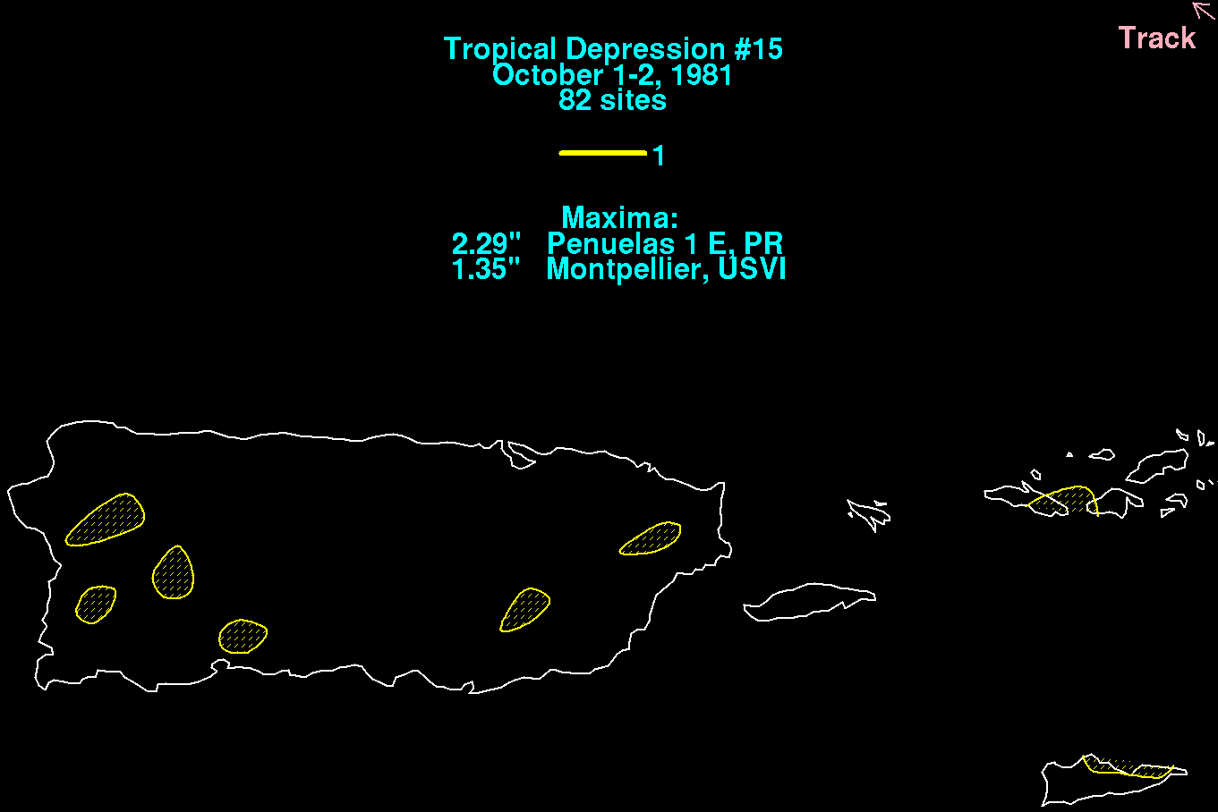
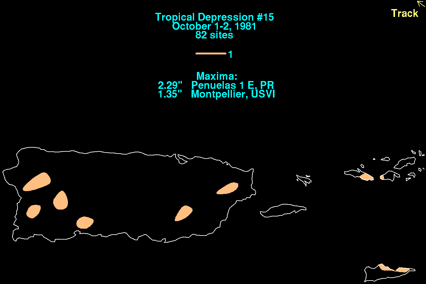
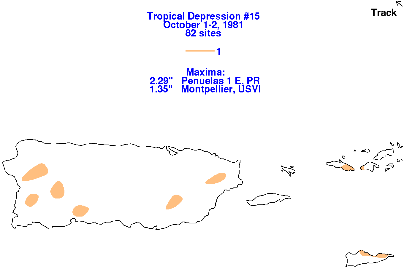
Below are the storm total rainfall maps for the depression, using data provided by the National Climatic
Data Center in Asheville, North Carolina through their daily rainfall totals. Its track was provided
by the National Hurricane Center. Bands of showers and thunderstorms moved through Puerto Rico
and the U.S. Virgin Islands while the tropical depression moved by to the north of the region.
 |
 |
 |