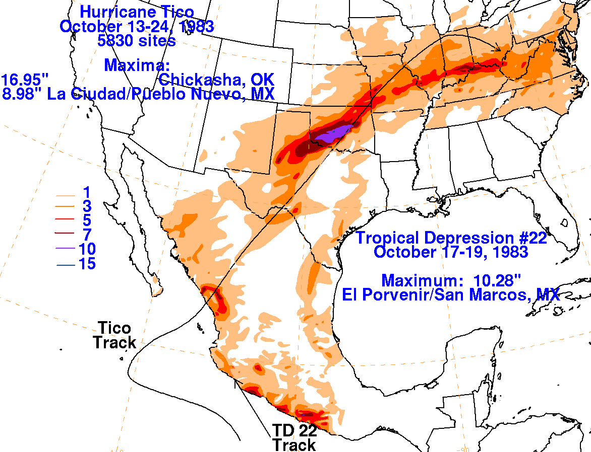
Tropical Depression #22-E - October 17-19, 1983
During October 7th and 8th, a tropical disturbance moved into the
eastern Pacific. It moved slowly westward
and intensified as it approached the 100th meridian. By the
morning of the 11th, it became a tropical depression
well south of Acapulco. Stengthening into a tropical storm on the
afternoon of the 12th, the system began to move
north. Acheiving hurricane status on the 13th, Tico drifted onto
a more westerly trajectory as a ridge to its north
intensified. Meanwhile, Tropical Depression #22 formed to its
east and moved into southern Mexico on its
eastern periphery. Tico reached its peak on the afternoon of the
16th as it began to recurve to the east of a deepening
trough across northern Baja California. The cyclone accelerated
northeast and roared ashore the Pacific coast
of Mexico near
Mazatlan. Its surface circulation linked up with a frontal
boundary and created flooding
rains
across Oklahoma and north Texas. The Red River rose to its
highest recorded stage in 40-60 years due to
the rainfall
from Tico.
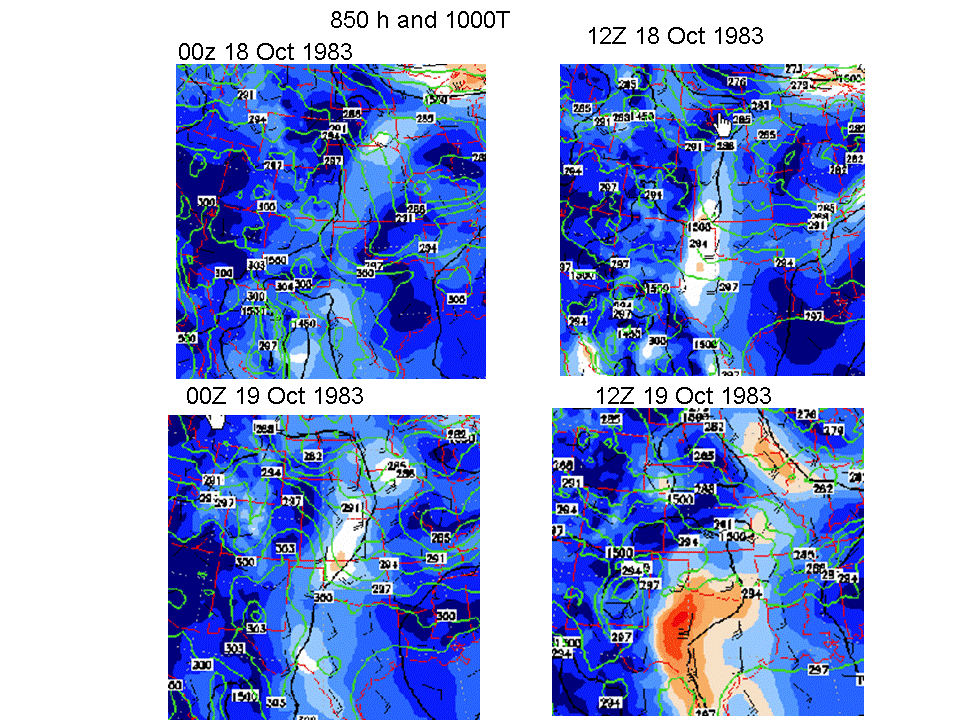
Below are the 850-hPa level maps for the environment around Tico,
prepared by Wes Junker from the North
American Regional Reanalysis.
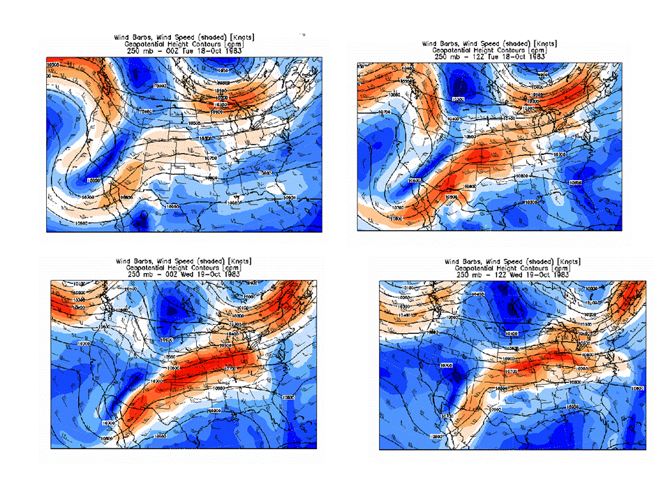
Below are the 250-hPa level maps for the environment around Tico,
prepared by Wes Junker from the North
American Regional Reanalysis.
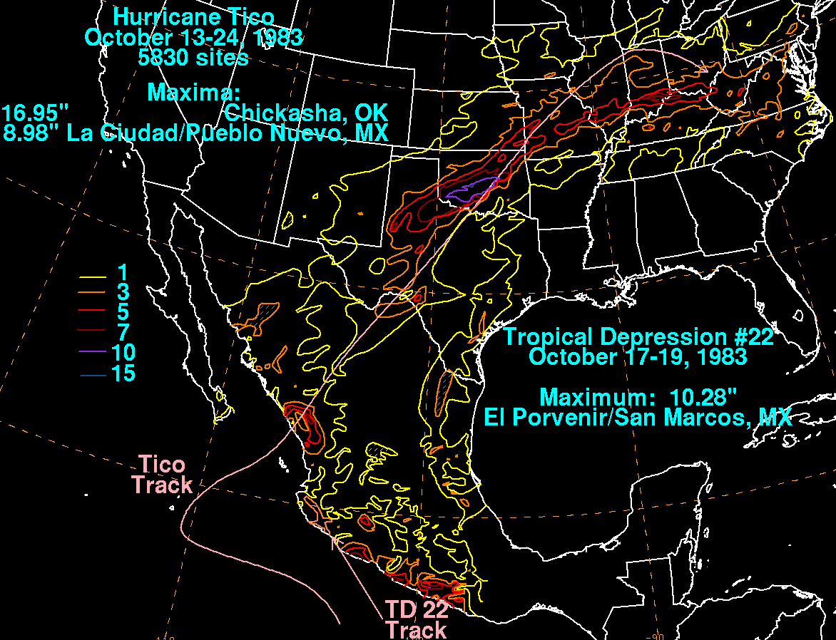
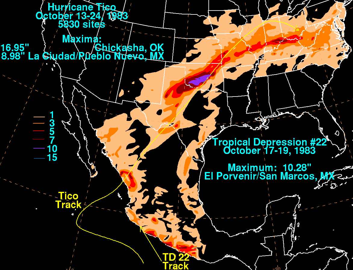
The storm total rainfall maps below were constructed using data from
the
National Climatic Data Center and the
Comision Nacional del Agua, the parent agency of Mexico's national
weather service. Note the maxima near and
east of the cyclone's points of landfall in Mexico. The maximum
in the United States was initially left of track as it
moved into the southern
Plains as a frontal wave, but then shifted right of track as it
occluded.
 |
 |
 |