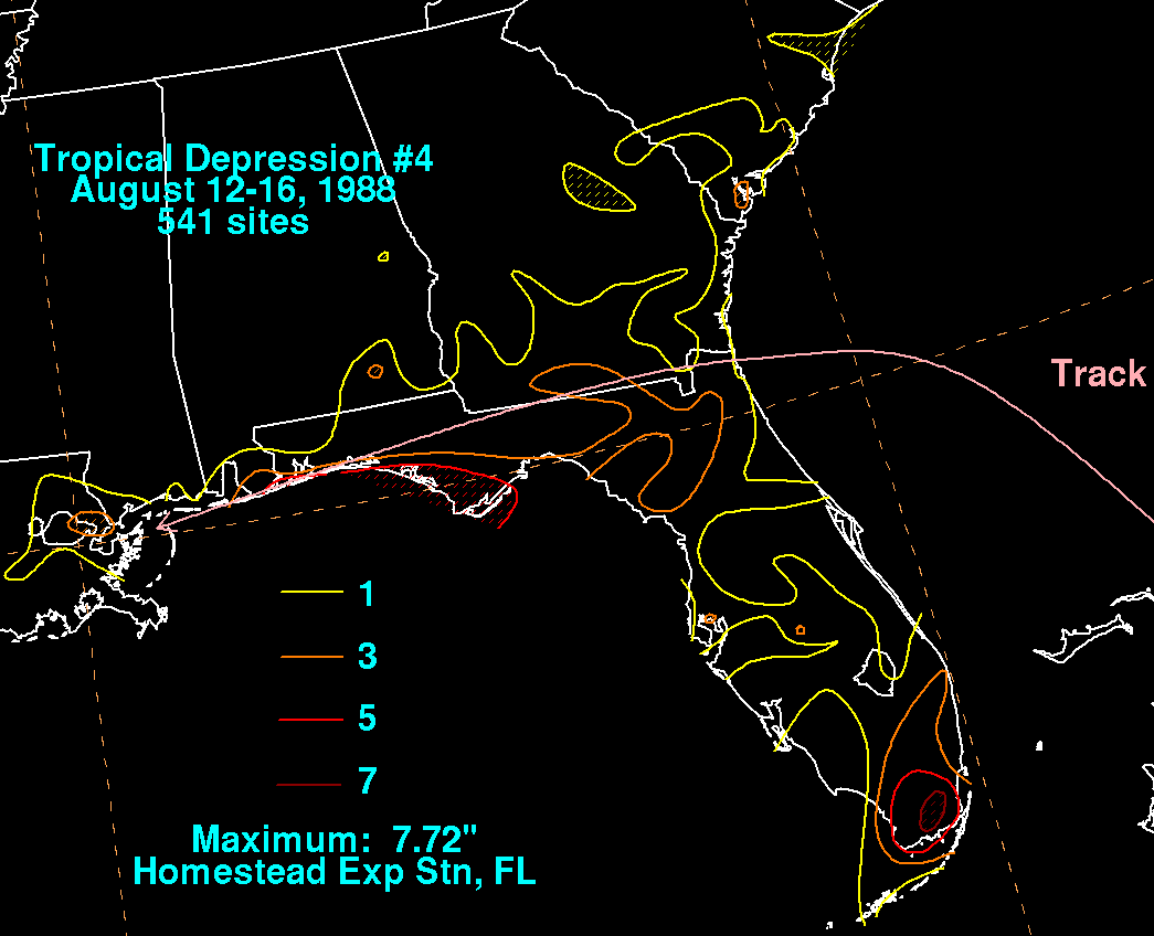
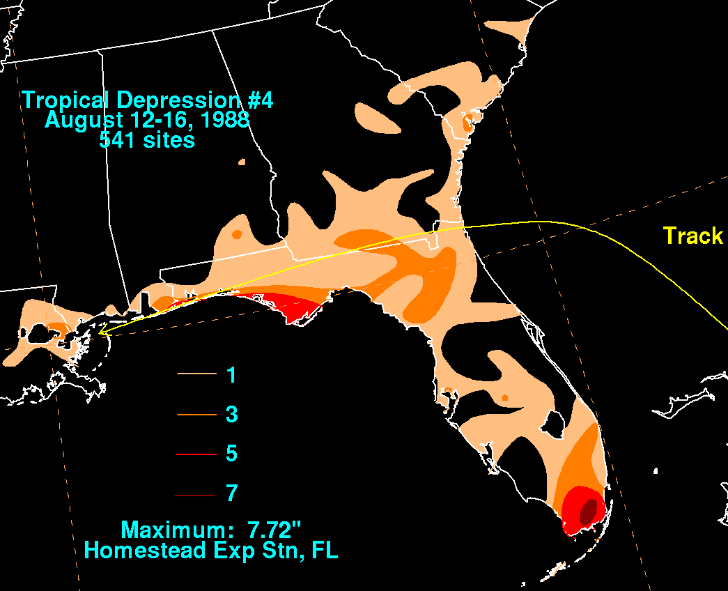
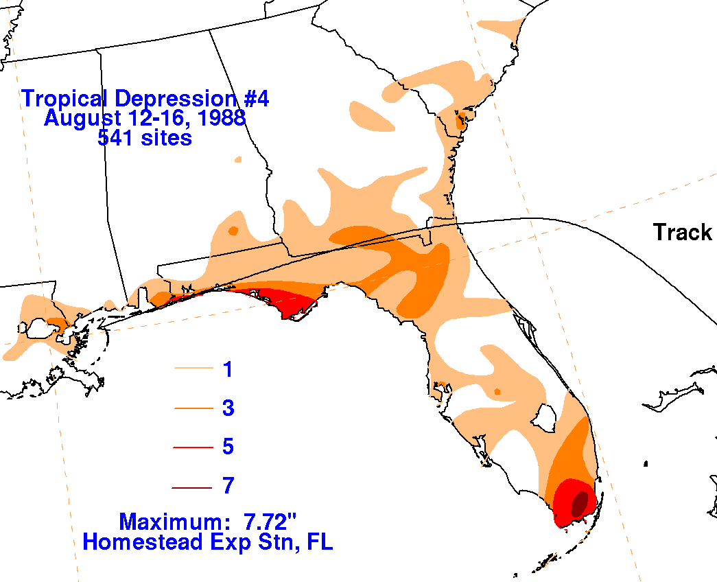
A tropical disturbance developed near the Bahamas and moved
west-northwest to reach the Florida/
Georgia border on the 13th. Thereafter, the cyclone turned west
moving just inland of the Gulf coast before
emerging offshore the Mouth of the Mississippi on the 15th and
dissipating on the 16th. Below are
storm total rainfall maps for the depression, using data
provided by
the National Climatic
Data Center.
 |
 |
 |