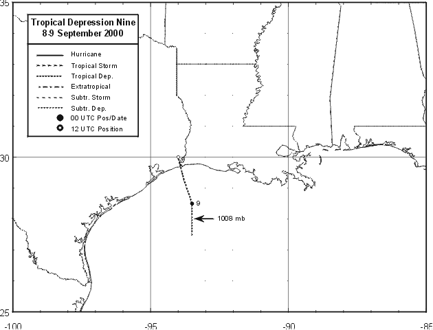
Tropical Depression Nine formed over the northwestern Gulf of Mexico
from the interaction of a persistent low-level trough and
a cluster of convection, associated with a tropical wave, that moved
north-northwestward from the Yucatan Peninsula. A poorly-
defined low level center formed about 160 n mi south of Lake Charles,
LA, on the 8th. Surface observations indicated that
the center moved north-northwestward and crossed the Gulf coast near
Sabine Pass, TX early on the morning of the 9th. The
cyclone dissipated over land later that day. Squalls with gusts
to tropical storm-force occurred well to the east of the center.
These produced a 45 mph gust at buoy 42001 during the afternoon of
the 8th, a 40 mph gust at buoy 42041 an hour later, and a
39 mph gust at the Southwest Pass C-MAN station. Rainfall associated
with the cyclone affected portions of Louisiana and
Mississippi. There are no reports of damage or casualties. Below
is the track of this storm, provided by the National Hurricane
Center.
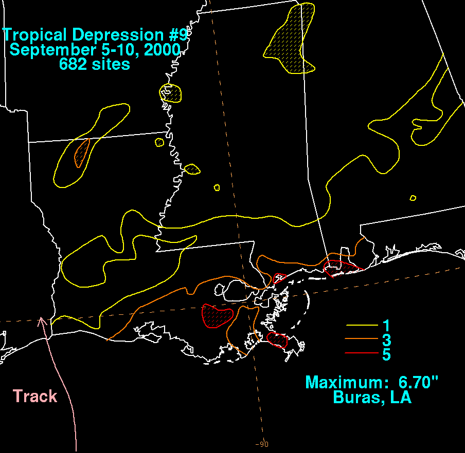
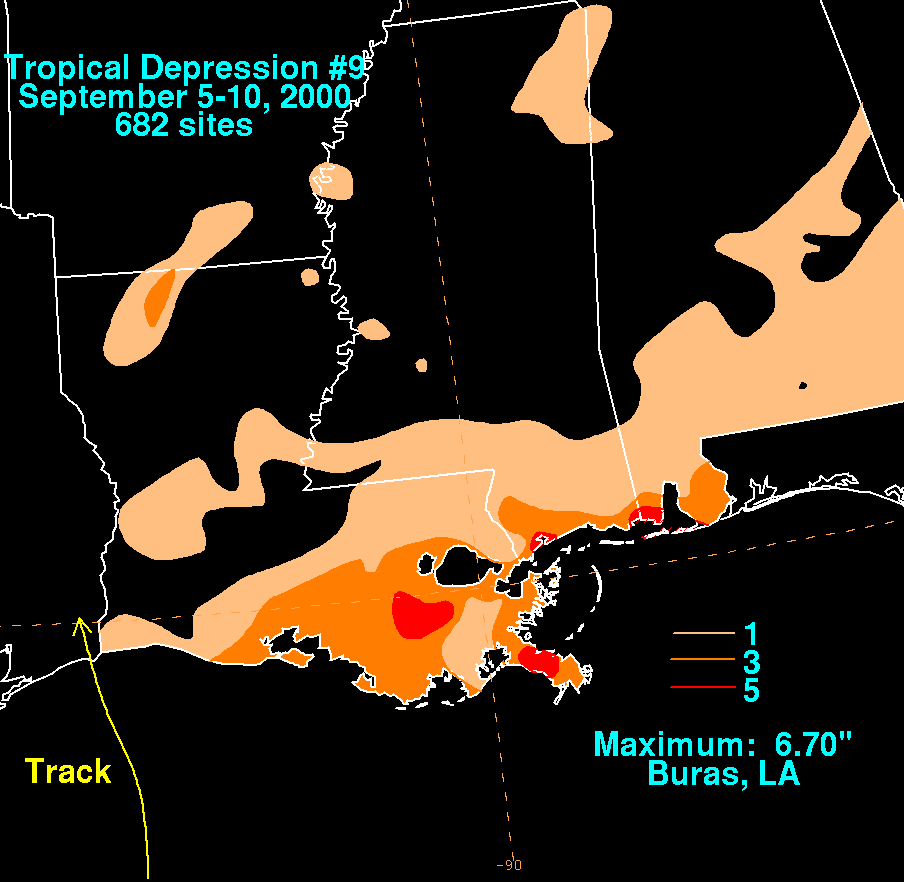
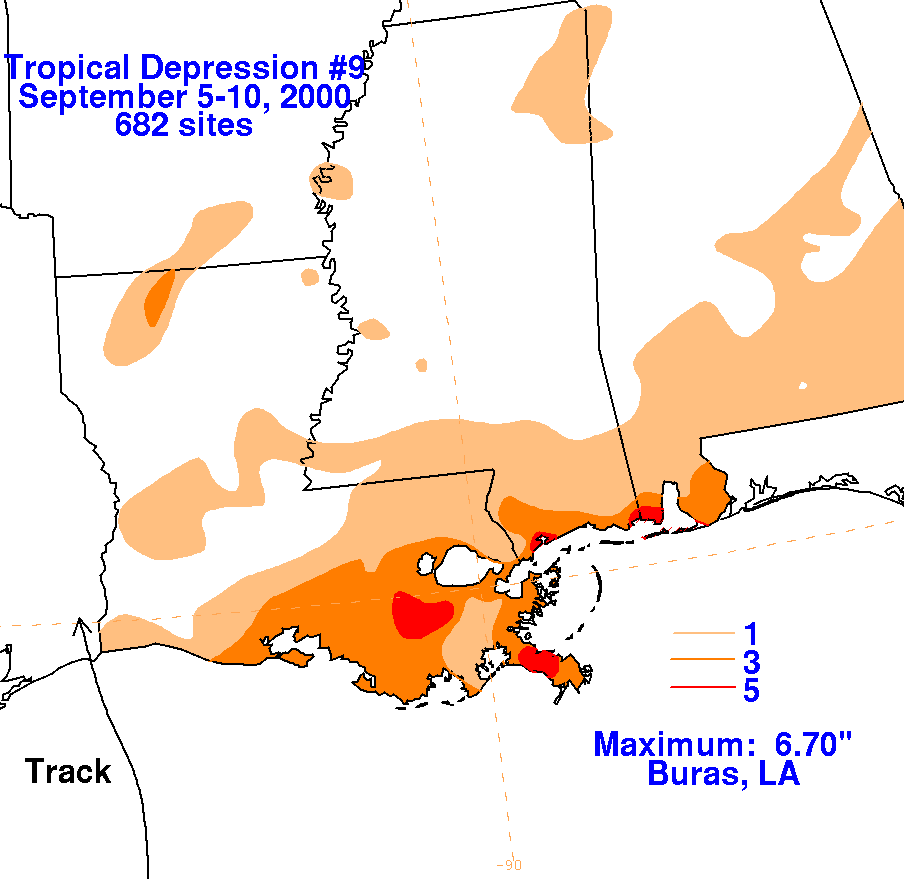
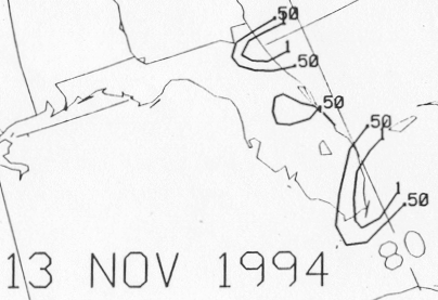
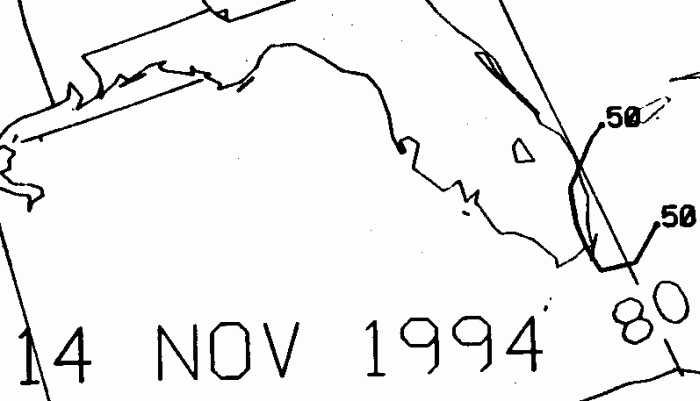
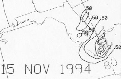
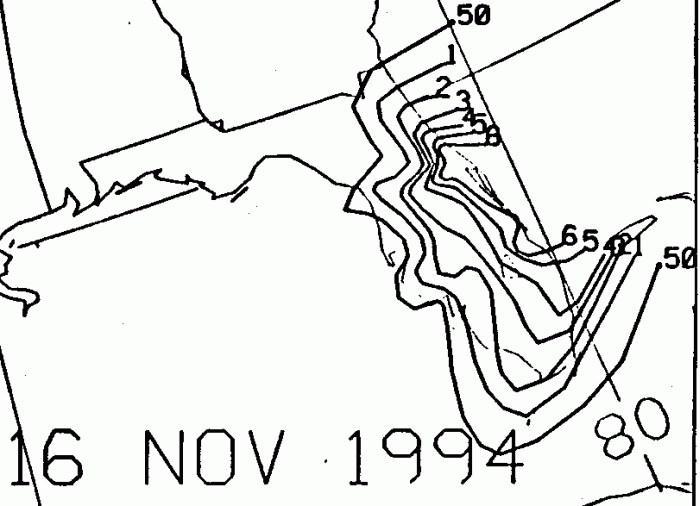
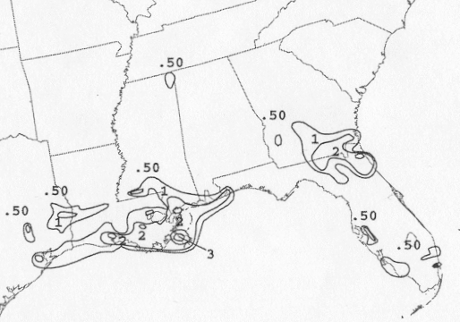
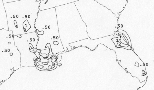
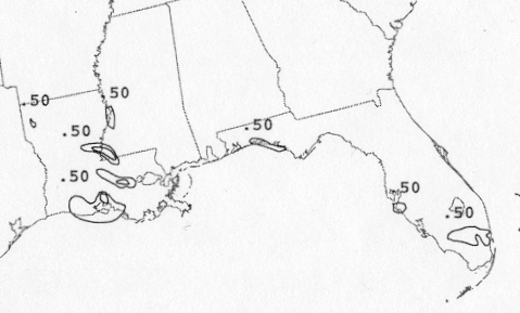
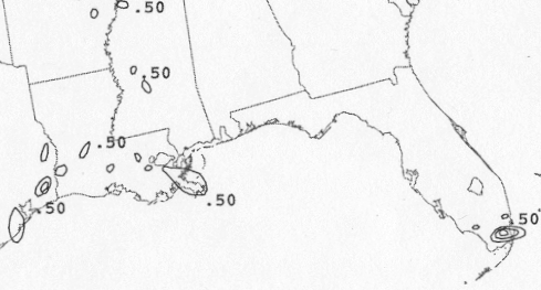
The storm total rainfall maps below were constructed using
data
from the National Climatic Data Center. Maximum rainfall
amounts occurred at the intersection of an inverted trough and a dying
stationary
front, which was northeast of the center.
 |
 |
 |
Below are the calendar for Daily Precipitation Maps.
Note that
the 24-hour periods end
at 12z that morning.