Surface pressures lowered over the southwest Gulf of Mexico by June
21st as a trough formed northeast of Eastern
Pacific Hurricane Delia. Convection formed along this trough,
forming a low on the 21st near Vera Cruz. By late
on the 22nd its center emerged over water with significant thunderstorm
activity northeast of its center. The system
became better organized on the 23rd. By the 24th, a strong upper
level trough developed across the Southeast which
led to the formation of a subtropical storm to its
northeast. The depression drifted northeast initially,
before turning
southward later in the day about 100 miles northwest of Merida.
On the 25th, its southward motion ceased and
well organized convection returned to the depression. It soon
accelerated northeast, becoming an extratropical
cyclone as it crossed Florida early on the 26th. The low then
weakened as it moved east of the Outer Banks of
North Carolina before moving through New England on the 29th and
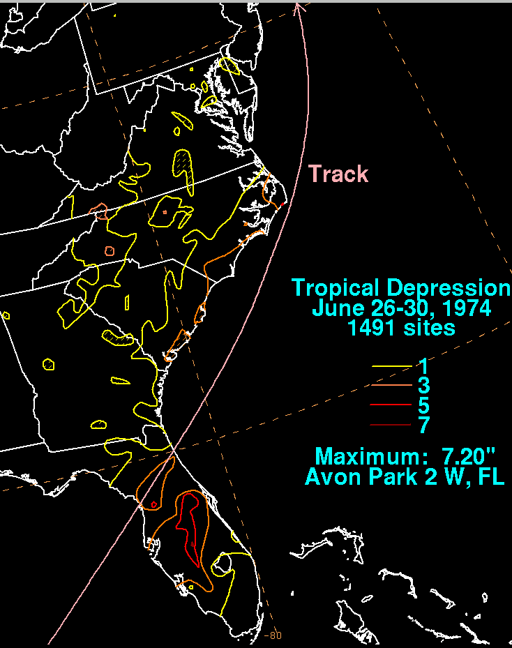
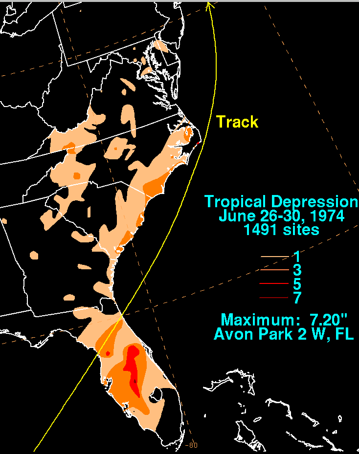
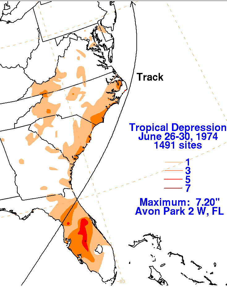
30th. Below is a storm total rainfall map
for the tropical depression.
 |
 |
 |