A tropical wave moved off the coast of Africa on July 29th. It was convectively inactive
until crossing the Lesser Antilles. In the Caribbean there were hints that a low to mid
level center was developing, but it moved inland into Central America on the 7th. A
cold low in the southwest Gulf of Mexico interacted with the northern portion of the
tropical wave, and a new center formed in the Northwest Gulf of Mexico late on the
8th, forming into a tropical depression as convection developed near the center. Oil
rigs began to report tropical storm force winds in the outer bands/squalls of the system
on the 9th, but reconnasiance aircraft never measured winds high enough to support
a tropical storm, and a pressure of only 1008 hPa. The decision was made to call
it a tropical storm rather than a subtropical storm due to its banded structure on radar,
and relatively small field of tropical storm force winds, though it did have a double
wind maximum and a broad area of lighter winds near the immediate center which
are characteristics of subtropical cyclones.
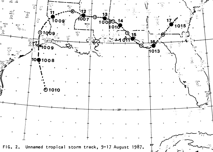
The cyclone moved north-northwest into east Texas, weakening into a tropical
depression as it arced northeast into Louisiana, then east-southeast back into the
Gulf of Mexico on the 15th before returning inland into north Florida and south
Georgia before the center dissipated. Its track is below, which was produced by the
National Hurricane Center.
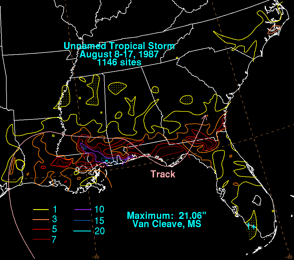
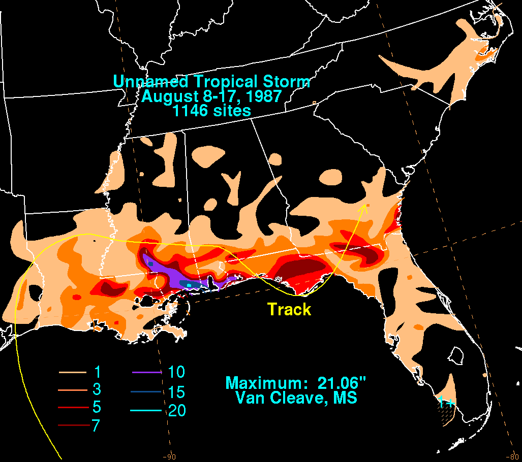
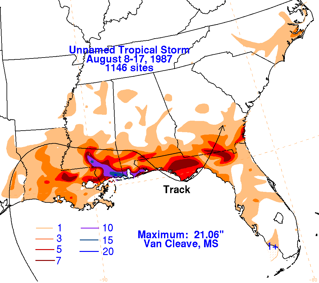
On the graphic below is the storm total rainfall for the Unnamed
Storm...data
provided
by the National Climatic Data Center in Asheville, NC.
 |
 |
 |