An area of thunderstorm activity increased near Panama on October
1st. The area of disturbed weather
moved west-northwest while slowly developing. By the morning of
the 6th, the system organized into a
tropical depression 400 miles south-southeast of Acapulco,
Mexico. Later that night, the depression strengthened
into a tropical storm. At this point, Winifred was rounding the
western periphery of the subtropical ridge to the
south-southeast of Manzanillo. By the morning of the 9th,
Winifred strengthened into a hurricane as it turned more
northward. Its track lies below, supplied by the National
Hurricane Center.
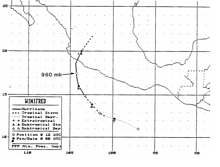
An upper level trough to its west turned the cyclone to the north,
and Winifred strengthened into a category 3
hurricane while 100 miles south of Manzanillo. Accelerating
north-northeastward, its eye became obscured
in satellite imagery as the system slightly weakened before it struck
Mexico just east-southeast of Manzanillo. Winifred
quickly weakened over mountainous terrain, and dissipated as a tropical
cyclone over central Mexico very early
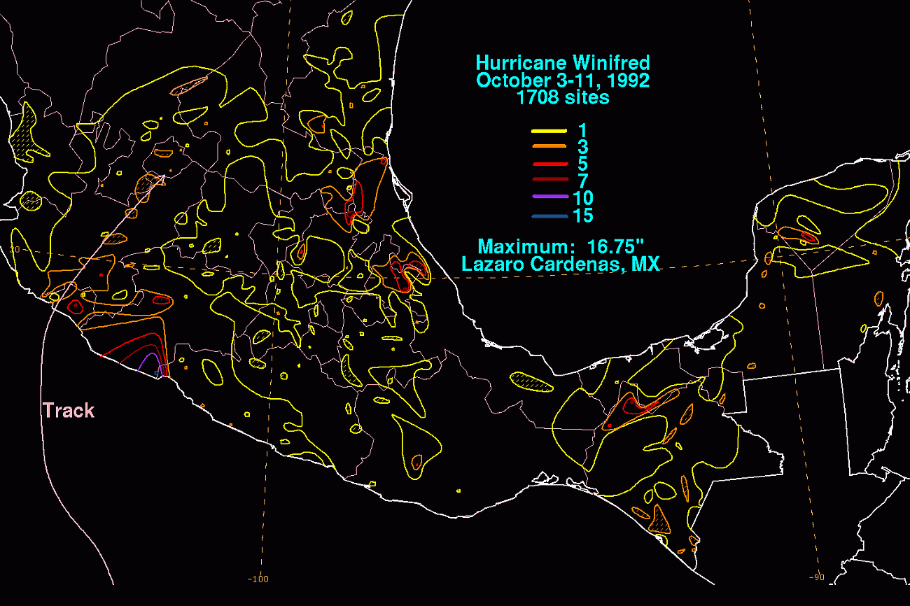
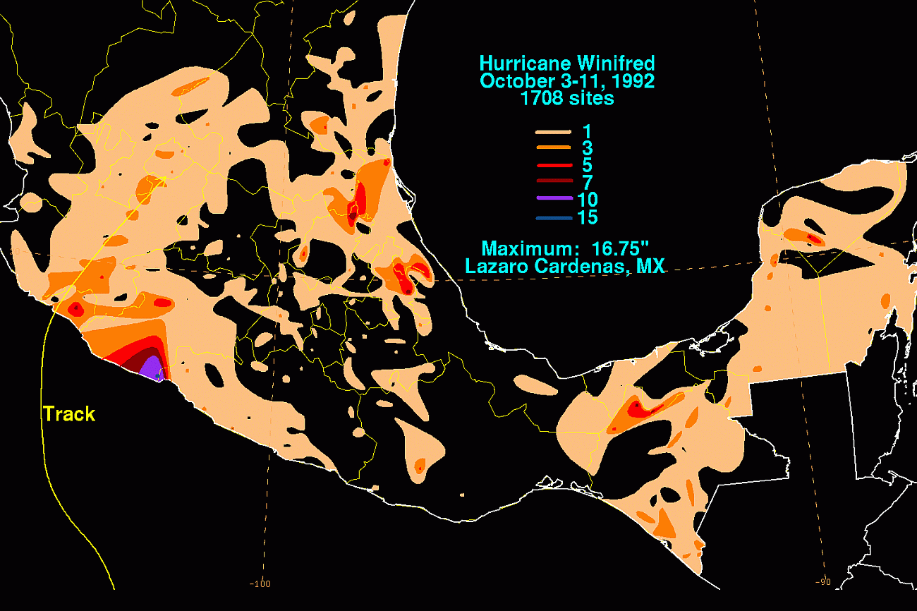
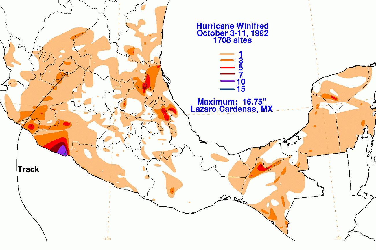
in the morning of October 10th. The graphics below the storm
total rainfall for Winifred. Data was provided by the
Comision
Nacional del Agua, the parent agency of Mexico's national weather
service.
 |
 |
 |