Probabilistic Heavy Snow and Icing Discussion
NWS Weather Prediction Center College Park MD
307 PM EDT Wed May 8 2024
Valid 00Z Thu May 09 2024 - 00Z Sun May 12 2024
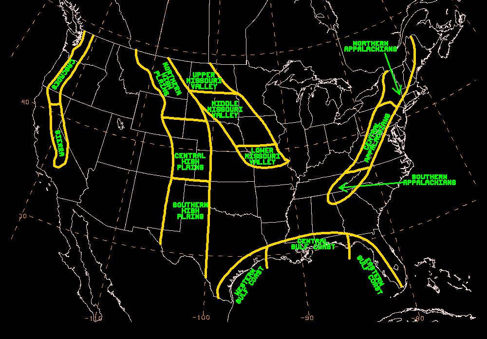
...Northern to Central Rockies...
Days 1-3...
As the upper low continues to sink south and weaken throughout the
night, the northerly IVT that prompted the anomalous supply of
moisture over the Northern Rockies and the enhanced upslope flow
into favorably oriented mountain ranges will diminish. The mountain
ranges favored for periods of moderate-to-heavy snow through
tonight are the Absaroka, Big Horns, Wind River, and Laramie
Ranges. By Thursday, high pressure building in over Montana will
prompt easterly upslope flow into the southern WY, the CO Rockies,
and as far south as the Sangre De Cristo and San Juans of northern
NM. Latest 12Z HREF shows the potential for 1-2"/hr snowfall rates
Thursday afternoon and into Thursday evening in the central CO
Rockies. Some light mountain snow is expected as far west as the
Uinta and Wasatch of UT as a 500mb cuts off beneath an amplifying
ridge over British Columbia. This cut off 500mb low will keep
mountain snow (generally at/above 9,000ft) over these mountains
ranges in the Central Rockies through Friday and even into
Saturday, but snowfall rates are not forecast to be exceptional and
should result in minor impacts at worst for elevations >9,000ft.
WPC PWPF depicts high chances (>70%) for snowfall >12" at
elevations >9,000ft in the Absaroka and Wind River Ranges through
Thursday afternoon. Farther east, the Big Horns and Laramie Range
have moderate-to-high chances (50-70%) for snowfall totals >8".
Then,
between Thursday afternoon and Friday afternoon, WPC PWPF sports
moderate-to-high chances (50-70%) for snowfall totals >8" in the
San Juans and Sangre De Cristo above 10,000ft. These listed
mountain ranges are forecast to witness Minor Impacts according to
the latest WSSI with elevations above 9,000ft having the best odds
of witnessing localized Moderate Impacts.
The probability of significant icing across the CONUS is less than
10 percent.
--
In other news, this is the final day the WPC Winter Weather Desk
is scheduled to be staffed for the 2023-2024 cold season. WPC PWPF
will still run automatically each night and afternoon for users to
review. Should a late season winter storm occur in the coming
weeks, we will quickly spin the desk up to provide support. Thank
you to all who have read our discussions and utilized our products
this past winter season! We will be back to fully staffing the
winter desk in late September.
Mullinax


