|
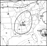
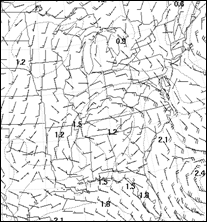
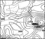
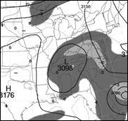
Tropical storms and hurricanes also cross the mountains when moving from west to east. Most of the time there is an upper low to the west or southwest of these type of storms which allows deep easterly flow to develop to the north and northwest of the storm. This storm is forecast to make landfall in the Carolinas and then is forecast to track northwestward. Below is an ETA/NAM 500-hPa geopotential height forecast of the pattern associated with the approaching hurricane. The hurricane is just showing up east of Florida at 24 hours. |
|
00-hr model 500-h forecast v.t. 00 UTC |
|
12-hr model 500-h forecast v.t. 12 UTC |
|
24-hr model 500-h forecast v.t. 00 UTC |
|
36-hr model 500-h forecast v.t. UTC |
|
During the 12-h to 36-h period on the maps above, do you think forecasters in North Carolina and Virginia should be worrying about heavy rainfall during 24-h period ending at 36-h? Click on the answer you like best. |
|
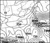
24-hr model 850 wind and PW (dotted line. inches) forecast v.t. 00 UTC |
|
The faint, dotted line that extends across central North Carolina into Virginia near Roanoke is the 1.80” PW contour. The highest PW and CAPE is forecast to be across eastern and central Virginia (see below). The ETA and GFS forecasts for the period are shown below. The models differed on their forecasts of the rainfall potential and on where the heaviest rainfall would occur. |
|
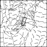
18 hr v.t. 18 UTC boundary layer winds, terrain (thin lines) and area of strong orographic omega (dark line) |
|
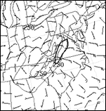
24 hr v.t. 00 UTC boundary layer winds, terrain (thin lines) and area of strong orographic omega (dark line) |
|
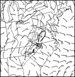
30 hr v.t. 06 UTC boundary layer winds, terrain (thin lines) and area of strong orographic omega (dark line) |
|
The GFS suggested the maximum might be along the east slopes of the Appalachians. What about the potential for upslope? Whenever deep easterly flow is present, there is potential for the upslope flow to enhance the vertical motion. One tool to look at is the upward motion due to the vertical transport of motion due to terrain that is available on the NMAP workstations. (see figures below). In this case, the eta was predicting an extended period with strong orographic lifting across portions of western North Carolina and Virginia. |
|
18 hr CAPE v.t. 18 UTC |
|
24 hr CAPE v.t. 00 UTC |
|
18 hr 700-hPa height, vertical motion and relative humidity (dark shading greater than 60%, light shading greater than 80%. |
|
24 hr 700-hPa height, vertical motion and relative humidity (dark shading greater than 60%, light shading greater than 80%. |
|
36 hr 700-hPa height, vertical motion and relative humidity (dark shading greater than 60%, light shading greater than 80%. |
|
The combination of having a 500-hPa upper low to the southwest of the mountains of western North Carolina, a very moist airmass with positive CAPES and anomalously strong 850-hPa winds directed into the mountains should provide a signal that there is potential for convective rainfall with the potential for the convection to remain focused along the east slopes of the mountains for an extended period if the eta model orographic omega was in the ball park. The predicted high PW and high relative humidity also suggested the potential for fairly high rainfall rates. Evaluation of the pattern suggests that the GFS had the right idea about the location of the maximum but that there is potential for heavier rainfall than it is forecasting. |
|
More on tropical systems and the Appalachians, an exercise |
|
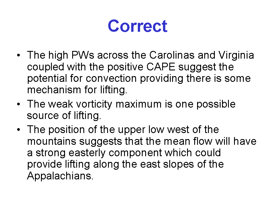
The airmass is predicted to be unstable across the region at the time of maximum heating. The PW is around 1.80 across central North Carolina and Virginia |
|
The subsidence ahead of the hurricane and the lack of a front should keep a cap in place across the Carolinas and Virginia limiting convection and rainfall |
|
The weak vorticity maximum that swings from South Carolina to West Virginia suggests there could be scattered showers with locally heavy rainfall so I’d monitor the situation in case a special weather statement is needed. I’d also look at the situation in more detail. |
|
Slow moving upper lows are dangerous but it looks like the upper low is probably too far from North Carolina and Virginia during the 24 hour period to be a major concern for those two states. However there could be some scattered showers with locally heavy rainfall. |

|
Let’s look at the case in a little more detail. The position of the upper low is one that is favorable for producing deep easterly flow into the mountains. 30 kt winds are predicted at 850-hPa across portions of Virginia with a strong easterly component. |
|
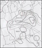
ETA QPF for period |
|
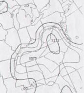
GFS QPF for period |
|
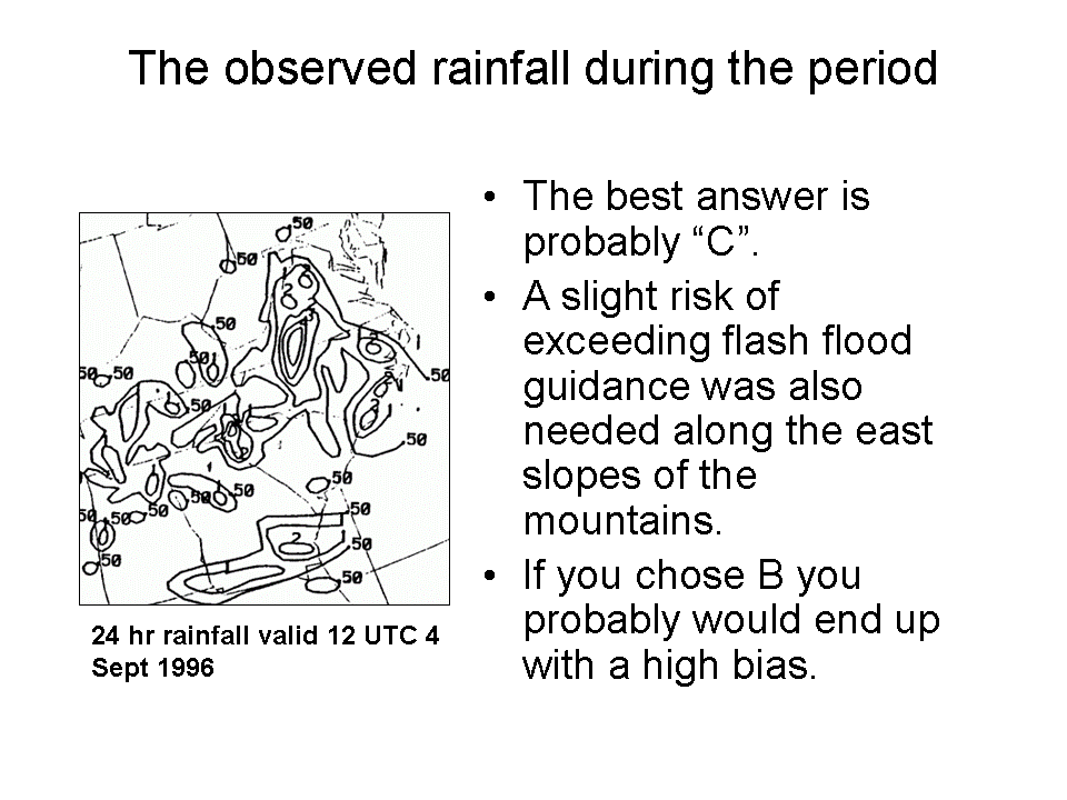
Look again at the model QPF and think how you would modify it. Choose the answer that best describe the changes to the models QPF and the actions you would make on shift. (Click on an answer and you’ll be linked to the verifying rainfall analysis) |
|
I would forecast a rainfall maximum near the axis of where the GFS predicted its maximum but would beef up its amounts near the mountains and would keep any two inch rainfall away from the coast. I would also issue a slight risk of excessive rainfall near the mountains. |
|
I would forecast two rainfall maximum of almost equal magnitude one near where the eta has the eastern portion of its two inch contour and another where the GFS has its maximum and would issue a slight risk of exceeding flash flood guidance values across both areas. |
|
I would forecast two rainfall maximum, a heavier one near where the GFS predicted its maximum and a second smaller, lighter maximum near the coast with a relative minimum in between. I would also issue a slight risk of exceeding flash flood guidance near the mountains. |

|
The hurricane off the southeast coast was Fran. In some respects it and Hugo were similar. Both produced flash flooding in the Appalachians well in advance of landfall. Both had upper lows located to the west or southwest as they approached the coast. However, the scale of the heavy rainfall was much smaller with Hugo than Fran. It also produced quite a bit less rainfall than Fran even though both hurricanes were fairly large ones. A few differences between these two storms will be discussed on the next page. |
|
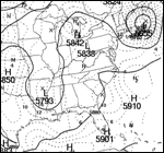
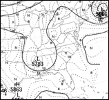
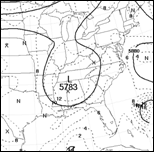
Forecast hurricane location |